Updated on • 18 Sep 2024
Improve Aerial Mapping Accuracy With Effigis EZSurv Post-processing Software
GIS specialist heliguy™ partners with Effigis to offer drone surveyors the EZSurv® GNSS post-processing platform - a powerful offline correction solution to improve the accuracy of photogrammetry data. ... Read More

heliguy™ has partnered with geomatics industry-leader Effigis to offer EZSurv® - a post-processing platform for photogrammetry;
It is a powerful offline correction solution to improve survey/GIS mapping data accuracy;
The software is especially useful when internet connectivity is not available during an on-site survey or RTK connection is lost midflight;
For greater accuracy, EZSurv® uses a surveyor's own base station data or automatically connects to different base station providers;
EZSurv® can be used in conjunction with DJI drone surveying solutions;
Partnering with EZSurv® enhances the GIS end-to-end workflow which heliguy™ offers to aerial surveyors.
GIS specialist heliguy™ is offering drone surveyors a sophisticated GNSS photogrammetric post-processing platform, after partnering with geomatics industry-leader Effigis.
EZSurv® is a powerful companion software providing a reliable and efficient offline correction solution (PPK) to significantly improve the accuracy of survey or GIS mapping data.
It is especially useful when internet connectivity is not available during an on-site survey, RTK connection is lost midflight, you are flying in standard GPS mode collecting images and satellite observation data, or your survey combines terrestrial and aerial data and the same satellite observation data is being used for both.
Users can play back their RTK survey for quality assurance control, make adjustments to non-RTK GNSS field data, calculate accurate UAV in-flight positions, precisely interpolate the position of each camera shot, conduct sophisticated baseline and kinematic processing and obtain precise point positioning.
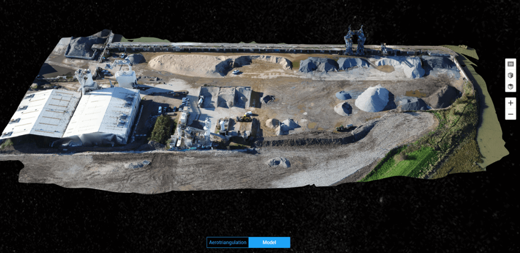
EZSurv® uses a surveyor's own base station data or automatically connects to different base station providers. This flexibility enables the retrieval of the closest base station data required to compute accurate rovers’ positions, post-mission.
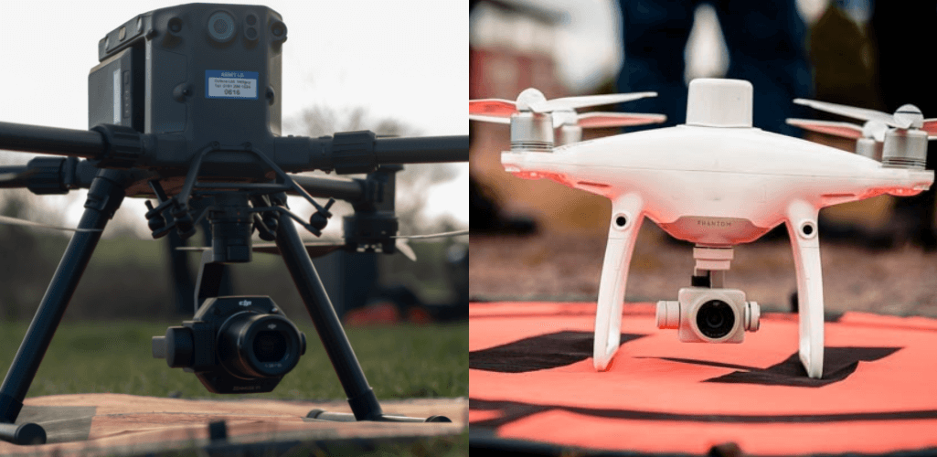
The software platform enables users to post-process geo-localised photogrammetry data that has been collected with a range of drones, including the DJI M300 RTK (below, left) and the Phantom 4 RTK (below, right)
Once the accuracy of these georeferenced images has been improved, the data can be uploaded to DJI Terra, or other photogrammetry software, to build detailed digital maps and models.
EZSurv® Workflow Example
The following step-by-step guide demonstrates how EZSurv® can be used to enhance accuracy at the post-processing stage.
1: A survey has been conducted using RTK. The red triangles show where the RTK corrections were lost. However, the accuracy can be recovered - post-mission - using EZSurv®.
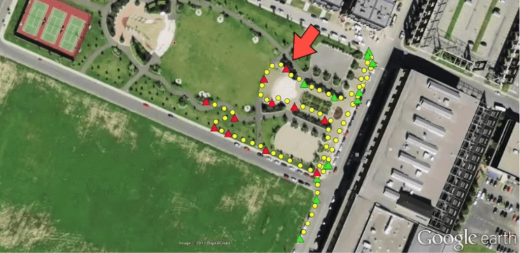
2: Back at the office, transfer the data files and GNSS observation files and import into EZSurv®. The software shows the areas of the survey that have not been RTK corrected (indicated below in yellow).
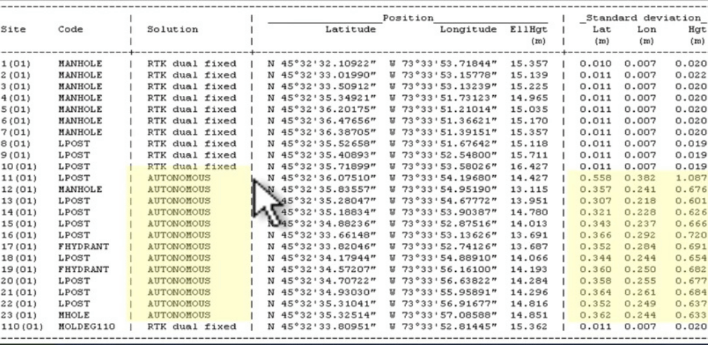
3: Begin processing. If you did not use your own base station, EZSurv® automatically searches the web to find the closest one...
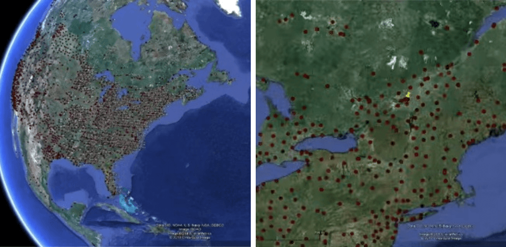
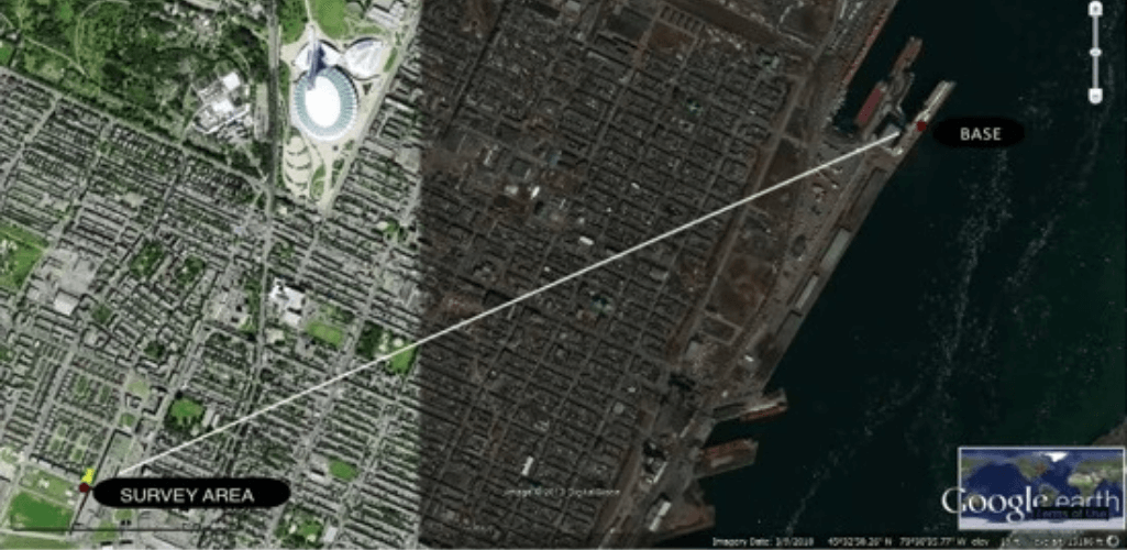
...and then downloads its files, merges them, creates all possible base lines or base rover combinations, interpolates the base at the field data interval and then processes the data - all with the press of a button.
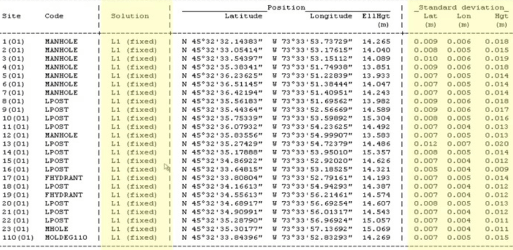
4: Now, when looking at the post-processed positions, all points have been corrected. The file/images can then be saved, including as a custom CSV format.
EZSurv® Adds To heliguy™ Surveying Ecosystem
heliguy™ provides end-to-end GIS support, including consultancy, hardware and software supply, and specialist surveying training. Adding EZSurv® to the portfolio enhances the photogrammetry aspect of the workflow.
heliguy™ in-house GIS lead, Ben Sangster, said: "We are delighted to partner with Effigis. Post-processing is an important step for photogrammetry and EZSurv® helps surveyors improve the accuracy and reliability of their survey or GIS data.
"In an event where RTK corrections are lost midflight, EZSurv® is able to retrospectively recover this accuracy, and gives users automatic access to thousands of base stations around the world to ensure results are as accurate as possible.
"This data integrity means that GIS professionals can fully utilise the benefits of PPK and have confidence in the fact that they are able to use this data to build robust digital assets which leads to better decision-making and return on investment."
As a GIS specialist, heliguy™ provides end-to-end workflow support, including dedicated aerial surveying training. Contact us to find out how heliguy™ can drive your GIS drone programme.

written by
James Willoughby
James joined heliguy™ in 2018 following a 13-year stint in print and online journalism, having worked on regional and weekly newspaper titles. He is responsible for spearheading heliguy™'s content strategy and social media delivery. James collaborates with DJI Enterprise's European marketing team to coordinate and produce case studies and helps organise events and webinars.