News
Atkins Using Drones For Increased Efficiency
Atkins is increasing efficiency, improving safety and saving money with drones, including a DJI M600 Pro with a Sony RX1R II camera integrated by Heliguy. ... Read More
Atkins, a member of the SNC Lavalin Group, is using drones for increased efficiency, improved safety, reduced costs, and high-quality data capture;
Heliguy completed a custom build for Atkins – integrating a Sony RX1R II sensor with a DJI M600 Pro drone;
Atkins praises Heliguy’s ‘design and development focus’ and describes M600 Pro as a ‘tried and tested system that provides high levels of redundancy and confidence when operating’;
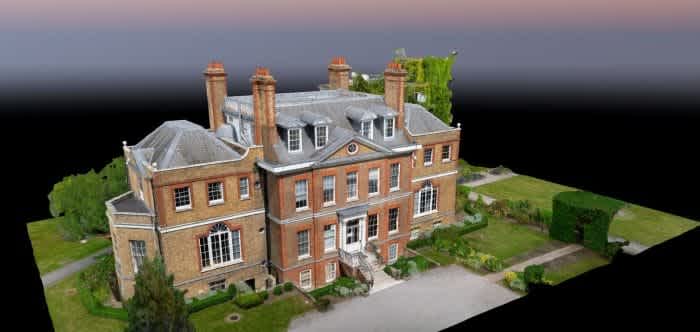
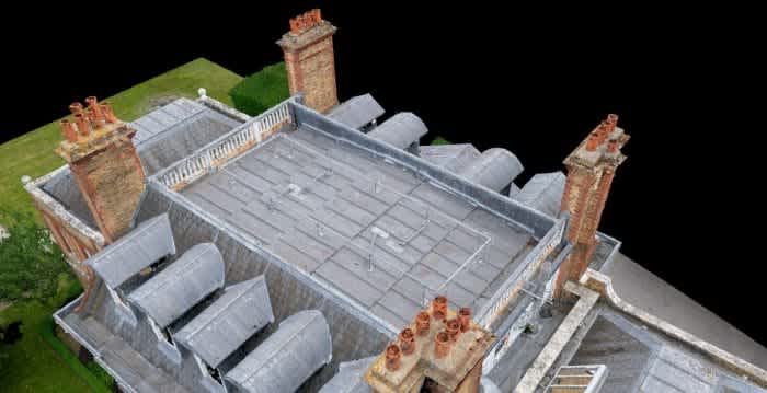
Check out eye-catching 3D models of a listed mansion house, created by Atkins using the DJI M600 Pro and Sony RX1R II.
Increased efficiency, improved safety, and reduced costs – world-renowned engineering and design company Atkins is benefiting from drones, including a bespoke DJI aircraft custom-built by UAS specialist Heliguy.
Atkins turned to Heliguy’s research and development team to integrate the Sony RX1R II sensor with a DJI M600 Pro – providing a tailored solution to meet the business’s specific survey requirements.
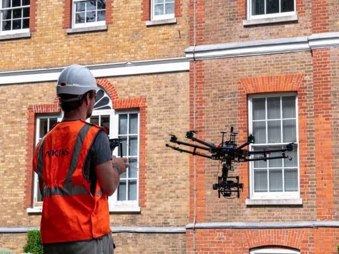
Atkins is using drones to maximise efficiency and capture accurate data.
Pairing the high-tech 42MP camera with the drone and a high-precision GNSS (Global Navigation Satellite System) has allowed Atkins to capture and generate accurate and repeatable data.
Heliguy’s design and development focus was a big part of why we chose them to assemble our chosen drone. The build and handover process of our M600 went very smoothly.
JAMES FLEMING, GEOMATICS CONSULTANT, ATKINS
Drones have become a key tool for the company’s aerial mapping missions, helping to mobilise quicker, reduce costs, and get higher-resolution images compared to the traditional method of manned aircraft.
Atkins is also using drones to create highly-detailed and accurate 3D models, like this one below, and says it wants to educate its clients on what can be achieved with unmanned aircraft.
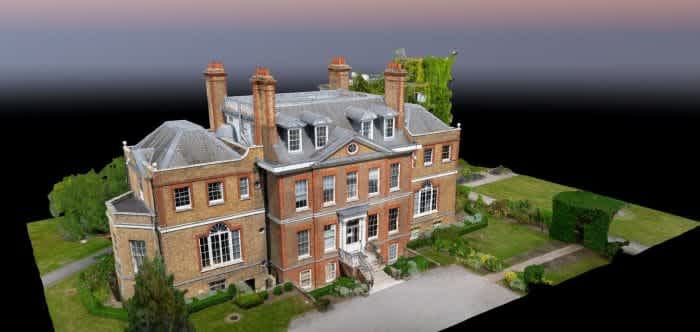
The 3D model of a mansion house.
In this Heliguy Insider blog, we talk to James Fleming, Geomatics Consultant (UK & Europe) at Atkins, to discuss how the company is benefiting from drones, and how Heliguy’s custom-sensor integration has played a key part in its operations.
Atkins’ Drone Programme At A Glance
Atkins, a member of the SNC Lavalin Group, is one of the world’s most respected design, engineering and project management consultancies, and has been using drones on its projects since 2015.
Compared to manned aircraft, drones allow us to mobilise quicker, reduce costs when surveying small to medium-sized sites, increase efficiency, and capture highter-resolution images – down to sub-cm from drones vs 2-3cm from manned aircraft.
JAMES FLEMING, GEOMATICS CONSULTANT, ATKINS
Until early 2019, the company was subcontracting the drone flying and focusing on the surveying and data processing, but has since brought the entire capability in-house.
James said: “This has allowed us to refine our workflow, operate at sensitive sites and provide a service that complements our wider geospatial offering.”
Atkins’ geospatial team has two drones in its fleet – a WingtraOne and the DJI M600 Pro.
The DJI M600 Pro – ‘A Tried And Tested System’
The DJI M600 Pro - which is sold by Heliguy - is a rugged and powerful drone for enterprise, including professional aerial photography and industrial applications.
The system’s modular design makes it easy to mount additional modules and it can be integrated with a range of Zenmuse cameras, as well as third-party software and hardware.
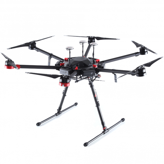
The DJI M600 Pro.
The airframe is equipped with the latest DJI technologies, including the A3 Pro flight controller, Lightbridge 2 HD transmission system, intelligent batteries and battery management system.
James said: “The DJI M600 Pro is a tried and tested system that provides high levels of redundancy and confidence when operating, and the ability to customise payloads means we’ve got a drone perfectly suited to our survey requirements.”
Atkins Utilises Heliguy Expertise
In this case, Atkins utilised Heliguy’s in-house technical team to integrate the Sony camera with the DJI aircraft.
Our R&D experts created a solution which involved a custom cable to trigger the camera and power the Sony device from the gimbal’s power supply.
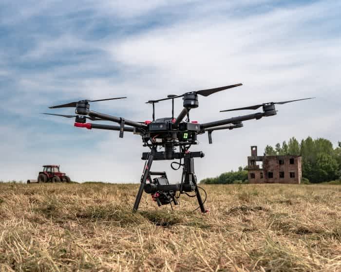
The DJI M600 Pro with the integrated Sony camera.
James said: “Heliguy was able to integrate our chosen sensor which, when combined with our high-precision GNSS, enables us to capture and generate accurate, repeatable data.
“Heliguy’s design and development focus was a big part of why we chose them to assemble our chosen drone. The build and handover process of our M600 went very smoothly and the team has been very quick to respond to any queries we’ve had since purchasing the kit.”
Heliguy’s technical department has a track record of custom-sensor integrations, creating bespoke solutions for the likes of the James Hutton Institute, Bridgeway Consulting, and Newcastle University.
Heliguy, a UK-based DJI Gold Partner and European enterprise award-winner, has recently expanded into America, opening a base in Texas to serve the U.S. enterprise and consumer markets.
Contact us to discuss how Heliguy can help with your bespoke build or custom sensor integration. Give us a call or send us an email.
Drones Versus Traditional Surveying Methods
Atkins has traditionally used manned aircraft for aerial mapping jobs. And while the company still employs these methods, drones have become a popular tool, especially for smaller sites.
James said: “Our primary offering within the geomatics team is aerial mapping, so for us the traditional way of capturing data is with a manned aircraft.
“While we still use planes and helicopters on many of our largest projects, drones allow us to mobilise quicker and reduce costs when surveying small to medium-sized sites.
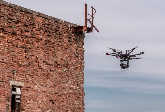
The DJI M600 Pro being used for inspections.
“We’re also able to capture higher resolution images – down to sub-cm from drones vs 2-3cm from manned aircraft – and combine mapping and inspection surveys into the same site visit, increasing efficiency.
“When compared with terrestrial survey methods, drones dramatically reduce the amount of time the survey team spends walking the site, allowing us to reduce or even eliminate the time spent working in potentially dangerous environments.”
Drone Mapping With Atkins
Atkins has harnessed the power of drones on many occasions, including during the redevelopment of the company’s office in Epsom.
James said: “We used the DJI M600 Pro to capture images of the site, which were then processed into survey products – orthomosaic, point cloud and a 3D topographic map.”
The team also carried out an inspection of a nearby listed Mansion House…
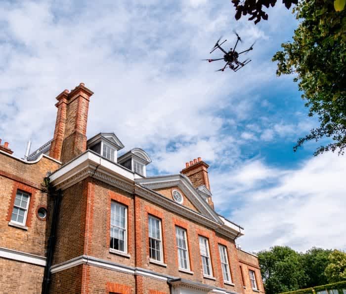
…and processed the images to create this 3D point cloud.

James added: “The addition of a PPK (Post Processed Kinematic) GNSS unit meant we were able to reduce the amount of control needed across the site, increasing the speed of our survey compared to previous drone operations and improving robustness of the Aerial Triangulation and BBA (Bundle Block Adjustment).”
Creating 3D models by drone is incredibly valuable. The models can be shared quickly and easily with stakeholders, providing key updates about how a project is progressing and allowing a property/site to be monitored and inspected.
What Does The Future Hold For Atkins’ Drone Programme?
With drones forming a key part of Atkins’ operations, what does the future hold for the business’s UAS programme?
James said: “The next step is of course growth – more projects, more teams and more parts of the business adding aerial survey data into their workflows. However, the real focus is all about maintaining quality.
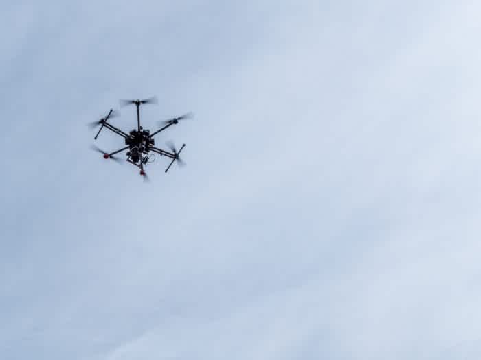
James Fleming, from Atkins, is keen to expand Atkins' drone provision in the future.
“We have a very thorough workflow that’s been developed on the back of our 30+ years of experience carrying out aerial mapping from manned aircraft, and we think it’s very important to provide confidence in the data we’re delivering and to educate clients on what can be achieved with drones.”
To discuss how the DJI M600 Pro can help your operations; to find out how Heliguy can start, support, or scale your enterprise drone programme; or to discuss a custom sensor integration, contact us by email or phone.
