News
DJI AirWorks 2020 Updates
Updates from DJI's 2020 AirWorks conference, including news about product launches and how drones are transforming the world of work. ... Read More

DJI's AirWorks 2020 conference takes place from Tuesday, August 25, to Friday, August 28.
Commercial drone professionals, technology experts and policymakers will be speaking during the event to discuss the key aspects of the drone industry.
HELIGUY.com™ will be reporting during the conference, so please keep checking back for updates.
Day Three - Thursday, August 27, 2020
Here are some of the key takeaways from the second day of AirWorks 2020.
Fear-Based Regulations Hurt The Drone Industry
Brendan Schulman, DJI Vice President of Policy & Legal Affairs, launched a scathing attack on politicians and competitors who are using fear to drum-up 'ham-fisted drone regulations'.
Mr Schulman was reflecting on the 'worrying and tragic' situation in America, which has led to some drones being grounded because they have been manufactured in China.
He said that this, and the potential for further drones to be grounded based on their country of origin, was not fair or rational.
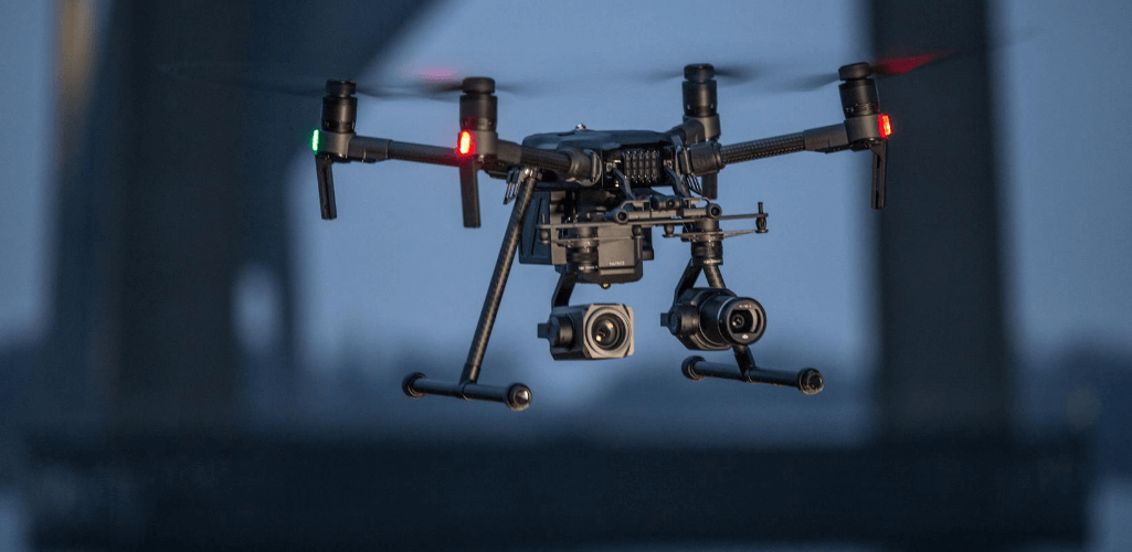
Mr Schulman said that so-called cybersecurity concerns that have been thrown at DJI were unfounded and unproven and warned that these fear-based bans put lives and property at risk and damage market competition.
He said: "There are proposals in place right now that would restrict your ability to choose the drone you want to operate and restrict the range of drone products that you can choose from. This is not an abstract threat, it is very real.
"Some would take away your ability to choose the best drone for your job, or force you to buy a certain type of drone, or ground your operation - no matter how beneficial.
"There are many proposals in Congress and the White House, such as the American Security Drone Act and a draft Executive Order, that would ground drones across the whole of the Federal Government based on where they are made or where their components are made.
"It is not a fair or rational policy outcome and we shouldn't be subject to discriminatory policies that hold us to higher and different standards.
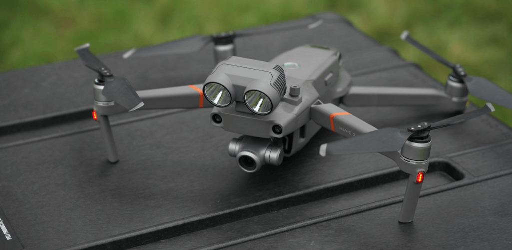
"Pilots flying sensitive missions deserve to have technology products that meet their security needs, but there are no standards or specific national requirements for drone technology cybersecurity. Proposals based on where a drone is made are a very poor substitute.
"How can you can block a drone with rock-solid security just because it is assembled in China, but give a free pass to a drone built in America even if it has security flaws? That's a problem."
Drone Industry At A Crossroads
Mr Schulman continued, warning that the industry is now at a crossroads.
He said: "Will myths and fears about drones and drone data security, pushed not only by politicians with an agenda but companies that hope to capitalize on fear, drive extreme and irrational policy outcomes that stop you from doing good things with your drone?
"Or will the government and the industry play a helpful role to treat drone technology like any other and develop standards so you can be assured that your equipment protects your data?"
He warned that ham-fisted regulation driven by fear will create a 'distorted market worked by political objectives', and if it is allowed, it will only be 'a matter of time before it restricts whether you fly at all'.
Rally Your Local Members Of Congress
To counter elected officials who are proposing the bans, Mr Schulman urged the drone community to rally their local Senators and members of Congress to highlight how drones are being used safely and effectively.
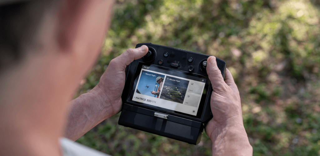
He said: "If they hear from American industries who have come to rely on drones, and are capable of managing security issues and choosing products fit for purpose, they will realise the truth.
"Take the time to brief them on the issues and explain how future innovation using these revolutionary tools is at risk.
"What you are asking for is reasonable - you should demand that all drone regulation, whether it concerns safety, privacy, or security, is risk-based and premised on technology standards that allow open and robust competition in the market place."
Day Two - Wednesday, August 26, 2020
Here are some of the key takeaways from the second day of AirWorks 2020.
Drones Have Saved Our Clients 'Millions Of Dollars'
Over the last two years, Valmont Utility has switched roughly 80% of inspection work over to drones - and is reaping the rewards.
Jake Lahmann, Quality - UAS Manager at Valmont Utility, said: "This has increased both the quality and speed of our inspection and we can offer more accurate, actionable reports to the customers.
"Even more impressively, we have saved a ton of money - literally millions of dollars - for our clients."
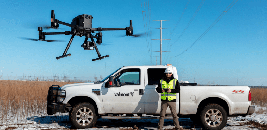
Valmont Utility has been utilizing the DJI M300 RTK with H20 payload, and the drone is helping with major efficiency gains.
Mr Lahmann said: "This platform has increased our efficiency by at least 30%.
"This means that this drone is not just a purchase for us, it is an investment that would pay for itself."
Deploying A Drone As A First Responder
DJI's Romeo Durscher highlighted how Chula Vista Police Department is using a drone as a first responder, and to great effect.
In many cases, the drone has arrived on the scene first, providing vital situational awareness and even leading to the cancellation of ground crews. It has also assisted in hundreds of arrests.
Chula Vista's concept of a drone as a first responder (DFR) is an interesting demonstration of the technology and the stats make for positive reading:
Total calls: 3,200
DFR Assisted Arrests: 414
DFR deployment avoided dispatching a patrol unit: 762
DFR first on scene: 1,316
Average response times - first on scene (in seconds): 106.54
Average Response Times - all calls (in seconds): 138.05
Mr Durscher said: "The DFR concept allows them to stream live views from the incident to the HQ and potentially escalate or deescalate the situation.
"Over 700 times they were able to cancel ground units, which is fantastic resource management, saving time and money."
The DFR Pilot Program is based from Chula Vista Police Department's HQ, with a limited flight range of about a one-mile radius.
The drone is used as a first responder for documenting crime and accident scenes, searching for missing or wanted people, fires, and evaluating damage.
DJI M300 RTK 'Really Fantastic' For Public Safety
DJI's Romeo Durscher praised the DJI M300 RTK and the H20 payload series.
"This is a really fantastic new platform with many new capabilities to help public safety during their crucial operations, especially with the integrated thermal, laser rangefinder and pinpoint features," he said.
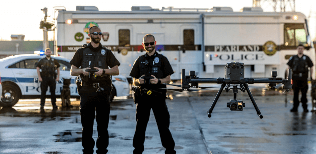
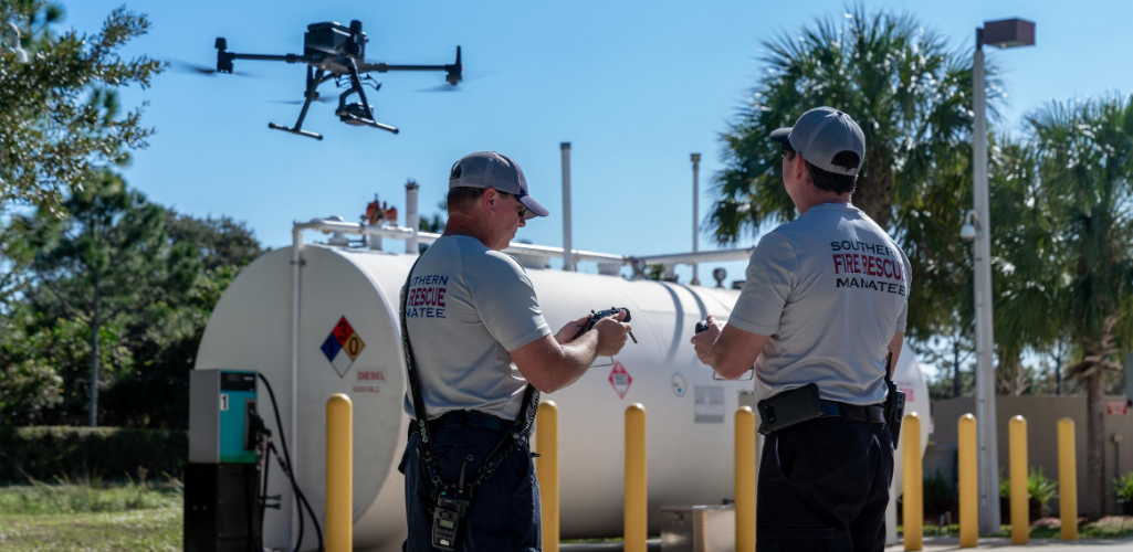
Rich Gatanis, Firefighter / UAS Coordinator, of Southern Manatee Fire Rescue, echoed Mr Durscher's sentiments.
He said that the M300 RTK is 'brilliant' for HazMat response.
He described drones as the 'unsung heroes of emergency response for the dull, dirty, and dangerous tasks'.
"Drone technology has changed the landscape of emergency response," he added.
Drones Have Saved 430 Lives
DJI's Romeo Durscher said that drones have saved 430 lives to date - and these are just the ones we know about.
This number has come from 244 incidents across 28 countries, showing the true value of drones in public safety.
To further enhance the importance of UAS, Mr Durscher said that drones have helped to save even more lives - those of the first responders who are going out to incidents and deploying UAS.
He said that thanks to drones providing fast and real-time data, better situational awareness can be gathered and better decisions can be made to keep first responders safe.
Drones Showed Their Worth During C-19
Brendan Schulman, DJI's VP of Policy & Legal Affairs, and Romeo Durscher, DJI's Senior Director of Public Safety, described how drones have been used for good during the coronavirus pandemic.
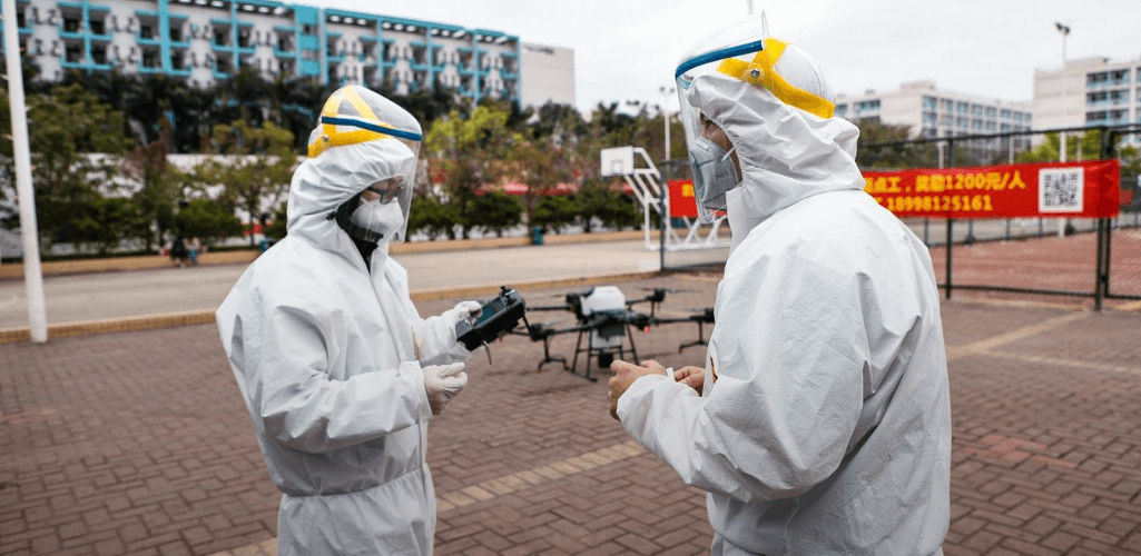
During the keynote speech, entitled Resilience Through Joint Innovation, Mr Schulman said: "The benefits of drones are most visible during the most challenging of times. We should all be proud of this industry and our technology as it has risen to the challenge of Covid-19 and helped the world face the unprecedented challenges of this crazy year.
"The spirit of innovation and adaption that has always driven the drone industry is exactly what we need when a global pandemic is turning the world upside down."
Mr Durscher gave numerous examples of drone deployment in North America during the C-19 crisis, including dropping masks, gloves and medicine to those in need, and assessing homeless camps to help at-risk people and using a speaker to provide information about available check-up stations and water.
He said that DJI's Disaster Relief Program was opened up across America in the wake of the COVID-19 outbreak and they were inundated with requests.
In total, 45 departments across 22 states benefited from the Program, with 100 drones given out by DJI. These departments were also tasked with passing on lessons learnt to others.
Day One - Tuesday, August 25, 2020
Here are some of the key takeaways from the first day of AirWorks 2020.
DJI Phantom 4 RTK Helps Meet Surveying Expectations
Mohammed Morsi, Customer Success Engineer, at Propeller Aero, praised the DJI Phantom 4 RTK for its mapping capabilities.
He said that a few years ago, in the very early days of drone surveying, there was a large disparity between hardware capabilties and expectations.
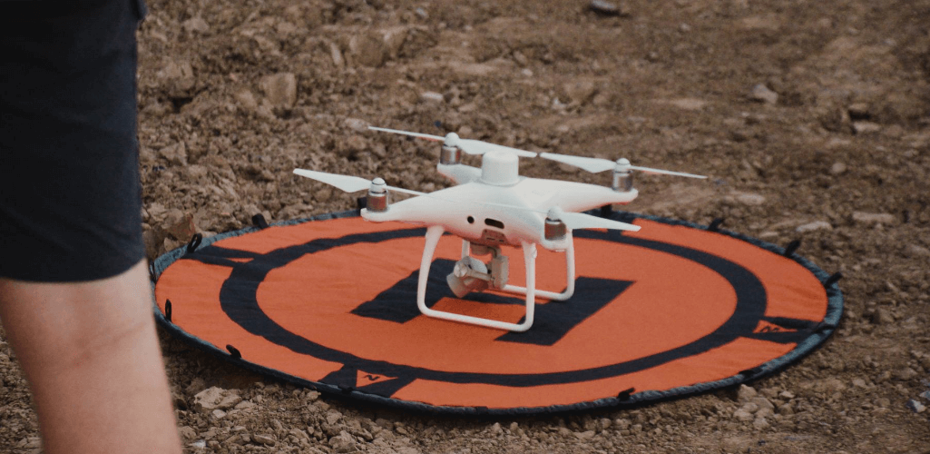
But thanks to the Phantom 4 RTK surveying drone - released in 2018 - 'the capabilities of the hardware are finally meeting expectations, coupled with software'.
"The Phantom 4 RTK is an accurate, easy, and affordable solution for drone surveying," he added.
DJI and Propeller Aero have teamed up to create a 'fully-integrated drone survey workflow'.
"The Phantom 4 RTK was the missing puzzle piece to Propeller's surveying solution," he said.
This solution combines the drone, with Propeller's AeroPoints (smart ground control points) and Propeller's software to provide a streamlined workflow, as detailed below:
Place AeroPoints (15 mins)
Fly drone over site (45 min)
Upload AeroPoints data (15 min)
Upload drone images (30 min)
Process dataset (within 24 hours)
Analyze and share site maps and models
"This allows users to pick up a solution out of the box, use that same day and generate an accurate drone survey," he said.
Drone Data Provides 'Roofless Transparency'
Thomas Haun, Chief Operating Officer at Turner Mining Group, highlighted the benefits of having a drone program for mining.
He said one of the most crucial aspects of using UAS is the ability to capture accurate, live, and up to date information - collecting data which is 'useable and valuable'.
He added that this data can then be shared with clients.
He continued: "Drones provide the ability to provide a shared understanding which creates a better partnership with our clients. It takes away the hesitation - it is a roofless transparency - and this provides trust."
Tactical BVLOS Waivers 'Very Exciting'
First responders can now apply to the FAA for a Tactical BVLOS drone waiver to help their response during emergency situations.
Chief Charles Werner, of DRONERESPONDERS, described this as very exciting and a fantastic achievement.
BVLOS waivers could be used for a variety of missions, including HazMat missions and incidents involving an active shooter, he said.
"These waivers allow operators to work from a safe location," he added.
Public Safety Use Cases On The Up
Chief Charles Werner, Director of DRONERESPONDERS Public Safety UAS Alliance, said that the number of public safety use cases has grown massively over the last few years, showing the potential and the benefit of drone technology.
Giving some examples, he explained how UAS can be used for vital situational awareness, such as deploying drones with thermal capabilities to pick up heat sources and see through smoke.
He said drones have become a key tool for accident reconstruction following road-traffic collisions, adding: "Drones free up roadways and reduce secondary accidents, helping to save lives."
Other use cases included HazMat response, and damage assessment following earthquakes, among other examples.
"Drones give us a bird's eye view of what is involved and the magnitude," he said.
New FLIR DJI Drone Camera Launched
FLIR launches the TZ20 - the first dual thermal payload. The sensor will be compatible with the DJI M300 RTK and M200 Series V2. Read more here.
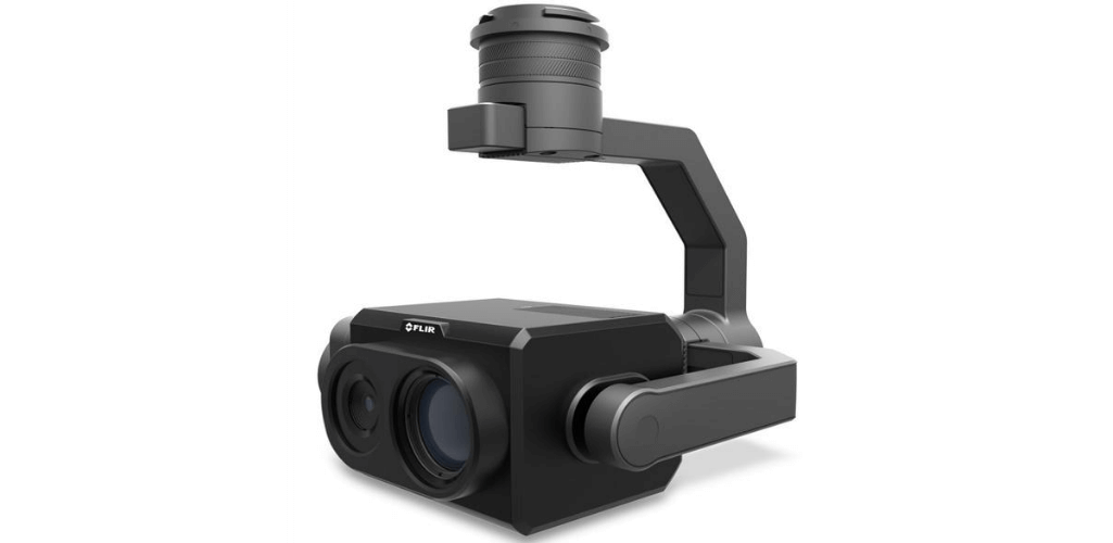
The FLIR launch was the last piece of the opening keynote speech.
DJI Sets Out SDK Vision
DJI's Christoper Tuazon outlined the future of DJI's SDK program. He said it comprised three main elements:
Improved industry capabilities;
Improved access to DJI;
New co-operation methods.
As part of this, he said that there would be improved access to DJI's support system and that DJI is looking to find new partners to enable more developer ideas.
"We want to jointly develop solutions, work together with ecosystem partners, and open up new applications for drone technology," he said.
DJI's Christoper Tuazon said that one of the key aims is to move towards intent-driven drone flights and more drone automation.
New Drone LiDAR Solution Unveiled
Christopher Chen, from Livox, unveiled a new LiDAR solution.
Livox Avia will be compatible with the DJI M300 RTK and M200 Series and features a compact design for easy integration, is sub 500 grams, has a wide 70 degree FOV, and has a detection range of up to 500 metres.
It can also create high-density point clouds and supports up to three returns.
He said it was ideal for surveying applications and drone integration and described it as the perfect combination: Small, compact, and powerful.
Mr Chen said that the Livox Avia will be available to pre-order from September.
Arjun Menon, Engineering Manager, for DJI Research LLC, stressed the importance of LiDAR, saying it allows teams to check for quality, cross-check for blueprints, and spot errors.
He said that DJI is stepping up its efforts to bring an affordable and scalable LiDAR solution to the market and that DJI is investing heavily in the LiDAR space.
He said that DJI believes in the value of LiDAR and wants the application to extend beyond surveying and mapping, with potential use-cases across a range of other industry verticals, including public safety.
DJI FlightHub To Become Mission Management Platform
DJI's Christoper Tuazon said that a new comprehensive drone management platform would be created.
This will mean that DJI’s FlightHub software will evolve from a fleet and pilot management tool, progressing to a comprehensive mission management platform centered on flight operations.
With the new system, drones will deliver live data on top of an enhanced reality model for better coordination between field operators and command centers.
He said that more information will be released in December this year.
DJI Looking At Whole Drone Ecosystem
Christina Zhang, Senior Director, Corporate Strategy & Communication at DJI, opened the keynote speech by saying that DJI will set out its vision for the commercial drone industry throughout 2021.
Christopher Tuazon, Senior Brand Manager for DJI, said that DJI wants to look at the whole drone ecosystem - including hardware, software and flight automation - to provide the world with a standardized, integrated data collection platform.
As part of this, DJI will move into three key areas:
Integrated product ecosystem, built around flight execution, flight management, and data output;
Optimizing geospatial data collection;
Move to intent-driven flights.
