News
Drone Cage Benefits International Conservation Projects
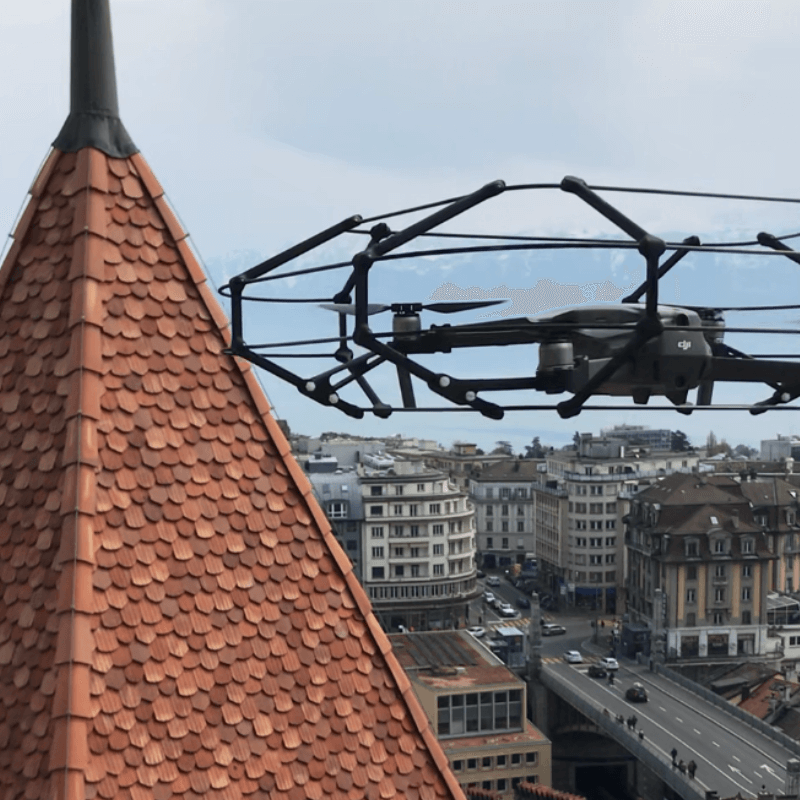
The heliguy™ Mavic 2 drone cage is helping an international conservation team map historic sites across Europe. The cage enables operations which weren't previously possible and helps the team fly closer to heritage structures to obtain bet ... Read More

heliguy™ Mavic 2 drone cage helping drone conservation projects, enabling operations that weren't previously possible;
Archéotech SA, in Switzerland, is using the cage during photogrammetry missions;
The protective frame facilitates better data collection, enabling the drone to be flown closer to heritage structures - sometimes located in remote or difficult-to-access areas;
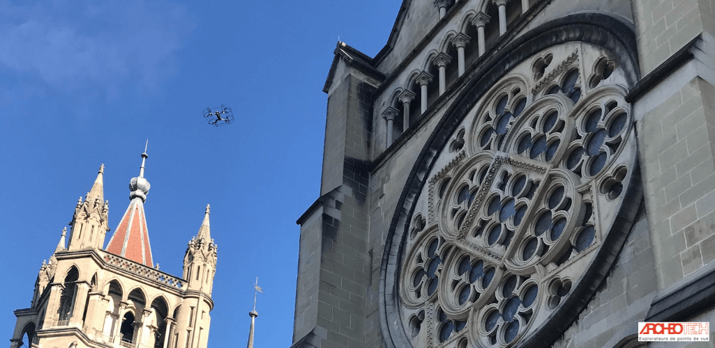
The robust cage has proved an effective tool for indoor data collection, including mapping parts of the 12th century Cathédrale de Lausanne;
Drones have become a key tool for conservation, collecting data to build 3D models and 2D orthophotographs for enhanced heritage protection and understanding.
A leading international heritage company is using DJI drones to enhance its conservation efforts - and says the heliguy™ Mavic 2 drone cage enables operations which weren't previously possible.
In one example, the protective frame was deployed during a mission to map an antique bridge in Le Sépey, Switzerland. It helped the Archéotech SA team fly closer to the historic and remote structure, collecting better quality data to build this stunning 3D model - using a Mavic 2 Pro - and conduct in-depth measurements.
Video: Drone Sépey Bridge Inspection
"We are really happy with the Mavic 2 drone cage," said Elise Feihl, Technical and Architectural Surveyor at Archéotech SA.
"It is easy to fly, it is a robust piece of kit which helps to protect our Mavic 2 drones and enables us to collect previously unobtainable data from heritage sites to enrich our conservation efforts and deepen our understanding of the past."
How The Mavic 2 Drone Cage Is Helping Conservation Projects
Archéotech SA has been contributing to the study and conservation of archaeological and artistic property in Switzerland and across Europe for nearly 40 years.
The company develops and applies innovative documentary techniques linked to natural, built and movable heritage.
Drones play an integral role. And the collision-proof heliguy™ Mavic 2 drone cage has become an essential tool in the box.
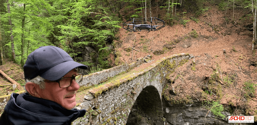
Elise said: "We conduct a lot of drone flights to collect photogrammetry data, so picture resolution is important for us.
"The cage allows us to fly closer and improve our photographic resolution and quality in remote and difficult-to-access areas."
Drone Bridge Inspection
The cage has proved its worth on a range of conservation missions, including a portfolio of bridge inspections.
Video: Caged Mavic 2 returns from bridge surveying mission
Reflecting on one in particular, Elise said: "We had to obtain pictures of the bottom part of a bridge made of concrete and the drone was the only way to get close enough to the structure so that the engineers could see and report cracks and concrete damages.
"It was a challenging mission: No GPS assistance, and the pilot team was attached to a rappel rope in the cliff, positioned about 100m from the drone.
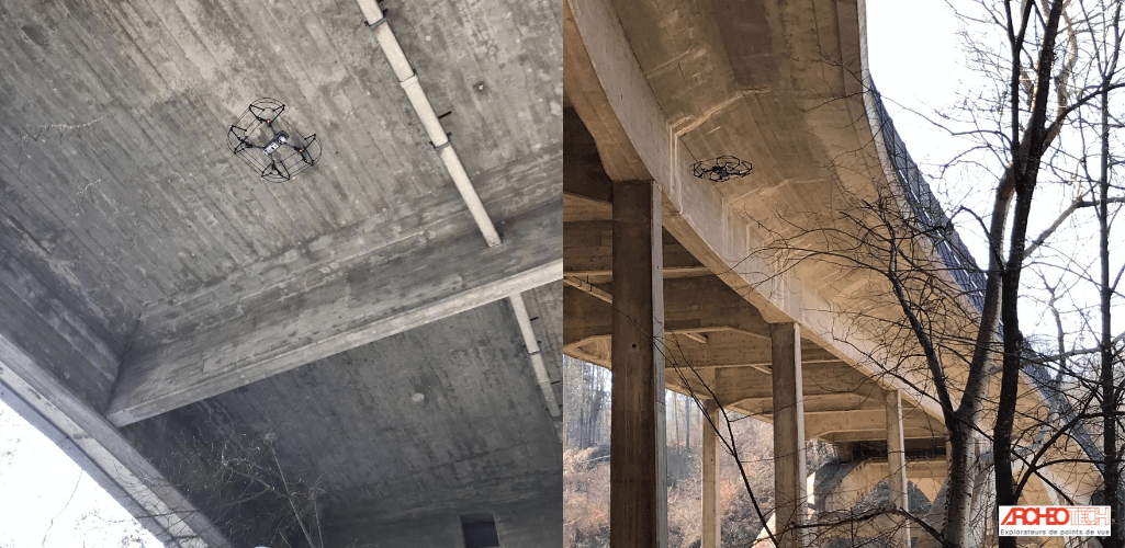
"To obtain the best data, we needed the drone to fly as close to the bridge as possible. In this case, the cage was absolutely necessary, and allowed us to fly about 1.5m away from the structure, safe in the knowledge that the drone and the bridge were safe from a damaging collision."
Drone Cage Deployed For Mapping Historic Cathedral
Through its work, Archéotech SA has demonstrated that the cage can benefit internal drone mapping missions.
The company is part of a group project working on the preservation of the 12th century Cathédrale de Lausanne, in Switzerland.
The collection of graphic and metrical documentation - both inside and outside - is required.
Video: heliguy™ Drone Cage used to inspect Cathedrale de Lausanne, in Switzerland
Elise said: "The cathedral contains lots of architectural details and paintings and we provide these documents by flying inside, close to facades, and obtaining imagery through drone photogrammetry to help build 3D models, such as this 3D representation of the cathedral's iconic Painted Portal.
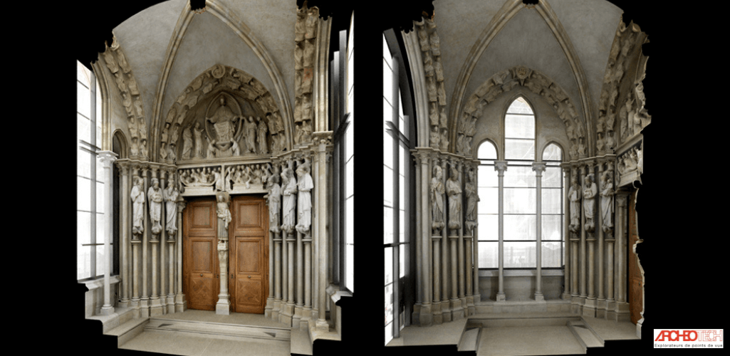
"The drone enables us to collect imagery and details that we cannot see from the ground and the cage plays an important role. It enables us to fly closer to these artifacts and church structures, and allows us to fly narrower areas.
"Our drone mounted with the cage also requires less logistics, compared to using an elevating nacelle - not to mention it is cheaper!"
Mavic 2 Drone Cage - A Robust Solution
Designed as a cost-effective and versatile entry to the caged drone market, the in-house designed heliguy™ Mavic 2 drone cage is made to withstand collisions up to 3m/s.
Video: heliguy™ Drone Cage returning from a surveying mission
Archéotech SA has first-hand experience of the frame's robustness.
Elise said: "During a mission to map a bridge, we bumped into the structure once and the cage rebounded without any uncontrolled movement, which was appreciable.
"We did not observe any mark on the cage or the drone, meaning that the cage is a robust solution."
Using Drones For Archeology And Conservation
Archéotech SA has a fleet of drones, including the Mavic 2 Pro, Mavic 2 Enterprise and Mavic 2 Zoom which are deployed with the cage.
Unmanned aircraft has emerged as an innovative tool to facilitate conservation, bringing with it multiple benefits, such as:
Quick and easy measurements of buildings, excavations or technical infrastructures;
Generation of photographic quality 3D models;
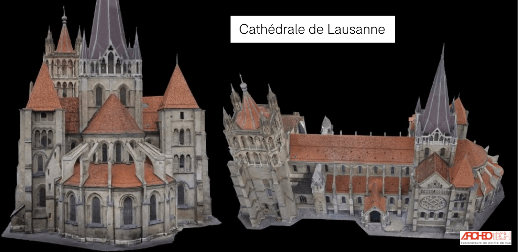
Possibility of superimposing the models on historical photographs to reconstruct missing elements;
Rapid production of photographic quality metric base supports;
Less intrusive way of collecting data from sensitive, heritage or at-risk sites;
Regular drone mapping can document the progress of an excavation project;
Computer-generated photographs illustrate situations which could never be documented simultaneously in situ before;
Attractive 3D models can be used in visitor exhibitions and in promotional material.
Elise said: "Drones, especially photogrammetry, are helping in archeology in surveying and documentation."
Archéotech SA uses drone data to build a range of digital assets, such as point clouds, orthophotographs...
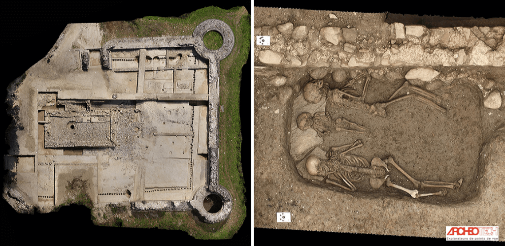
...3D models, augmented reality and topographical surveys...
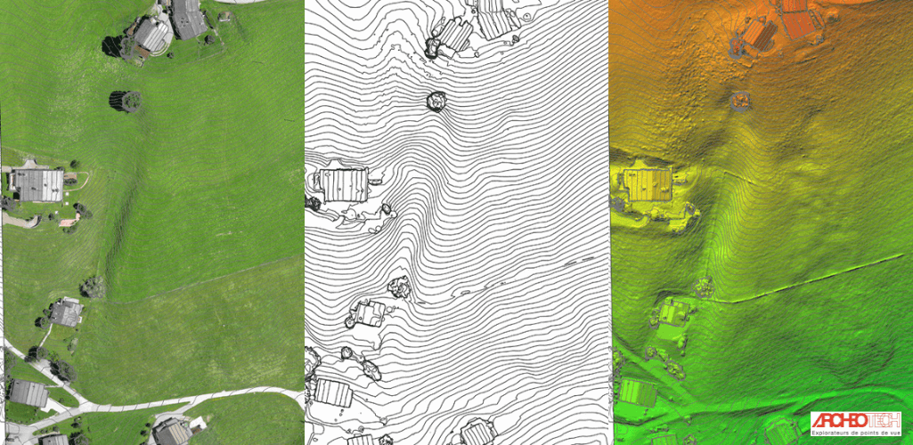
These assets can be used to conduct accurate measurements and build striking visual representations to help conservators come up with advanced and data-driven plans to better protect and understand worldwide heritage assets.
It is a beautiful combination of the old meeting the new: Deploying modern technology to preserve the past and safeguarding historic sites for future generations.
© all images, videos and 3D models presented in this article are Archeotech SA property and more info can be found at www.archeotech.ch
