Products
Drone Gas Detection With Sniffer4D
A demonstration has shown how the Sniffer4D gas detection system can be used with the DJI M300 RTK drone to benefit public safety operations.
Demonstration of the Sniffer4D gas detection system with the DJI M300 RTK drone showed its value for public safety;
The module quickly identified numerous gases/substances during a simulated fire, providing real-time insights about concentration levels, location, and direction of travel;
Data can be viewed in 2D or 3D, courtesy of Sniffer4D Mapper, for deeper insights;
A drone and Sniffer4D is up to 60 times more efficient than traditional methods, quickly covering large areas. It is also a safer method of data collection, replacing the need to send personnel into hazardous areas;
The module can be used for a range of applications, such as industrial inspection, scientific research, and environmental monitoring.
A demonstration has shown the capabilities of a drone-based multi-gas detection system, including for public safety and HazMat operations.

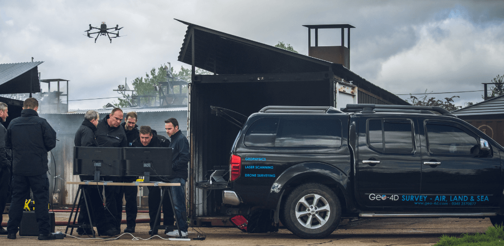
The Sniffer4D V2 solution was integrated with the DJI M300 RTK for the trial, hosted by London Fire Brigade.
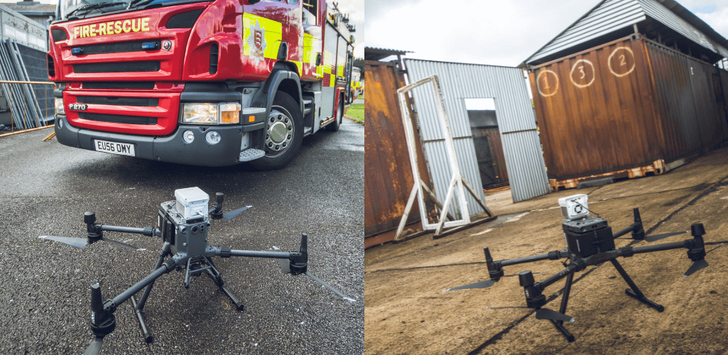
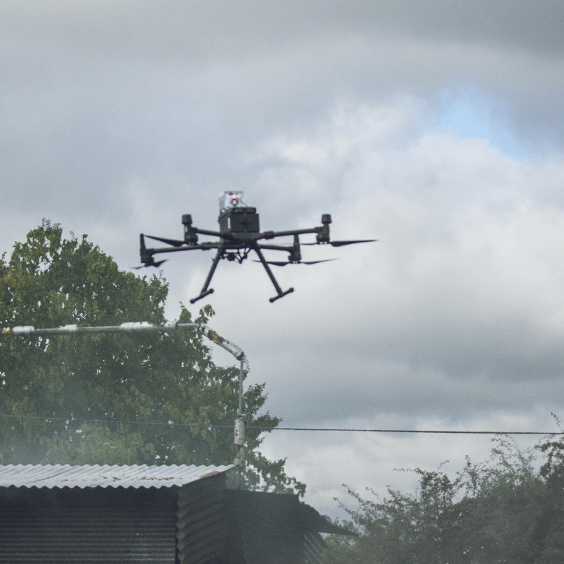
Flown above a smoking building, the module quickly identified numerous air pollutants in the plume, such as carbon monoxide, sulphur dioxide, nitrogen dioxide, and VOCs (volatile organic compounds).
Providing real-time insights, it not only detected different gases, but also revealed their location, concentration and direction of travel.
Lee Newman, Station Officer at London Fire Brigade, said this type of information would be invaluable for bolstering situational awareness and safety during a live incident.
He admitted that the drone gas detection system impressed at the trial and 'raised a few eyebrows' among attendees, which included representatives from Essex Police and Fire, and Hertfordshire Police.
Station Officer Newman said: "Sniffer4D is really good and performed well during the trial, showing its effectiveness for public safety and HazMat operations. Information is king and the more you have helps to build a better plan, which facilitates incident response and crew safety.
"In the case of the trial, the gas detection system was able to provide more details about the smoke cloud than a visual camera could, telling us what type of hazardous substances were in the plume, their concentration, and where they were heading.
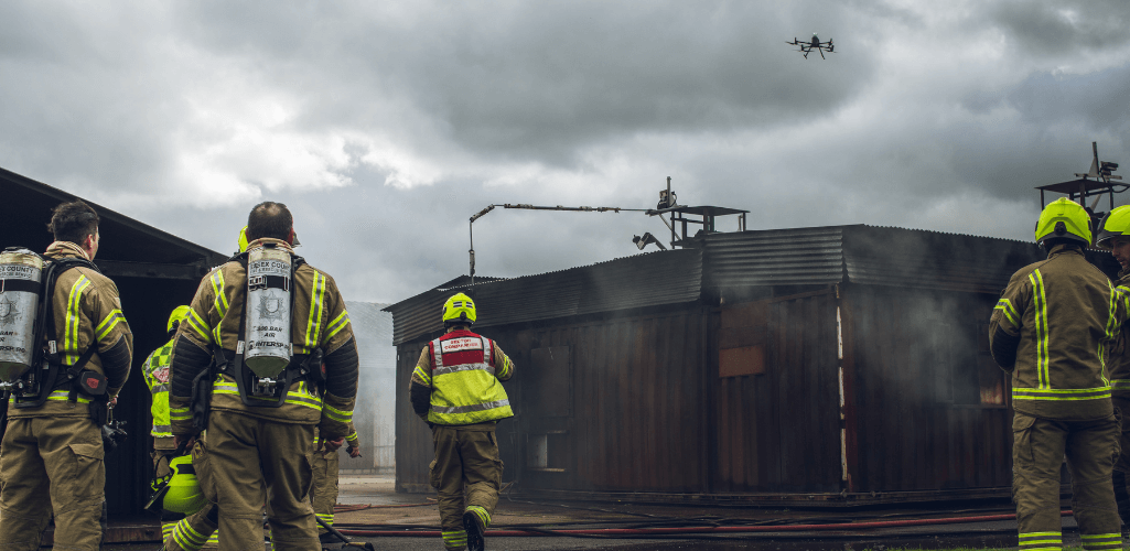
"In a real-world event, this would not only help us tackle the incident, but help us better protect the nearby community, taking preventative action such as telling them to shut windows or redirect traffic - especially if there were high levels of really dangerous substances. And the system obtains the information you need while keeping crews away from the incident."
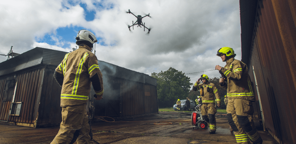
Sniffer4D Aerial Gas Detection - The Solution
The Sniffer4D ecosystem combines the gas detection unit which integrates with the drone and the Sniffer4D Mapper software, helping to analyse spatial distributions of particles and air pollutants and identify sources and transportation of air pollution.
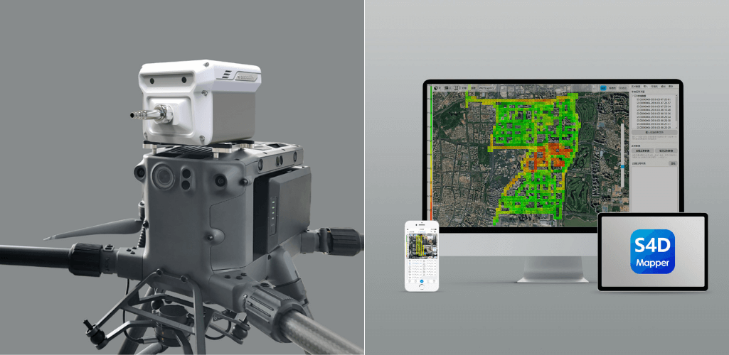
This plug-and-play solution - also compatible with the DJI M210 Series V2/V1 as well as the Mavic 2 Series, including the Mavic 2 Enterprise Advanced (via a mounting kit) - can detect up to nine gas and particle concentrations at a time. The available parameters are:
PM2.5&10
Hi-Res O3+NO2
Hi-Res NO2
Hi-Res CO
Hi-Res SO2
Wide Range VOCs
Wide Range H2S
Wide Range CxHy/CH4/LEL
Wide Range CO2
Wide Range NH3
Wide Range HCI
Wide Range HF
Wide Range O2
Wide Range SO2
Wide Range H2
CI2 Sensing Module
PH3
TSP PM100
These can be configured for specific operations, ie:
Ambient Air Monitoring: PM2.5, PM10, O3, NO2, CO, SO2, VOCs.
HazMat: VOCs, CH4, CO, CI2, O2, NO2, H2S, CO2.
Oil and Gas Plant Leak Detection: VOCs, CH4, H2S, SO2.
Each gas detected is individually georeferenced, and operators can also obtain temperature and humidity data for each section of the dataset.
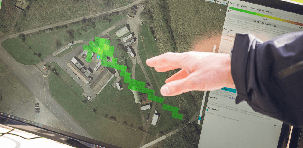
Using data from the exercise, the graphic below shows how operators can obtain key pieces of information across individual areas of the map.
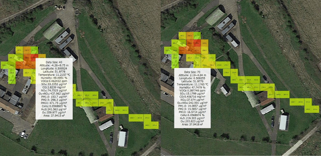
During the trial, the module detected numerous gases/substances, such as nitrogen dioxide (NO2), carbon monoxide (C0), and P.M2.5 (particles or droplets in the air that are two and one half microns or less in width).
The below graphic shows four of the substances detected and demonstrates how operators can toggle between them to obtain crucial insights.
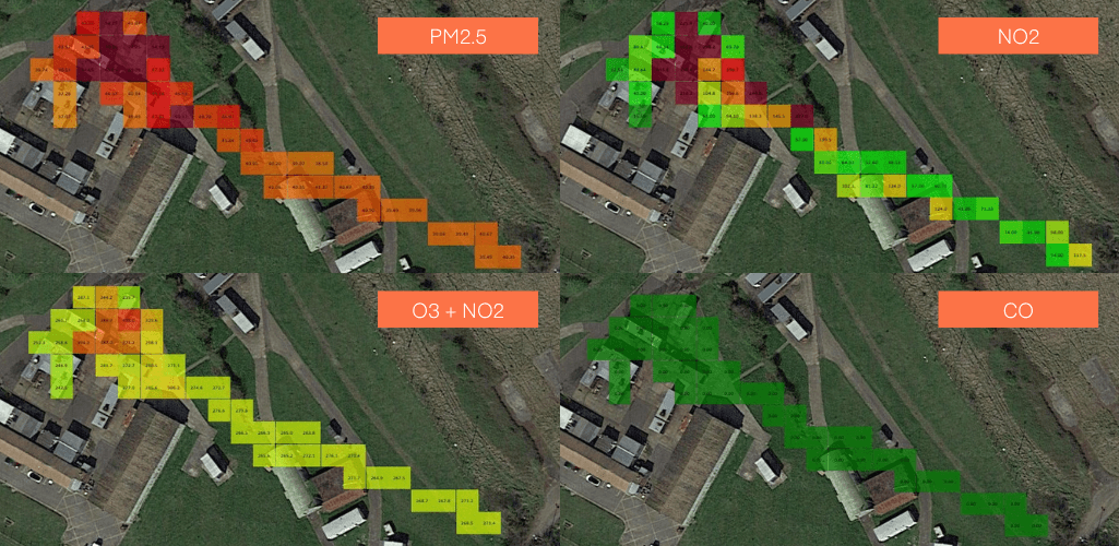
Notice how the concentration intensity of each substance is reflected by a numerical value and different colours, which align to a matching scale and with parameters relative to each gas. The image below gives a close-up view of part of the dataset.
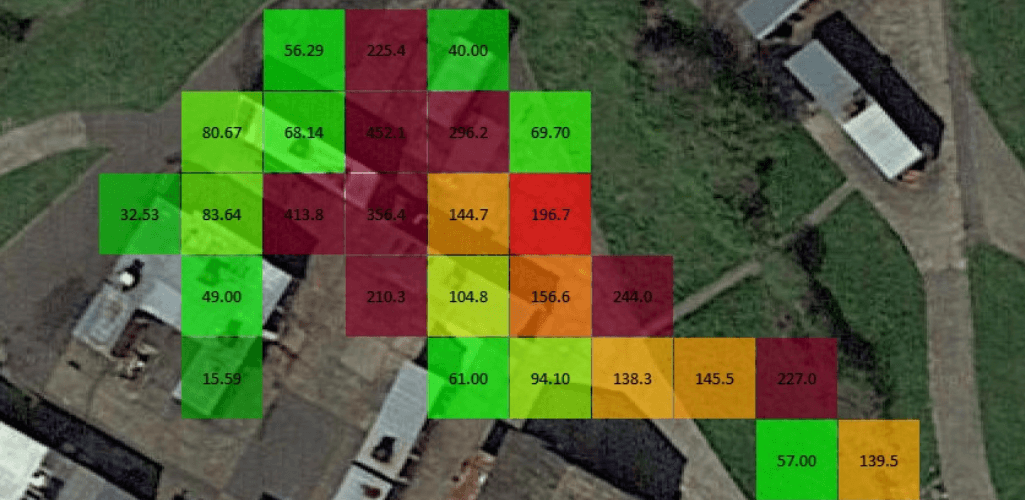
The information is overlaid on a map to provide a true visual representation of where the gases are and their direction of travel.
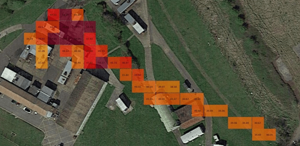
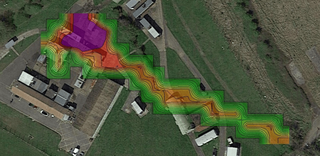
The data can be analysed using 2D or 3D concentration maps. The options are a 2D grid, 2D contour, and 3D point cloud. Taking the levels of nitrogen dioxide from the trial as an example:
2D Grid: Best for displaying how the concentration values vary in different locations.
2D Contour: Best for showing the concentration distribution trends. It also shows the hotspot for that particular gas.
3D Point Cloud: Best for revealing concentration differences at different altitudes.
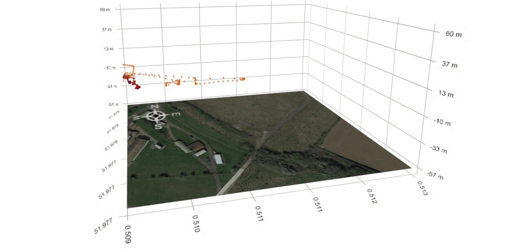
This information - via Sniffer4D Mapper - enables the quick evaluation of concentrations of pollutants and the spatial extent of contaminants in hazardous accidents to facilitate decision-making.
The concentration of each gas can also be viewed in real-time via the DJI Pilot app screen.
A video live stream from cameras such as the H20T can also be played within the Mapper software.
For deeper insights, Sniffer4D Mapper enables operators to conduct the following:
Load historical data for analysis and review.
Overlay a high-definition orthophoto on top of the obsolete or low-definition satellite map to better match up high concentration spots with actual scenes.
One-click generation of mission reports and datasheets.
Real-time readings from one or multiple Sniffer4Ds can be viewed on multiple PCs with Sniffer4D Mapper installed.
Which Industries Benefit From Sniffer4D Drone Gas Detection?
Sniffer4D provides hyper-local gas detection and mapping.
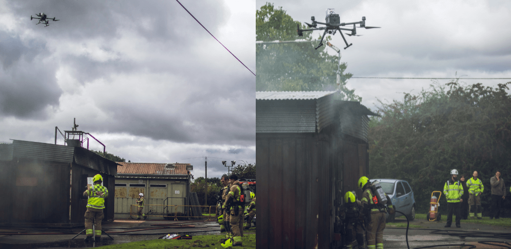
As such, it can be used across a range of industry applications. These include:
Environmental Monitoring: Efficiently and accurately locate suspected pollution sources in industrial areas, construction sites and ports.
Emergency Response: Quickly evaluate the concentrations of pollutants and the spatial extent of contaminants in hazardous accidents.
Pipeline & Tank Inspection: Find suspected leakages in tanks and pipelines by mapping CH4, H2S and VOCs distributions.
Environmental Evaluation: Evaluate the environment more efficiently and reduce cost.
Scientific Research: Help research teams easily obtain rich air quality and pollutant information in 3D.
Asset Monitoring: Reveal potential anomalies in chemical plants by periodically monitoring air pollutant distributions.
A drone is an ideal tool to carry a gas detection unit: A cost-effective and quickly-deployable platform that can scan large areas efficiently while keeping personnel away from danger.
The table below shows some of the advantages of pairing drones with gas detection systems, such as Sniffer4D.
Traditional Methods | Drone + Sniffer4D | |
Efficiency | Going in by foot is slow, leaving time for hazardous materials to take action. | Proven to be up to 60x more efficient, leaving less time for emissions to spread. |
Localisation | Gases can be hard to locate with scarce data. | Georeferenced gas-concentration data to identify gas sources and movements. |
Safety | Personnel maybe required to enter the hazardous area. | Automated inspection without personnel going into hazardous area, lowering the risk. |
Data Capture | Tend to be ground-level only measurements. | Scan large areas at different heights to clarify spatial distributions of air pollution in 2D/3D. Also easier/cheaper for repeatable data capture. |
To facilitate drone use, the module is compact and robust. It weighs 400-500g, measures 157 x 103 x 87mm, is protected by an anti-EMI aluminium casing, and has an IPX2 rating.
It also benefits from an internal suspension mechanism and has built-in 4G/3G/EDGE/GPRS connectivity.
For more bespoke missions, gas sampling modules with different capacities can be attached to the DJI M300 RTK and DJI M210 Series and controlled via the DJI Pilot App or Sniffer4D Mapper.
Contact heliguy™ to discuss the Sniffer4D gas detection system and how it can benefit your operations.
