News
Drone Mapping: A Guide
Create centimetre-accurate 2D and 3D maps with drones. Explore software, hardware, and industry benefits.
Discover how drone mapping services can deliver results up to 90% faster than traditional manual surveying.
Find the best 3D mapping drone options for your needs — from compact quadcopters to high-end aerial mapping drones.
Compare leading drone mapping software, covering both professional tools and free entry-level solutions.
Learn how drone topographic mapping is shaping workflows in construction, agriculture, public safety, and more in 2025.
**2025 Update: Released on 8th January, the DJI Matrice 4E is a compact enterprise drone built for precision mapping and now includes a free one-year DJI Terra licence.**
"Drones enable firms to create highly-accurate maps and point clouds, discover costly job-site mistakes, and predict schedule delays, saving up to tens of thousands of pounds per week.”
That's the verdict of Richard Clement, from Komatsu, on the value of using drones for mapping and surveying.
And he isn't alone.
Jim Gorrie, CEO Brasfield & Gorrie, says that drone mapping has helped to create a much more efficient process - taking weeks out of a schedule - while Michael Lambert, VDC Manager at Chasco Constructors, believes that drone mapping data helps teams make 'better-informed decisions'.
Indeed, drone mapping has become an important process within UAS programmes, helping teams collect data quickly, accurately, and safely.
But what exactly is drone mapping and how can it benefit your industry application? And which drones and drone mapping software are best for the task?
Read this guide, which will cover the essentials of drone mapping.
What is drone mapping?
Drone mapping is the process of conducting an aerial survey using a 3D mapping drone equipped with specialist sensors, such as RGB cameras (for photogrammetry), multispectral, thermal, or LiDAR systems.
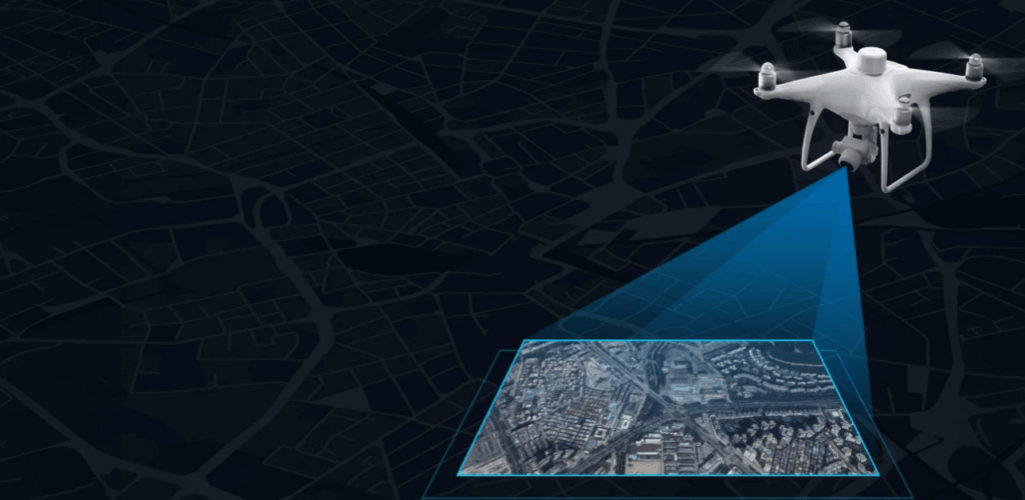
This method enables the collection of highly-accurate data, extremely quickly. In fact, one piece of analysis showed that drone mapping services can gather data more than 90% faster than traditional manual surveying methods.
Using a drone 3D mapping platform not only saves time, but it significantly improves safety by eliminating the need for staff to walk over hazardous terrain or work at height — the aerial mapping drone does the work for you.
This data can be processed through drone mapping software to create a range of assets, such as 3D models, 2D maps, and digital elevation models, which can be used to extract valuable information like highly-accurate measurements and volumetric calculations.
This information helps with informed decision-making, provides valuable insights - including identifying mistakes or problems and, keeping up to date with the progress of a project - and streamlines effective communication with colleagues, stakeholders and the community.
Whether using photogrammetry techniques or a LiDAR mapping drone, drone mapping has become a crucial tool for efficient, informed, and safer surveying practices.
Key drone mapping outputs
Two of the most common types of drone mapping methods are photogrammetry and LiDAR.
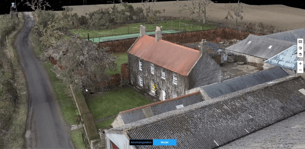
Photogrammetry is the art of capturing high-resolution photographs to recreate a survey area. These images are processed and stitched together using sophisticated software to create realistic, geo-referenced, and measurable 3D models of the real world, as well as 2D maps.
LiDAR works by sending pulses of light to the earth's surface or a feature on it and measuring the time it takes to reflect back. LiDAR is particularly effective for detecting small objects during drone mapping, such as powerlines.
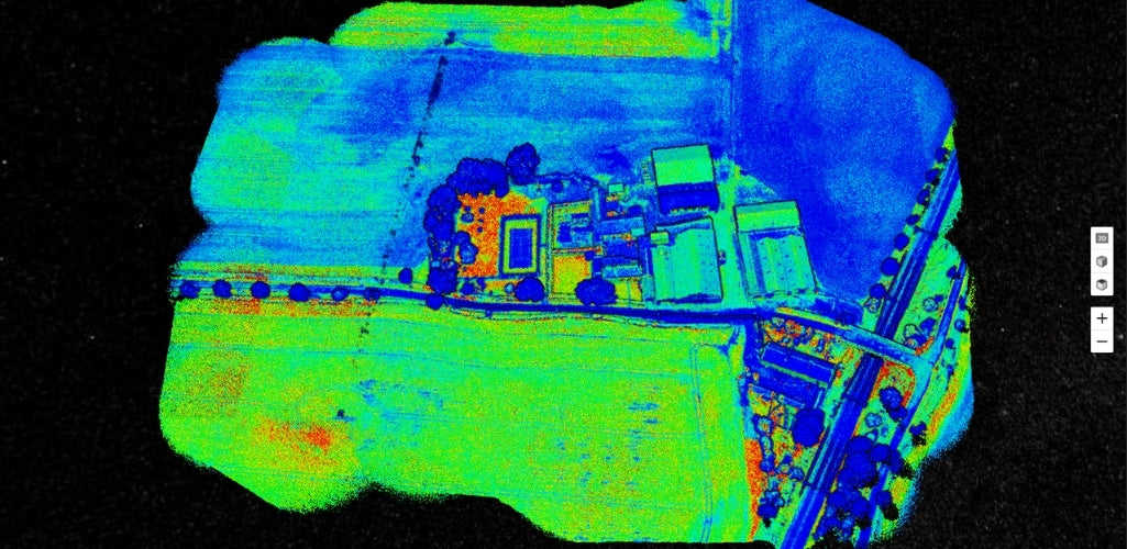
You can find out the difference between the two in our LiDAR vs Photogrammetry blog.
Drone mapping, including photogrammetry and LiDAR, can produce a variety of outputs to help surveyors and professionals in other industry applications gain vital insights.
2D orthomosaic drone maps
A 2D orthomosaic is a top-down map of a survey site, or asset, built by stitching hundreds or thousands of digital photos - collected by the drone - together. It's a staple in professional drone mapping services.
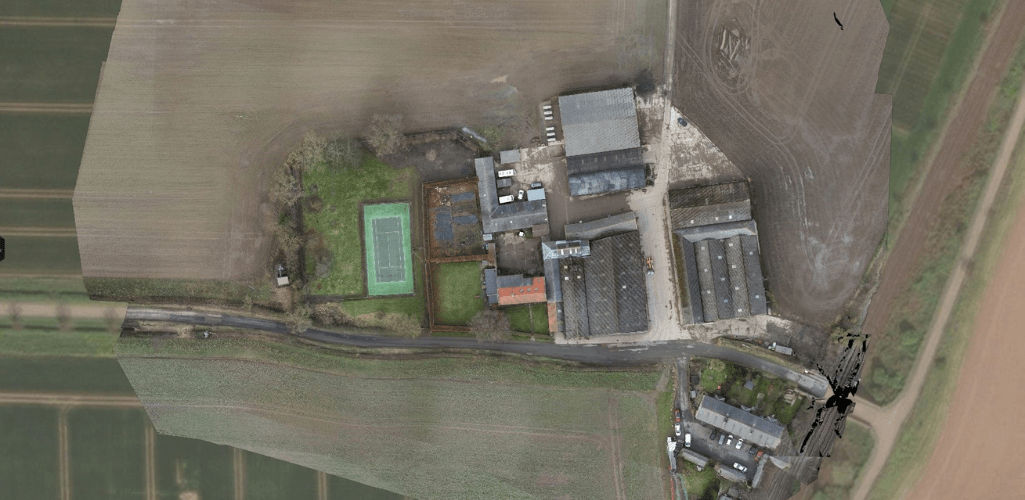
Drones and high-resolution cameras can help to build detailed, centimetre-accurate georeferenced maps.
These maps and pictures provide a real-world view, helping rapid decision-making and analysis of how a project is progressing, and are a staple in drone mapping services.
3D point clouds
A point cloud dataset is a digital representation of the survey area or object. It is made up of thousands of points, with each being a geometric coordinate. When combined, they build a fleshed out 3D model.
The denser the point cloud, the more accurate and realistic the model — making point cloud generation a crucial step within a professional drone 3D mapping workflow.
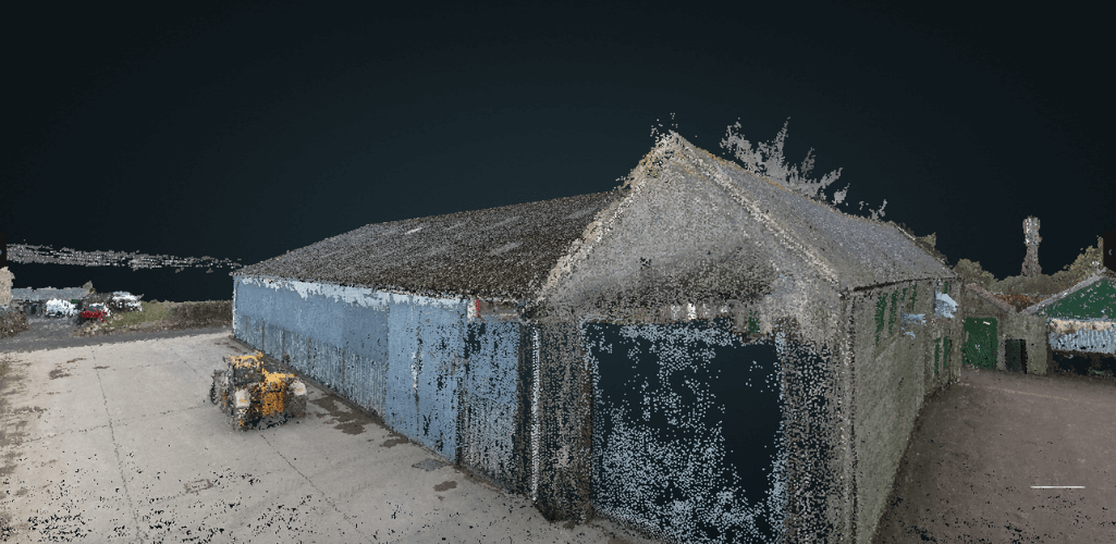
Point clouds can provide a wealth of information, such as observations and measurements about an object’s depth, elevation, geometry, and location in space.
Point clouds tend to be generated by using 3D laser scanners and LiDAR, with each point representing a single laser scan measurement.
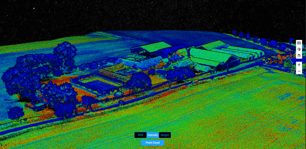
However, photogrammetry can also be used to build point clouds.
3D mesh maps
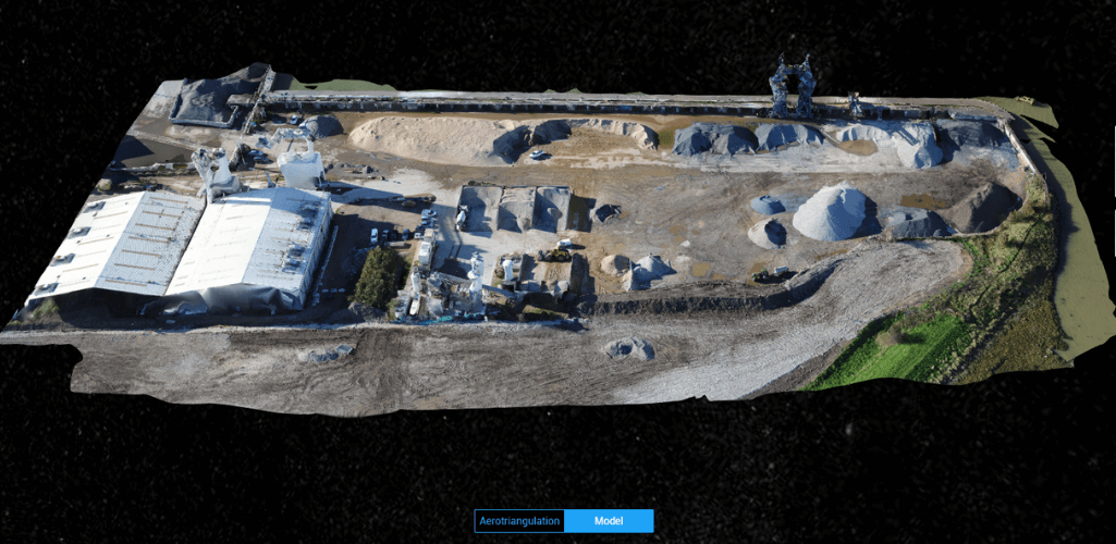
A 3D mesh is the evolution of a point cloud. Small triangles are created between the points and mapping software creates a texture to build a 3D mesh or model.
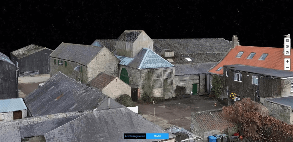
3D models are a great visual asset and are ideal for project monitoring and progress.
They can also be used to conduct
Digital Elevation Model Surface Models and Digital Terrain Models
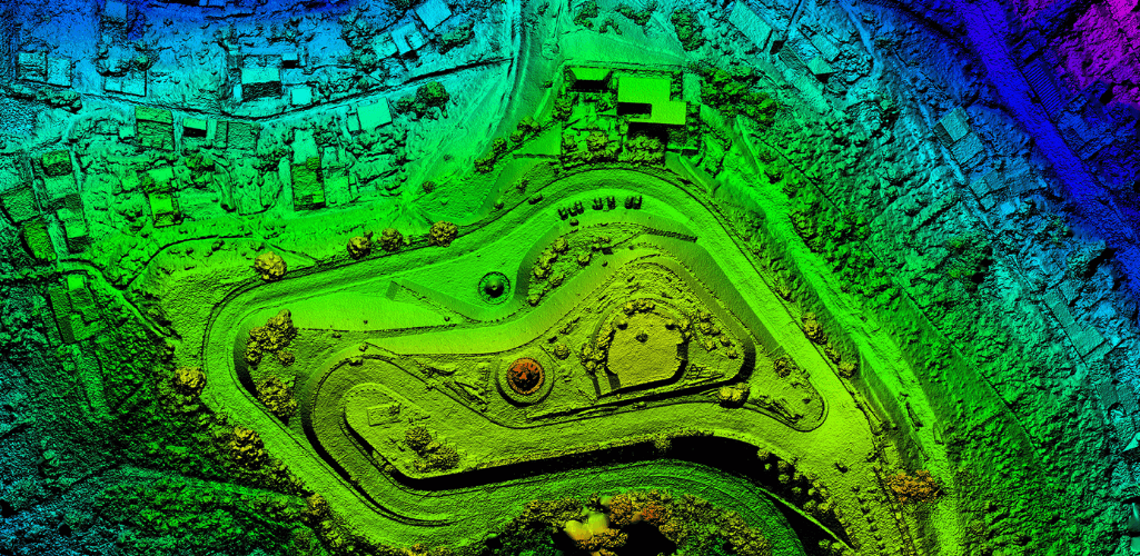
Used extensively in drone topographic mapping Digital Elevation Models are a useful drone mapping output, providing elevation data of the survey area.
For instance, waste management company, SUEZ, took an orthomosaic data set captured from a Phantom 4 RTK and processed through ArcGIS Site Scan, to build this 3D Digital Elevation Model to gather vital volumetric insights about this specific stockpile. Read the full blog here.
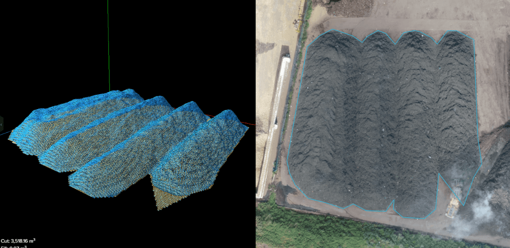
DEM models can include Digital Terrain Models (DTM) and Digital Surface Models (DSM).
The distinct difference between DTM and DSM is that DTM represent the bare earth (without any objects/buildings in it) to provide terrain data...
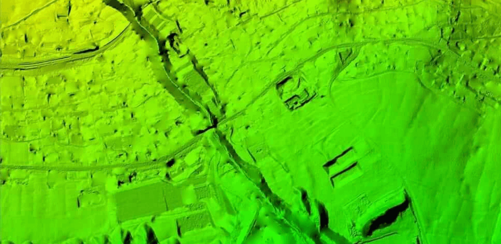
...while DSM represents the earth's surface and includes all objects on it.
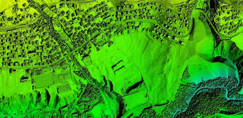
LiDAR is particularly effective for DTM's, as its pulses can penetrate gaps between leaves and branches to reach ground level and measure the terrain. Both LiDAR and photogrammetry can be used for DSM.
Drone thermal mapping
Thermal drone mapping is a useful application, especially for monitoring assets in the oil and gas and utilities industries.
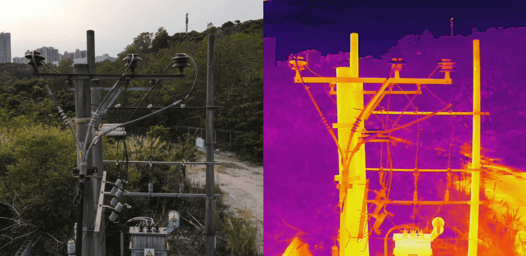
A thermal drone survey can identify abnormal heat signatures - which can be missed with the naked eye. Thermal drone mapping can help identify heat loss, water leaks, or electrical faults.
Multispectral mapping
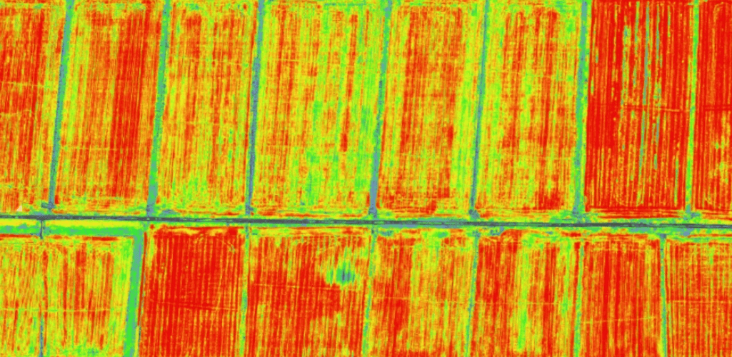
Particularly useful for the agricultural industry, multispectral drone mapping can provide farmers with a wealth of information.
Drone mapping can generate vegetation indices to help visualise and understand crop health; orthomosaic maps can be created to monitor the evolution of crops; and fertiliser strategies can be formulated to improve overall productivity.
Drone mapping applications
Drone mapping has become so valuable, it is being used for land surveying, roof inspections, bridge/building surveys, infrastructure maintenance, and on construction sites.
Below is a breakdown of some of the most popular types of drone mapping applications.
Construction and infrastructure
Drone 3D mapping is an effective tool for the construction industry.
Maps and models can be created to monitor site progress, spot for mistakes or deviations from plans, measure stockpiles, and for rapid and highly-visual information sharing.
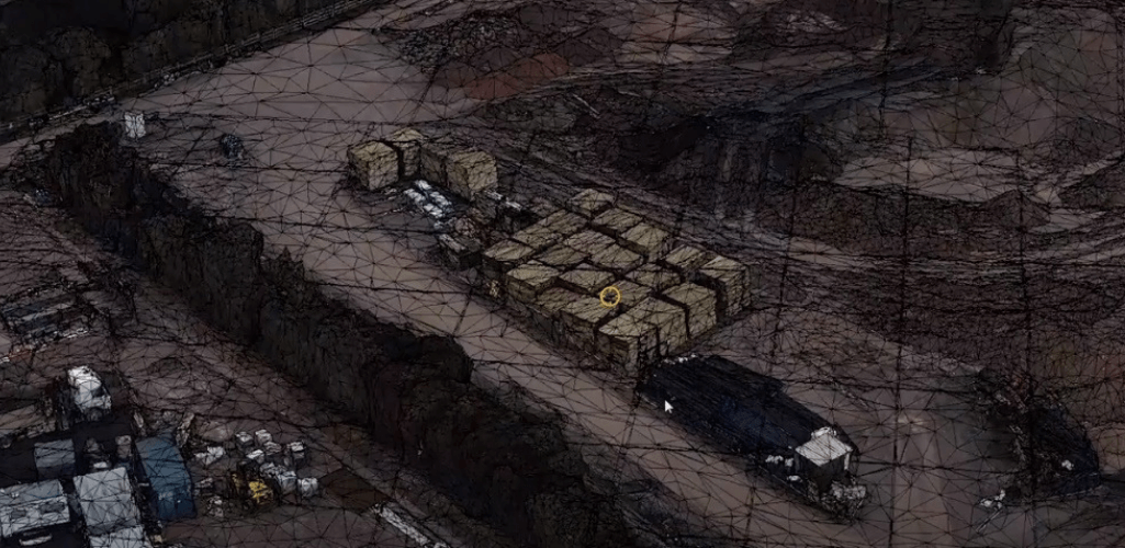
Drones enable construction professionals to collect this data safer than before, removing the need to clamber over dangerous stockpiles or access building sites.
Craig Matthews, Principal UAS Manager for Balfour Beatty, said: "Drones are a great tool to deliver the results safely, quickly and accurately. They remove people from harm's way, which is a big plus for us, and they give the project team and clients a unique view on the progress of a project that you couldn't get from the ground."
Real estate
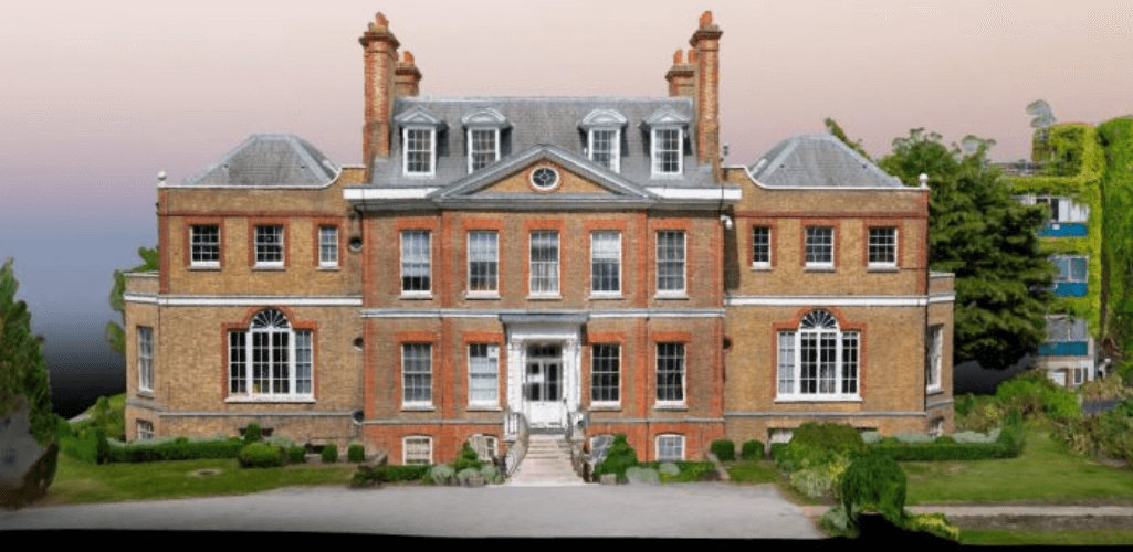
Drone mapping is extremely valuable to the real estate industry, providing buyers and sellers with low-cost, high-resolution, and frequently updated imagery.
Data such as boundary lines, trails, flood zones and topographic contours can be laid on top of the drone imagery for mapping.
Interactive 3D models can be a great feature for promoting a property.
Mining
Drone mapping is particularly valuable to the mining industry.
Detailed and up-to-date maps - which can be collected by regular drone surveys - can be used to manage stockpiles, water drainage, erosion detection, and pit and dump management among a host of other uses.
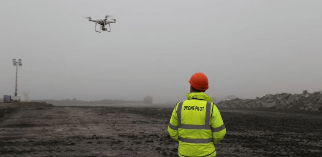
Andrew Carey, of Rio Tinto Kennecott Utah Copper, said: "We use DJI drones for a lot of mapping work, helping to improve decision-making and optimising inspections.
"Drones help the mining industry for a number of reasons, including increased safety, removing employees from hazardous areas, and increasing cost savings. We use drones for a range of operations, including reality modelling, asset management and drill/blast analysis."
Agriculture
Drone mapping is replacing the time-consuming process of farmers walking their fields.
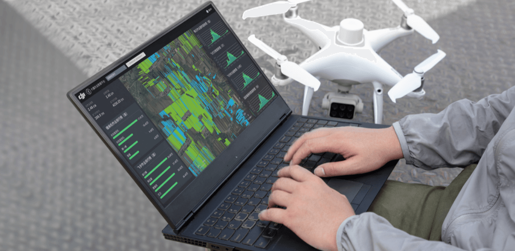
Using UAVs to digitise agricultural land helps to maximise operational efficiency.
Drone mapping helps to monitor crop production and health, while irrigation and soil erosion can be managed through the creation of digital surface models.
You can read more about drone mapping for agriculture here.
Public safety and emergency management
Drone mapping can be extremely useful for public safety agencies, for digitising a crime scene or for recreating the scene of a road-traffic collision, helping to get roads reopen quicker in the process.
Click to read our blog on Drones for Accident Reconstruction.
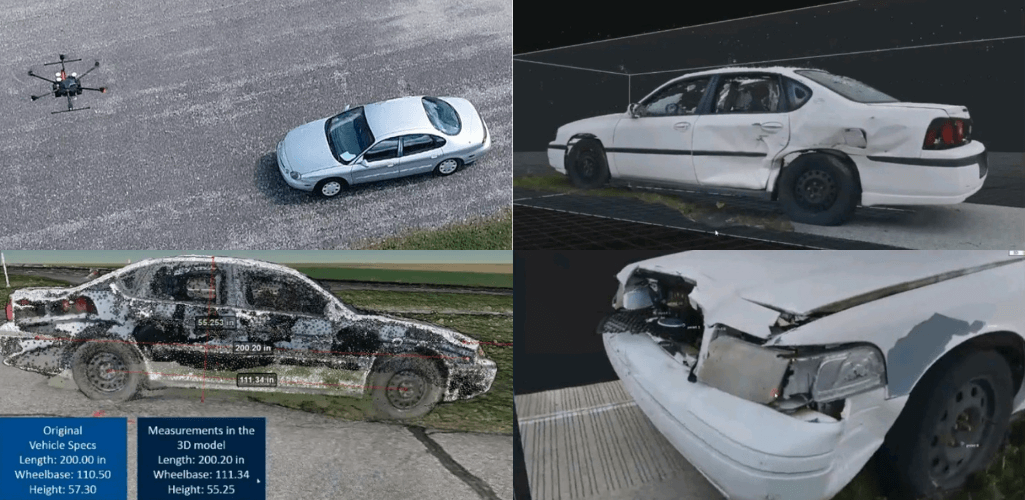
Drone mapping is also highly valuable for emergency management: Enabling teams to safely and quickly access a disaster zone to collect unique aerial views for situational awareness, response planning and management, and to provide a true ands clear record to validate insurance claims.
For example, drones were used following the deadly Californian wildfires in 2018.
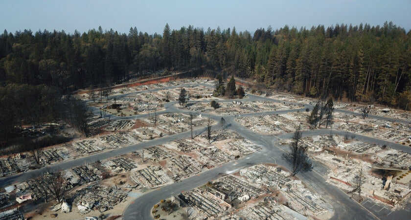
Commander Tom Madigan, of Alameda Country Sheriff's Office, said: "We used drones to take 10,000 photographs from low level and stitched them together into an orthomosaic map so the citizens who lived there and couldn't get back in could take a look at that map down to their street address and they could see what had happened to their property without going into a danger zone.
"We learnt that drone mapping was really important as part of an integrated emergency management strategy."
Land surveying
Drone mapping is extremely beneficial to land surveyors.
Drones enable industry professionals to collect vast amounts of data which can be converted into 3D topographic maps with contour data - eliminating a process which used to be extremely laborious.
Utilising RTK technology, land surveyors can use drones to create very accurate maps for their clients.
Best mapping drones 2021
The DJI M300 RTK, Phantom 4 RTK, and WingtraOne are all reliable drone mapping aircraft, depending on your needs and applications.
DJI Matrice 300 RTK
The Matrice 300 RTK is DJI's most powerful commercial drone platform to date, with enhanced endurance, advanced safety systems, and an improved IP45 rating for dealing with wet weather.
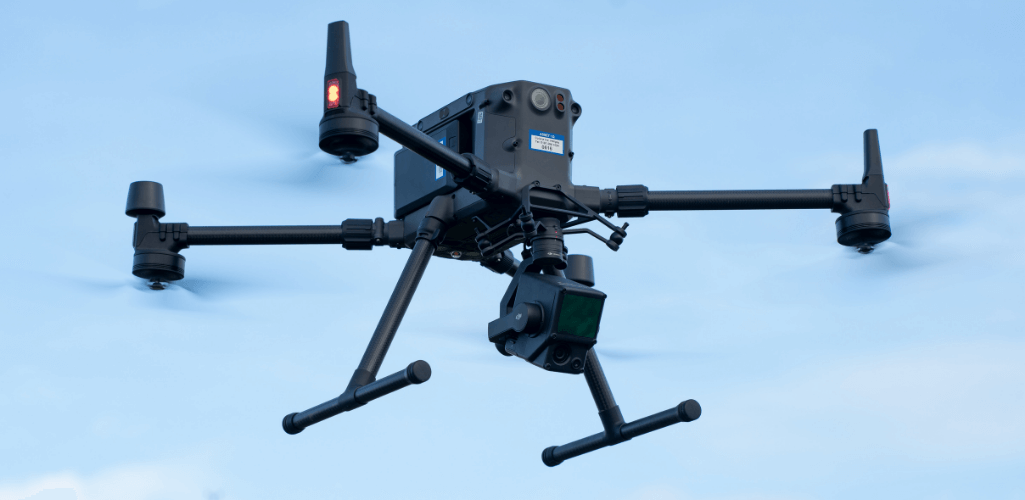
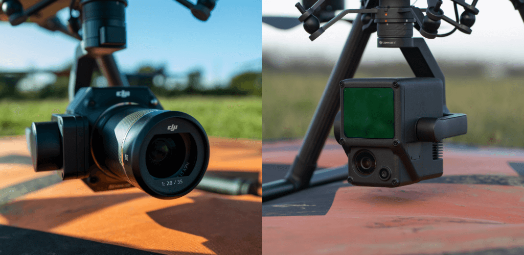
For mapping, it can be integrated with the P1 45MP full-frame photogrammetry camera, or the L1 LiDAR sensor - both pictured below - or the H20T camera can be deployed for thermal/visual drone mapping missions.
DJI Phantom 4 RTK
The Phantom 4 RTK is DJI's compact and low-altitude drone mapping solution, especially suited to smaller sites.
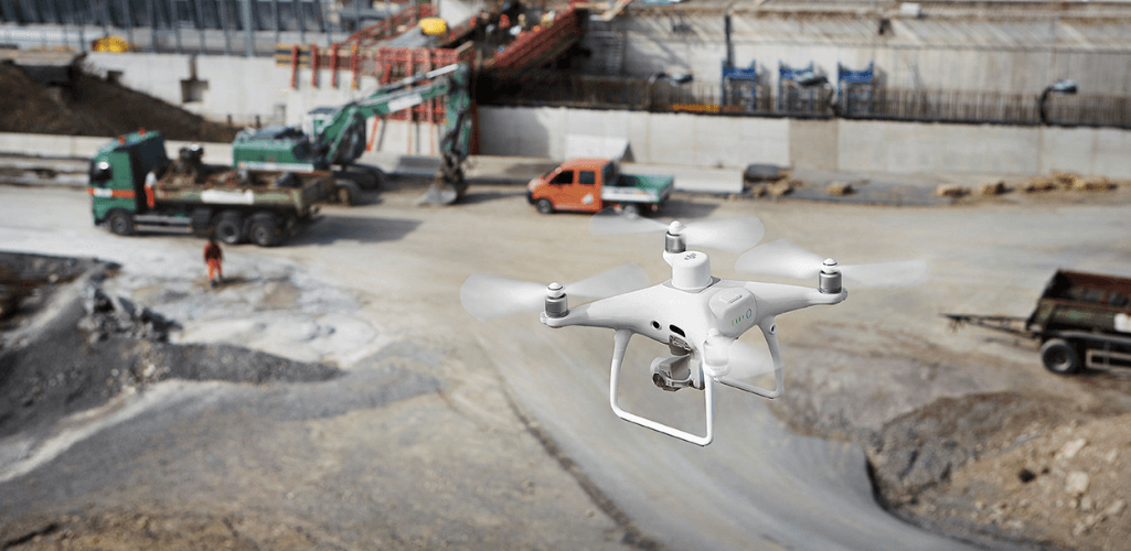
It has a 20MP camera, an RTK module for real-time centimetre-level positioning data, and can be used in conjunction with the D-RTK base station.
The Phantom 4 RTK is capable of achieving 1cm+1ppm RTK Horizontal Positioning Accuracy, and 1.5cm+1ppm RTK Vertical Positioning Accuracy.
DJI Phantom 4 Multispectral
The DJI P4 Multispectral is an all-in-one solution to collect multispectral drone data.
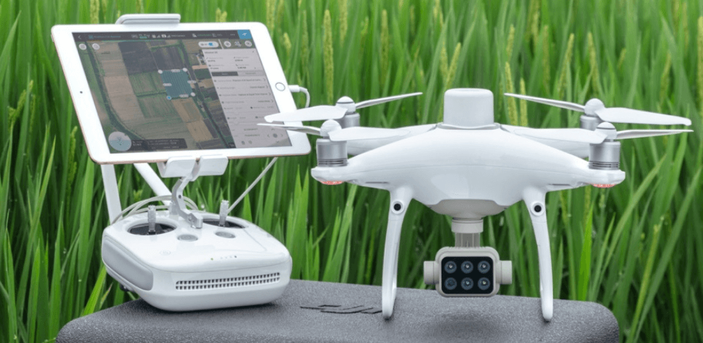
It has a five camera array covering the Blue, Green, Red, Red Edge and NIR (Near Infrared) spectrums, as well as an additional single RGB camera.
The DJI Phantom 4 Multispectral is perfectly suited to agricultural drone mapping missions.
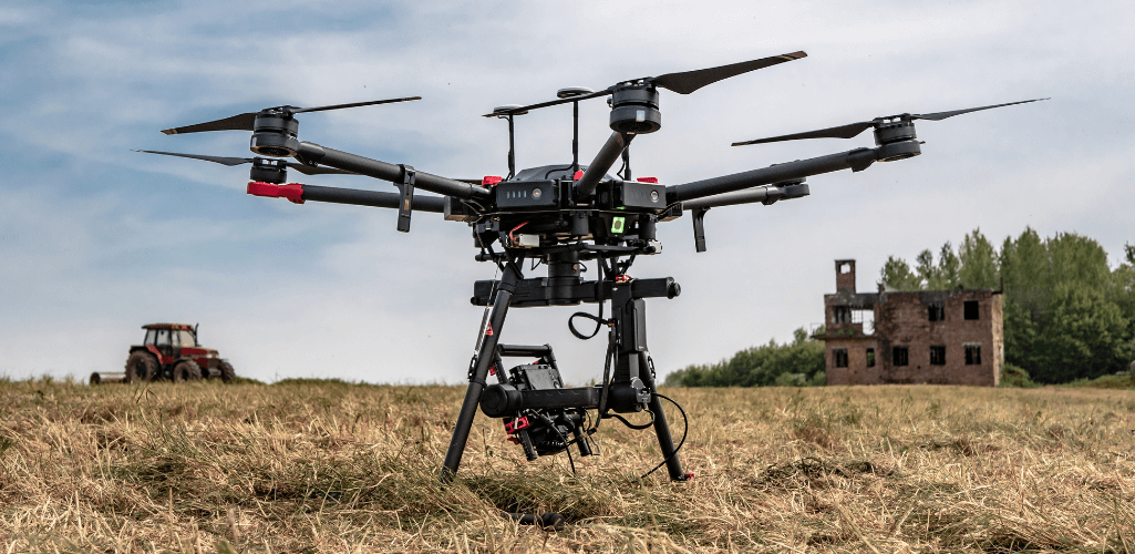
DJI M600 Pro
The M600 Pro is a heavy lifter with six arms, motors, and rotors for specialty cameras and sensors too heavy for the M300.
Wingtra VTOL Fixed-wing Drone
The WingtraOne is ideal for large-area surveys and can provide absolute accuracy down to 1cm.
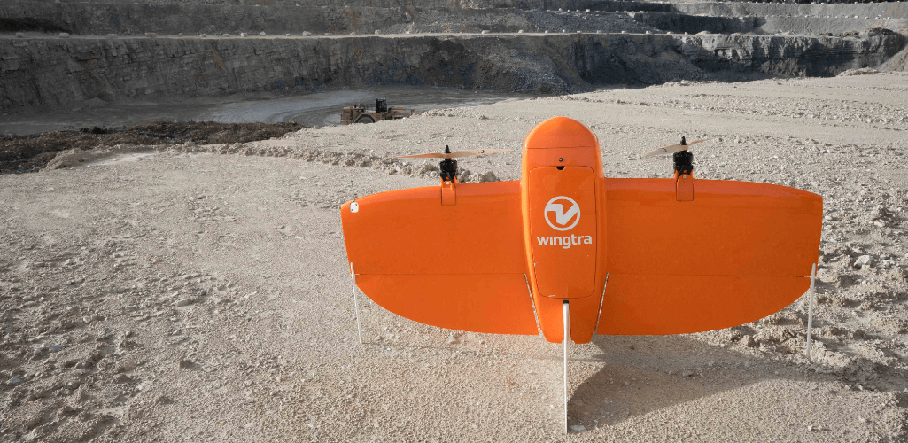
It can be equipped with a choice of Sony high-resolution mapping cameras - including the flagship 42MP Sony RX1R II sensor, or professional multispectral cameras from MicaSense for multispectral data collection.
2025 Update: DJI Matrice 4 Enterprise
The DJI Matrice 4 Enterprise (M4E) is DJI’s compact enterprise aerial mapping drone, designed for high-precision surveying, inspection, and drone mapping services.
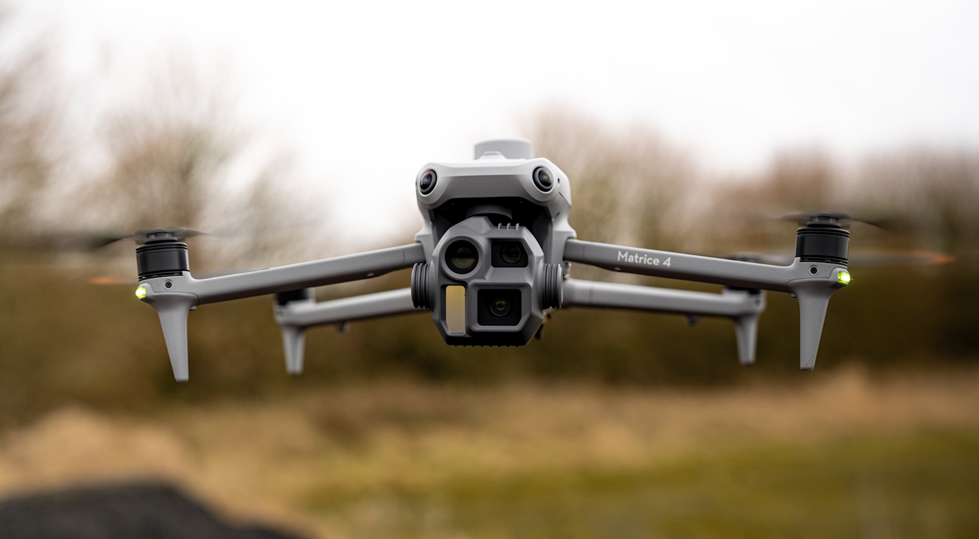
It features a dedicated wide-angle mapping camera, medium and telephoto zoom lenses, a laser rangefinder, and supports 5-directional oblique and 3-directional orthographic capture.
The M4E is fully compatible with DJI Terra, enabling a complete drone 3D mapping workflow to produce detailed 2D maps, 3D models, and drone topographic mapping outputs.
Best Drone Mapping Software
Software is a fundamental part of drone mapping; processing and stitching the drone data together to create the all-important maps and models. These data sets are then used for calculations, measurements and to gather other vital insights.
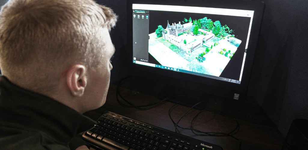
Below is a guide to some of the best drone mapping software available.
DJI Terra
DJI Terra provides an end-to-end drone mapping solution and can be used in conjunction with drones such as the Phantom 4 RTK, as well as the DJI drone mapping payloads, the P1 and L1, as well as the X7.
Terra can be used to automate flight routes, create 2D and 3D maps and models and conduct detailed analysis of drone mapping data. It has extremely quick processing capabilities.
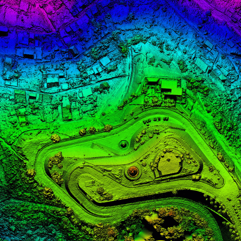
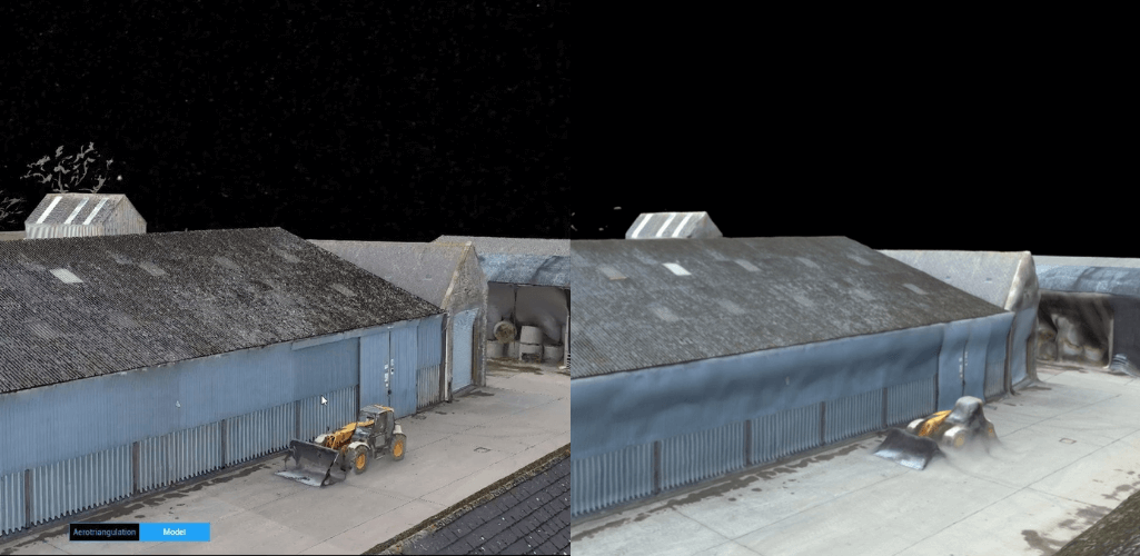
One of the biggest advantages of DJI Terra is its ability to create very high-fidelity 3D models. For instance, the Terra image on the left is far more detailed and sharp compared to the image on the right, processed with an alternative software.
When used in conjunction with the L1, DJI Terra becomes an end-to-end drone LiDAR solution.
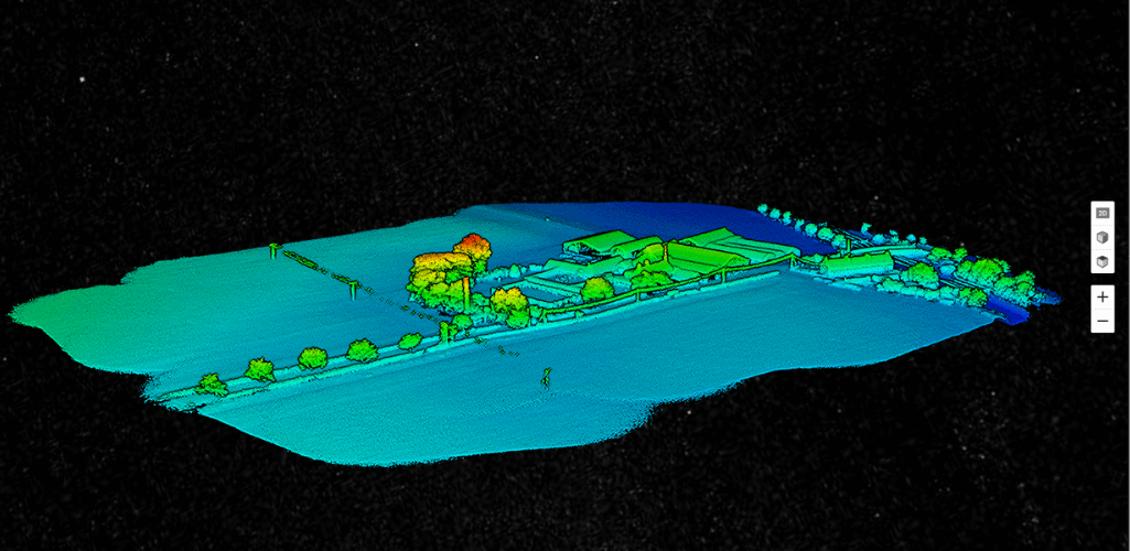
Four licences are available: Agriculture, Pro, Electricity and Cluster. These come with different features and have different price tags. Cluster enables multiple computers to conduct computations simultaneously, significantly improving efficiency.
Esri Site Scan for ArcGIS
Esri Site Scan for ArcGIS is a comprehensive data acquisition and cloud processing platform, especially suited to the AEC industry.
This cloud-based software suite provides an end-to-end drone mapping workflow, comprising drone flight planning, fleet management, image processing, and data analysis capabilities.
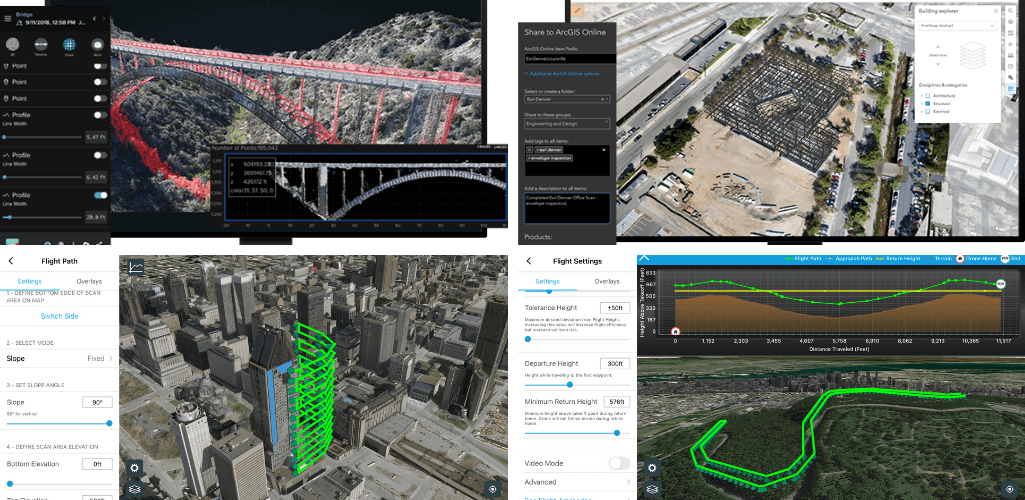
Its ability to share data and be used to manage fleet and team management data, coupled with survey data, is a major asset of Site Scan.
Site Scan for ArcGIS can also be used in conjunction with other software platforms in the Esri ecosystem. For instance, publish drone maps to ArcGIS Online, ArcGIS Enterprise, and Autodesk BIM 360.
DroneDeploy
DroneDeploy is a comprehensive but user-friendly drone mapping software tool.
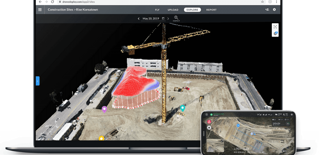
Its key features include real-time mapping, autonomous flights and a 360° virtual walkthrough mode. DroneDeploy is also compatible with an ecosystem of third-party apps.
DroneDeploy does come at a cost, with three licences available: Pro, Business, and Enterprise.
Pix4D
Pix4D is a professional drone mapping and photogrammetry software, which like DroneDeploy, is very user friendly.
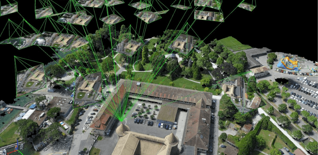
It has a vast ecosystem to provide a tailored solution. For instance, its photogrammetry and geospatial software include Pix4Dmapper (for professional drone mapping); Pix4Dsurvey (bridging the gap between photogrammetry and CAD); and Pix4Dmatic (for large-scale photogrammetry).
This is boiled down further with industry-specific applications, such as Pix4Dinspect, for industry inspection; Pix4Dfields, for crop analysis; and Pix4Dreact, for emergency response. This provides great versatility and solutions tailor-made to specific industry drone mapping applications
Agisoft
Agisoft is a stand-alone software product that performs photogrammetric processing of digital images and generates 3D spatial data.
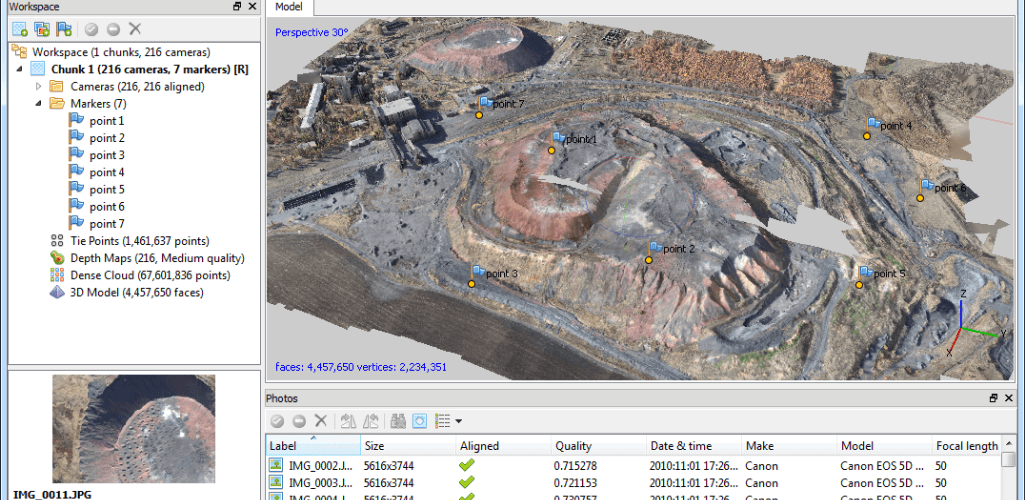
Two versions are available - Standard and Professional. Standard has features such as batch processing, and can generate point clouds and highly-detailed 3D models.
But if you want more from your drone mapping missions, such as multispectral/thermal processing, ground control support, and georeferenced DSM/DTM generation, then the Professional package is the way to go.
Both come at a cost, however an Agisoft licence is not time-limited.
Free drone mapping software
Most drone mapping software comes at a price, but there are some options out there which are free.
These are ideal for the more casual drone mapping missions, but for more complex and professional drone mapping flights, paid for software is probably the best way to go.
WebODM: OpenDroneMap
WebODM from OpenDroneMap is a piece of open source software, which can be installed manually through GitHub. Alternatively, there are paid-for packages which come with installation support.
WebODM can be used to generate maps, point clouds, DEMs and 3D models from aerial drone images.
PrecisionMapper
Back in 2017, PrecisionHawk announced that PrecisionMapper would be free.
The software tool can be used for stitching together 2D and 3D maps.
There is an option to pay for a PrecisionMapper subscription, but free users still have plenty of scope.
Pix4Dcapture
Pix4Dcapture is a free mobile app to plan, fly and collect optimal images for professional drone mapping. It supports a range of drones from DJI, Parrot and Yuneec.
Images can be uploaded to Pix4Dcloud (which has a monthly subscription) to create 2D or 3D maps and models.
Free Trials
While not strictly free, there are some drone mapping software packages which include free trials, such as Pix4D, DroneDeploy and Agisoft, to give you the chance to test them before committing to the paid-for licences.
**2025 Update**
The DJI Matrice 4 Enterprise comes with a one-year free trial of DJI Terra when you purchase the drone.
Summary
Drone mapping offers a faster, safer, and highly accurate way to collect geospatial data, with solutions ranging from aerial mapping drones and lidar mapping drones to full drone 3D mapping workflows using software like DJI Terra.
Whether you need detailed 2D orthomosaics, 3D models, or drone topographic mapping outputs, professional drone mapping services are reshaping industries like construction, agriculture, mining, and public safety.
Contact the Heliguy team today for expert advice on choosing the right 3D mapping drone and setting up your complete drone mapping solution.
