News
Published on 28 Jan 2019
James Willoughby
Drones a key tool for construction sites
Improve safety, save money and increase efficiency - why you should use drones on your construction site. ... Read More
Did you know that the construction industry is the fastest growing adopter of commercial drones?
In fact, the use of UAVs on job sites grew by a whopping 240% in 2018 alone, according to a recent webinar with experts from DroneDeploy - the drone surveying and 3D mapping app.
Real-time drone datayielded 75% cost savingsfor Chasco Constructorson $29m project
Meanwhile, a recent study conducted by ProDroneWorx shows that the number of construction companies in the UK and Ireland that are using drone technology has increased significantly, with 52% of survey participants saying that they are now using UAVs, compared with only 33% in 2017.
So why are drones quickly becoming the go-to tool for data collection and analysis on construction sites?
In this blog post, Heliguy Insider looks at the reasons why construction companies are turning to UAVs and how this technology could benefit you. We will also look at which drones are out there to help you achieve the best possible results.
Drones a game-changer for the construction industry
When you look at the benefits that drones can bring to construction companies, it is easy to see why their stock is rising.
Believe the hype you are hearing about drones. Drones are going to change the construction industry - it’s already happening.
Grant Hagen, Virtual Design and Construction Manager
In a nutshell, drones enable you to see, measure and report what is happening on your job site, helping to:
Save time
Cut costs
Reduce workflow
Improve safety
Most construction project managers choose to map their entire job site each week with a drone. This regular, overhead view is invaluable when it comes to tracking progress, inspecting for safety issues and keeping real-time tabs on every corner of a site. This aerial view gives a different perspective, helping catch issues that might be missed at ground level.
Drone maps give my team a bird’s eye view of the site, which looks a lot different than being on the ground. It gives them a full picture.
Matthew Forster, Project Engineer for Choate Construction
Because drone maps are geotagged, it’s even possible to take basic area measurements and instantly estimate stockpile volumes for real-time decision making right on the spot.
Survey: Why use drones on construction sites?
Improved data quality - 56%Time-saving - 54%Reduction of risk - 42%
Essentially, drones digitise your job site, giving a really good snap shot of what your site looks like in that point in time. There are numerous things that you can do with this digital snapshot, helping to visualise and monitor change from above.
So how does this help and why is it better than traditional methods?

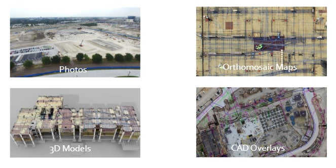
Firstly, a drone photo can help you see the whole of your site in one frame, giving an entirely different perspective of the job in hand.
Secondly, drones enable you to build orthomosaic maps. These are made up of a series of individual photos which have been matched up via drone software so that they form a new composite image, consisting of all the smaller ones.
These images have been adjusted for topographic relief, lens distortion and camera tilt. And because orthomosaic maps offer an accurate representation of the land, they can be used to measure true distances.
If you see an issue, you know where it is and you can send somebody to look at it. Orthomosaic maps also allow you to look at how things are changing over time, flicking backwards and forwards. It allows you to easily measure and monitor what is going on.
Jono Millin, co-founder and CCO of DroneDeploy

Drone images also let you create 3D models, allowing you to take your work into the next dimension.
These 3D models give you additional perspectives. Taking this picture as an example, you can see a couple of floors up and see what is going on.
Sharing an interactive 3D model allows customers, collaborators, and stakeholders to explore a job site remotely. This gives them a 360 perspective of the entire project.
Another huge benefit of UAVs is the ability to create CAD overlays. In other words, you can take a picture of the site in its current form and then put design plans on top.
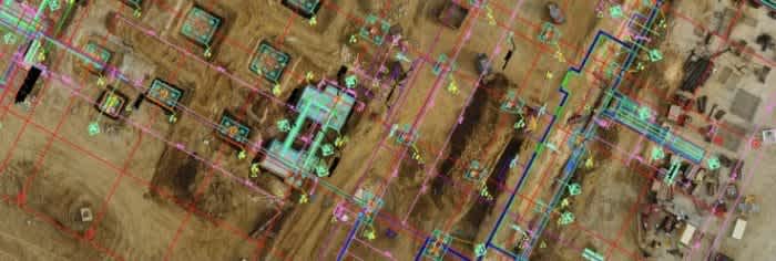
This is really useful for a number of reasons, including the huge advantage of being able to see whether the building work has deviated from the design plans.
Michael Lambert, VDC Manager at Chasco Construction, said: "Combining surveying, drones and CAD information allows us to display our projects in ways never seen before.
"We provide our team with the big picture and the information they need to more effectively share information and make better-informed decisions."
Drone data helps project management
One of the key things that UAVs help with is project management. Taking photographs from above gives you an overview of how the site is coming along and keep tabs on progress.
The graphic below is a good example of this, showing from the same aerial position how the site has evolved over time - going from a field, through to the initial foundations being laid and culminating in the completed job.
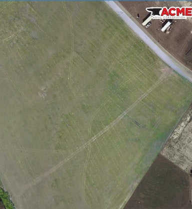
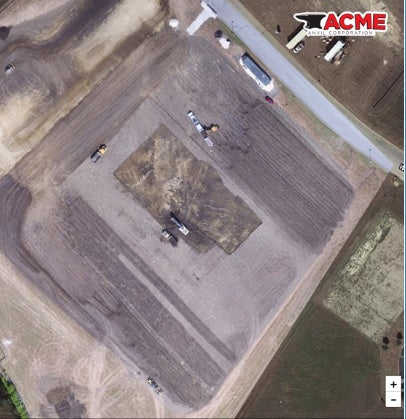
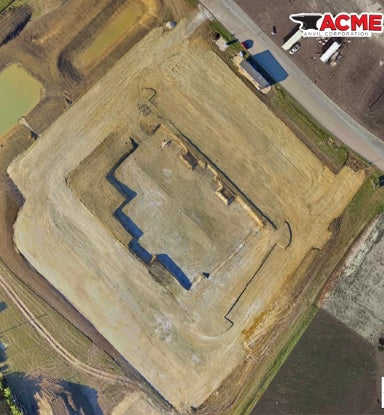
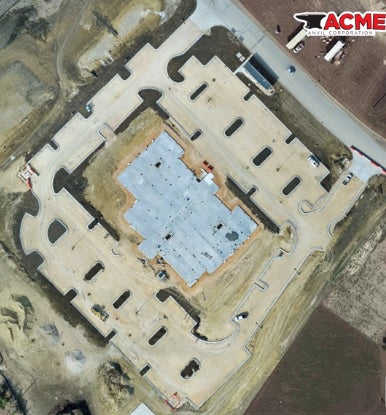
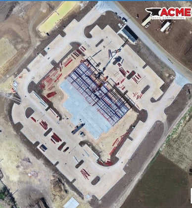

Jono Millin, co-founder and CCO of DroneDeploy, said: "When you have this documented site progress, you are able to go back in time and start to have a look at what was going on at any point in time.
"You can say 'why are we having this issue over here? What pipes did I lay in that trench? Did I do the trenching in the correct place?'
"If you have that data, you have that progress locked in digitally and you can go backwards and forwards."
Having this information also makes it really easy to communicate across the construction site, keeping workers up-to-date with the current state of play. This helps to keep staff and key stakeholders informed.

These vital eyes from the sky are also invaluable for subcontractor management, letting you know who is doing what and how things are being done.
Jono said: "No longer do you have to rely on interpreting some notes on a bit of a paper, because using the drone data gives you a clear and precise picture."
Drones and on-site safety
If you are new to the idea of drones on a construction site, your first thought might be: How can flying an unmanned aircraft around heavy machinery be safe?
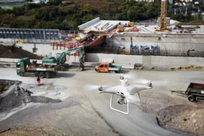
But in reality, when used correctly, they can actually improve the safety of everyday work by reducing the need to put boots on the ground in dangerous areas.
Our project and safety teams can now complete walkthroughs remotely — increasing safety and awareness without ever having to step on site
Russell Byrd, Virtual Design and Construction Coordinator at Brasfield & Gorrie
By using drone maps as part of the regular safety inspection process, site managers are able to identify hazards more efficiently. In many cases, the comprehensive overhead view helps managers spot potential hazards sooner, and take action before a problem becomes larger.
Saving time with drones
One of the biggest advantages of using drones on a construction site is that it saves time, compared to traditional methods.
We’ve created a much more efficient process. We can literally take weeks out of the schedule, our projects are much higher quality than before, and they’re safer.
Jim Gorrie, CEO Brasfield & Gorrie
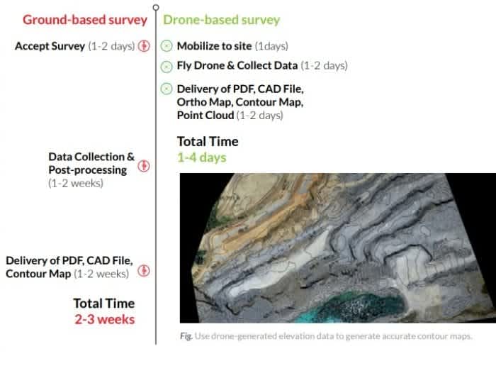
In a fraction of the time it takes to conduct a ground-based survey, a drone can automatically fly and capture imagery of a project site.
Using traditional ground methods, it can one-to-two weeks to collect survey data on a 60-acre job site. For most construction sites of this size, it takes less than an hour to fly and capture the same information using a drone.
The benefits of drones - a case study
Texas-based Chasco Constructors is one of the many companies to have seen major on-site benefits, thanks to drone technology.
What would have taken surveyors about eight hours took me about two hours with the drone. You also have the cost savings of paying one person instead of a three-man crew.
Michael Lambert, VDC Manager at Chasco Constructors
The contractor deployed UAVs to help it manage the construction of a 65,000-square-foot main structure—as well as 10 additional support buildings—for the Public Safety Training Center in Round Rock, Texas.
The entire project lasted about 18 months and drone monitoring helped keep everyone on the same page. And the work was completed ahead of the estimated schedule.
The benefits:
Faster surveys75% cost savingsEffective monitoringPrecision detail
Chasco used a DJI Phantom 3 Pro drone, combined with drone-mapping software from DroneDeploy, on the project. The software enabled a single technician to manage everything from flights and mapping to analysis and reporting.
Using a drone allowed the company to:
Monitor the progress of the work, including monitoring subcontractors, tracking materials and equipment and measuring stockpile volumes;
Capture and analyse much more granular site detail than a ground-based survey team could collect;
Free-up the surveyors to focus more on what they do best, such as high-precision layout, bluetops and cut sheets for utilities;
Collect aerial imagery to make high-resolution maps and 3D models of the site. Not only was this good to check site progress, but this data allowed the city council of Round Rock to provide greater transparency to tax-payers on money well spent;
Allowed managers to keep a watchful eye on both their own work teams and subcontractors;
Identified a potential issue related to excavation for a roadway. This eliminated the mobilisation costs that would have otherwise been required to complete additional site work.
During the excavation phase of the project, the drone made weekly flyovers of the site. Once vertical construction started, the company collected drone data every other week.
Drones proved so useful to Chasco, that the company is now using drones to help monitor more than 35 job sites throughout Texas.
What drones are best for you?
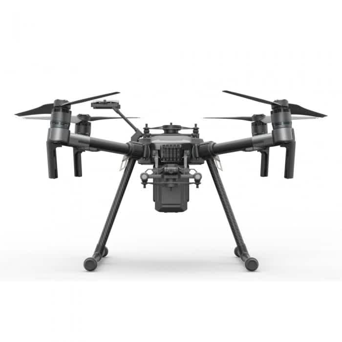
There are numerous drones to help you carry out vital work on your construction site. These include:
Which drone is best for you depends on what you want it to achieve.
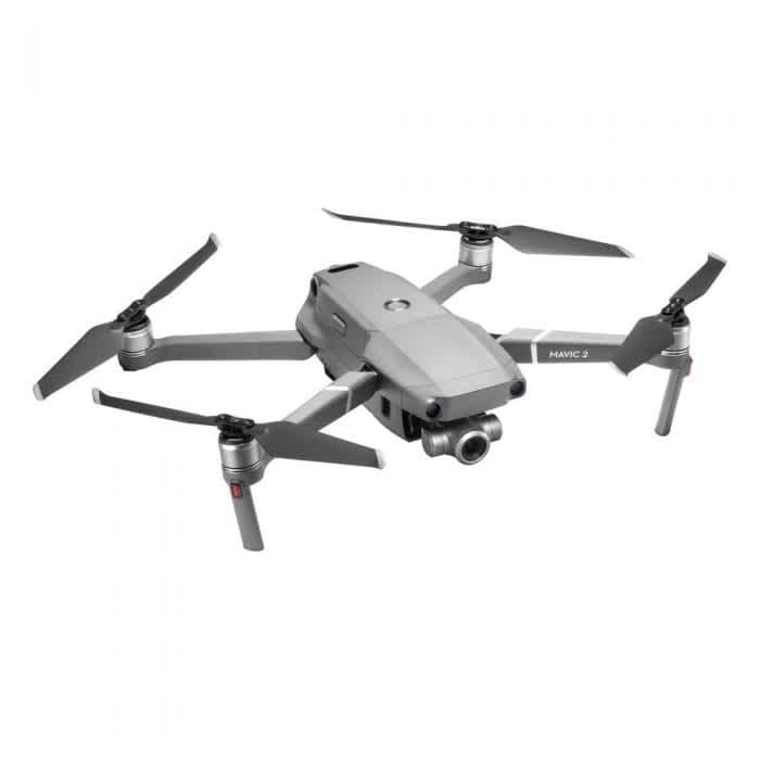
If you are simply wanting to capture high-quality images of your site, especially some aspects close-up, then the Mavic 2 Zoom could be ideal. Not only does it have incredible image capability, but it is light and portable, and, priced at under £2,000, it is a very affordable option,
If you are wanting something a bit more comprehensive, giving you accurate data measurements, for instance, then something more enterprise specific is the ideal way to go.
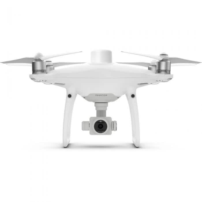
For example. the Phantom 4 RTK is a high-class mapping UAV, priced at just over £5,000 and described as providing a new standard for drone accuracy while requiring fewer ground-control points.
A new RTK module is integrated directly into the drone, providing real-time, centimetre-level positioning data for improved absolute accuracy on image metadata. A redundant GNSS module helps to maintain flight stability in signal-poor regions such as dense cities.
How accurate?
1cm+1ppm RTK Horizontal Positioning Accuracy
1.5cm+1ppm RTK Vertical Positioning Accuracy
5cm Absolute Horizontal Accuracy of Photogrammetric Models
Another option is the heavy duty Matrice 210 or Matrice 210 RTK.
The great thing about these models is the fact that you can add multiple payloads. For instance, you could integrate the DJI Zenmuse XT2 thermal camera and the DJI Zenmuse Z30 onto either of these drones. While the combined cost of a Matrice UAV and numerous cameras does build, great results can be obtained from these combinations.
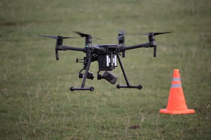
An M210 equipped with two payloads.
The Z30 boasts a 30x zoom, which is great for inspecting parts of the site close up.
Thermal cameras, such as the XT2, can be vital on a construction site, for instance, helping with roof inspection. In some cases, this can reduce the time spent on a roof by three-to-four hours.
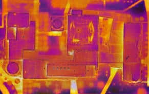
Grant Hagen, VDC Manager at The Beck Group. said: “The work input to value output with drone-based thermal imagery is game-changing. It’s unlike anything else in construction technology right now.”
The Matrice 210 RTK is the premium model in the Matrice 200 series. The 210 RTK has all the features of the Matrice 210 but has the added benefit of RTK (real-time kinematic) functionality as standard.
Other useful drones for construction sites include the DJI Wind Series.
Once you have your drone, there are numerous pieces of software to help you take your mission further. One of these options is DroneDeploy.
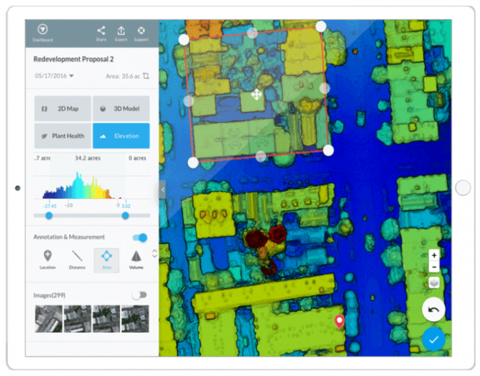
DroneDeploy is an intuitive solution used to create aerial maps and 3D models. Using the mobile app - which is available on both Android and iOS - it’s possible to transform a range of DJI drones into reliable and powerful mapping tools.
The DroneDeploy app facilitates automated flights from take-off and right through to landing while automatically capturing images that can be uploaded for processing. These stills can be used to create a range of visualised data from 2D maps to 3D models.
Why Consider DroneDeploy?
An intuitive, simple to use solution
Affordably priced and feature rich
Potential for a greater return on investment when compared to its competitors
Rapid processing and accurate results
Works with a range of DJI drones
An all-in-one drone surveying and mapping solution
If you need further proof that DroneDeploy is a vital tool, then take a look at this world map - which shows the construction sites around the globe which have benefitted from pairing this app with drone technology.
