News
Drones Are Vital - First Responders Tell Senators
U.S. public safety officials who use DJI drones share use cases and tell Senators in California that UAS technology saves lives and is a force multiplier. ... Read More
First Responders from Alameda County Sheriff's Office and Sacramento Metropolitan Fire District - who both use DJI drones - share success stories with the Californian Senate Select Committee;
Senators told that drones are an 'absolute force multiplier' and help public safety crews do their jobs more efficiently, effectively and safely;
Senators urged to 'remove any barriers' which deter agencies from adopting UAS;
Meeting hears that transparency was key to allaying initial public concerns about privacy.
Drones are a force multiplier and are essential for public safety and enhancing disaster response, Senators in California have been told.
First responders highlighted the benefits of using unmanned aircraft - including technology from DJI - to the Californian Senate Select Committee on Aerospace and Defense last week.
Addressing the panel during an informational hearing on Drones In Emergency Management, UAS advocates shared their success stories and told Senators that drones allow first responders in California to do their jobs more efficiently, effectively and safely - helping to fight crime, enhance public safety, and ultimately save lives.
They also made an impassioned plea for all emergency services to be given the tools to facilitate the use of drones, and urged law-makers to 'remove any barriers' which deter agencies from adopting UAS.
Drones add value to the important work that firefighters and search and rescue people are doing and this technology can keep firefighters and police officers from losing their lives.
Commander Tom Madigan, Alameda County Sheriff's Office
During the session, Alameda County Sheriff's Office was praised for having an 'influential' drone program, which has been built on a solid foundation of trust and transparency with the public, helping to allay initial concerns around privacy. The team at Alameda has used drones for a range of missions, including creating detailed interactive maps - like the one below - in the wake of wildfires to keep citizens informed about damage to their neighborhood. The map can be moved around to give a 360-degree view, and you can also zoom in on all areas of the map.
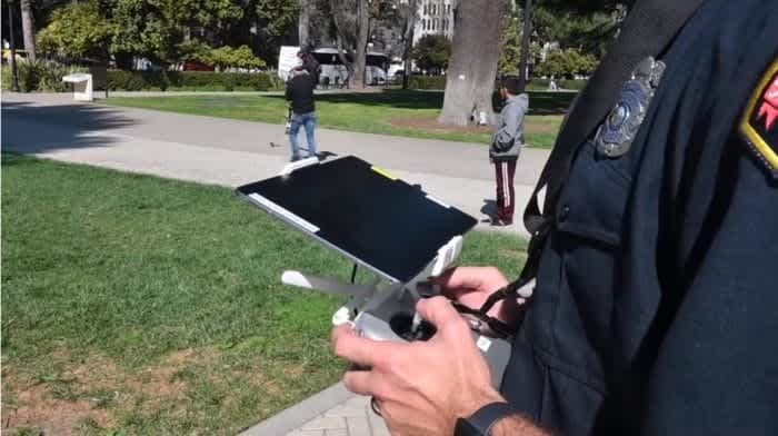
As part of the meeting, Sacramento Metropolitan Fire District was given the chance to showcase drone technology - using a DJI Inspire aircraft - to the Committee and media outside the State Capitol, as this video shows.
Sacramento Metropolitan Fire District Fire Captain Ryan Gifford said that drones give Incident Commanders the information they need to 'make good decisions to bring about a swift and timely conclusion to an emergency as it is going on'.
Following the meeting, Romeo Durscher, DJI's Senior Director of Public Safety Integration, praised the work being done by Sacramento Metropolitan Fire District and Alameda County Sheriff's Office - who both use DJI drones - for 'pushing the integration and acceptance of this technology' and being a 'tremendous resource for other departments across the nation.'
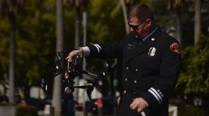
Sacramento Metropolitan Fire District uses drones for a range of missions.
In this Heliguy Insider blog post, we take a deep dive into the Senate meeting and look at some of the ways that first responders at Sacramento and Alameda are using drones.
Heliguy USA is based in Texas and serves the U.S. enterprise and consumer drone markets. Heliguy is headquartered in the North East of England, and is the UK’s largest and longest-standing DJI-accredited drone retailer, with in-house technicians, a research and development division, renowned training team, and experienced sales staff.
Heliguy supplies drones to major enterprise clients across industries such as nuclear, construction and infrastructure, as well as the emergency services.

Sacramento Metropolitan Fire District - 'Drones Are A Force Multiplier'
One of those to testify during the hearing was Fire Captain Ryan Gifford, of Sacramento Metropolitan Fire District.
He explained how drones have been vital for a range of missions, such as monitoring wildfires, tactical search and rescue, and flood monitoring.
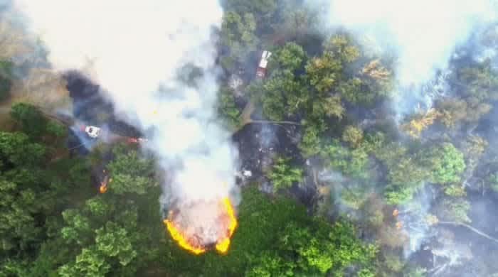
Drones provide vital situational awareness from above.
"UAS use in public safety has seen an exponential increase and it is no wonder why," he said.
"Drones give us the ability to see things that we couldn't see before, to go places we hadn't been able to go before and use technologies that had been limited because of cost or infrastructure needs.
"Drones are small enough and portable enough to get them anywhere."
Captain Gifford told the committee that the team had utilised drones at almost 1,000 missions over the last three years. He later described drones as an 'absolute force multiplier for public safety'.
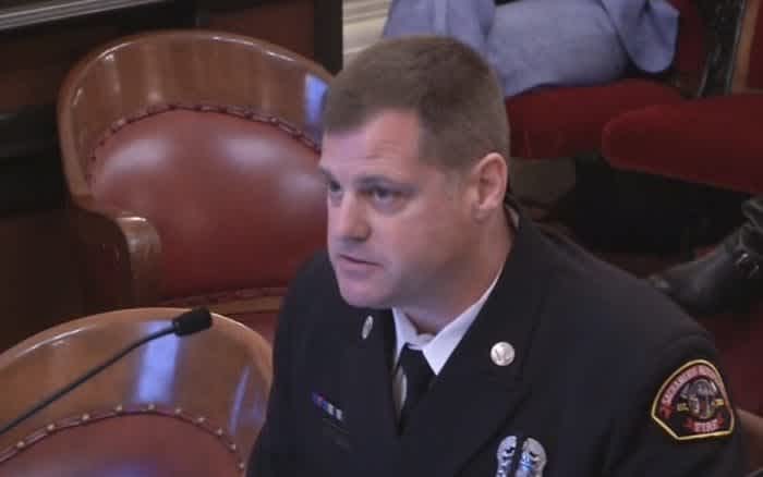
Captain Ryan Gifford spoke at the Senate meeting.
Drawing on this experience, he presented a series of slides which showed various drone use-cases.
The presentation included shots of the DJI M200 Series aircraft - ideal for public safety as they can carry top-class zoom and thermal payloads - and the Mavic 2 Enterprise (M2E) Series - which are lightweight, portable and quickly deployable. The Mavic 2 Enterprise Series also comes with three accessories - a loudspeaker, bright spotlight, and a beacon - while the M2E Dual has a thermal sensor.
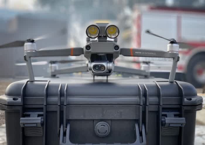
A DJI Mavic 2 Enterprise Dual.
Using Drones For Structure Fires
Drones with thermal cameras have proved to be a vital tool for first responders.
Captain Gifford explained how this technology helped crews fight a 'fairly complicated' structure fire.
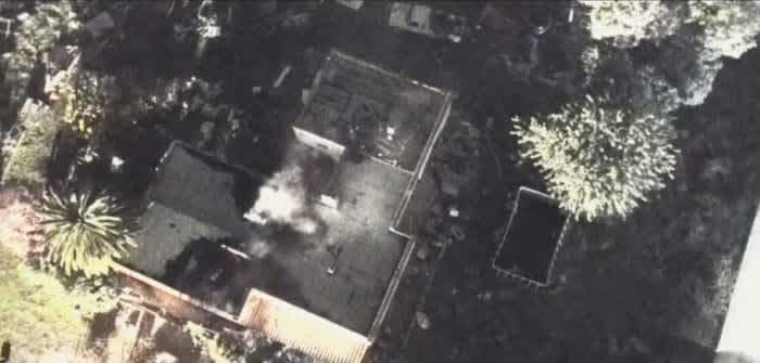
This building was on fire...
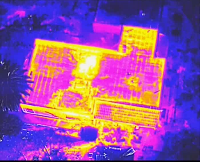
...but the thermal image gave crews a clear picture of where the hotspots were.
He said: "Thermal imaging (on a drone) helps find a persistent hotspot which crews on the ground weren't able to locate. By jumping up over the top of this and using thermal imaging and working through it we can get them to where they need to be."
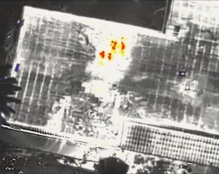
Using drones and thermal imagery helps first responders shape firefighting tactics.
Using Drones For Technical Search and Rescue
Using a drone with a zoom camera - such as the DJI M200 Series with a Z30 camera - has been beneficial for conducting technical search and rescue missions. This set-up means that difficult-to-reach areas can be accessed by drone, enhancing officer safety in the process.
For instance, check out this video which shows the zoom capabilities.
Captain Gifford said: "Technical search and rescue has always been a difficulty in the Fire Service. It is unique. But the use of UAVs as pop-up aircraft to jump over the top of a collapse to take imagery and push it out in real-time for our searchers to be able to know where they're searching and know what they are looking at and looking for is impressive.
"It also helps us to put eyes into a situation where it might not be safe to put our people into. For example, we can look into a hole in a collapsed building that otherwise we wouldn't send rescuers into and be able to look inside that building."
Using Drones For River Patrols
Sacramento Metropolitan Fire District covers roughly nine miles of the Sacramento River and drones play a key role for a range of purposes.
Captain Gifford said: "We spend a lot of time on the river as a lot of river rescue calls go on, whether it is for search and rescue, identification or providing an oversight.
"Using a drone gives the incident commander and crews on the ground a better view of what they are going in to."
He praised the ability of a drone with a zoom camera for providing sharp images from afar, as this example below shows. He also said that this type of camera technology was relatively cheap, especially for the images it can capture.
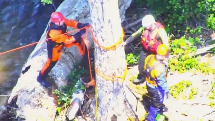
Close up...
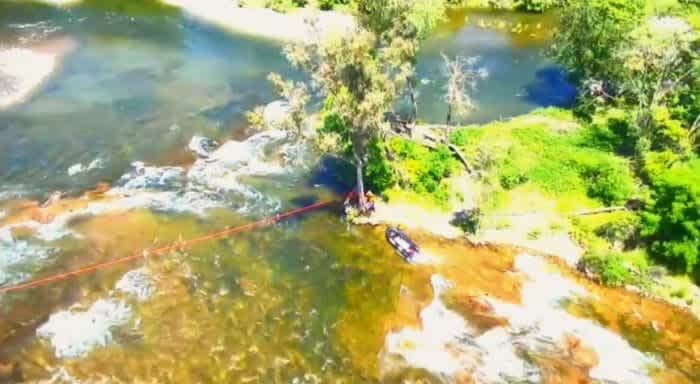
...zoomed out.
Using Drones For Wildfires
Captain Gifford said that drones show 'great promise' for fighting wildfires, providing incident commanders with an overhead view of an incident, especially during the initial stages of a fire before resources get to the scene.
"It is pretty epic," he said.
In the example below, he said that the incident commander could use drone footage in real-time to direct the fire engine to the blaze, telling crews to turn left at the fork instead of driving straight ahead, to support another unit.
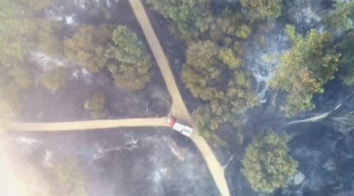
The view from above helped incident commanders direct the crew to the fire.
"It can be tough to see things from the ground, but the ability to put a light aircraft overhead and be able to immediately have that information and push it back to an incident commander is huge," he said.
Using Drones For Hazardous Material Inspections
Hazardous material inspections are another area where drones are being deployed to enhance crew safety.
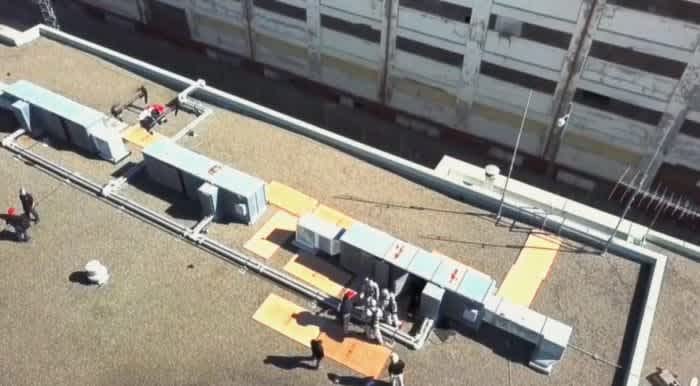
Drones are being used for hazardous material inspections.
Captain Gifford said: "This is one of the areas where we have seen a huge increase all over the country. Being able to put an aircraft in a position where you don't want to put people and give the HazMat teams a view of, perhaps, aerial gas monitoring
"We can fly a gas monitor through a plume and allow resources on the ground to see where that plume is, model it and figure out how far it is going to stretch out is a really interesting concept for use."
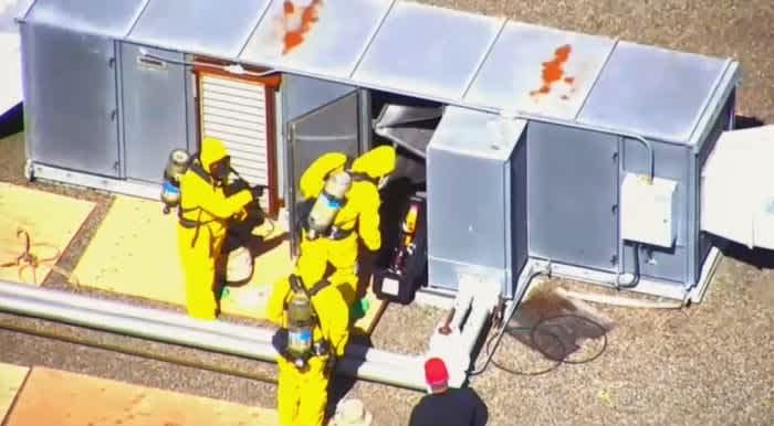
Gas monitors can be flown into an area to keep crews out of harm's way.
Using Drones For Flooding Operations
Captain Gifford said that overflying a flood incident from above is a 'fairly major' use case for the department, with the drone providing important situational awareness, letting crews know what the challenges are and helping to shape deployment tactics.
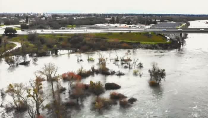
This aerial view gives a clear picture of the flood.
He told Senators: "Drones allow us to get ahead of the flooded area. It's pre-planning. Being able to go out and look at areas that are flooded and see whether that will impact our access or egress to that area is a huge portion of getting in position to make effective rescues when it becomes necessary."
This image, captured by drone, shows a real-life rescue mission, after a driver drove through some closed road signs and flooded his vehicle.
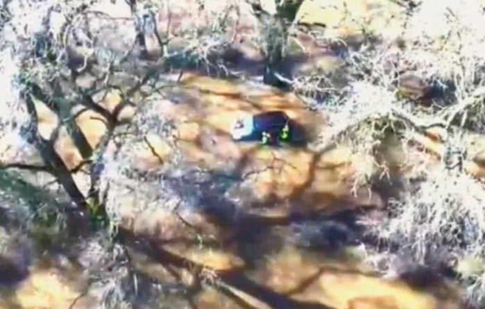
The drone is used to provide crews with vital situational awareness.
"We used the drone to overfly the incident and get a view for our rescue teams before they walked in so they knew what they were walking in to," Captain Gifford said.
Alameda County Sheriff's Office - 'All Public Safety Agencies Should Utilize UAS Technology'
Commander Tom Madigan, of Alameda County Sheriff's Office, is a major advocate of drones.
His crew utilizes DJI drones for a range of missions and believes that every public safety organisation should embrace UAS.
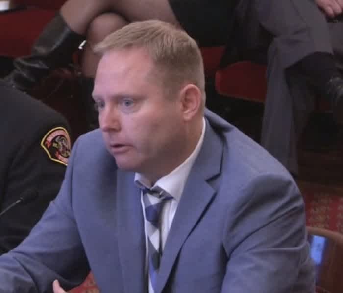
Commander Tom Madigan.
And he is talking from experience. He said: "We were one of the first agencies ever to be able to deploy UAS technology. We have intertwined UAS operations into all the business we do and use them to assist with dangerous situations."
He told the meeting that the department first started using drones after the Ghost Ship warehouse fire, in Oakland, which broke out on December 2, 2016, killing 36 people.
He said: "It was the first time we realised that UAS could add value to the important work that the firefighters/search and rescue people are doing - in terms of looking for victims and thermal imaging for hotspots prior to sending people into a dangerous area. It is very important stuff. We learned a lot from that tragic incident."
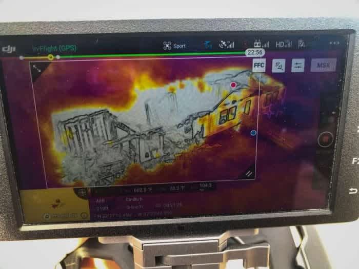
Thermal imagery is a vital tool for first responders.
Since then, Alameda County Sheriff's Office has not looked back. For them, drones have really proved their worth in the aftermath of the devastating wildfires at Coffey Park, Redding, and Camp Fire.
The department utilized drones to provide vital situational awareness and to create highly-detailed maps quickly and safely, to help inform citizens about the extent of damage to their homes and their neighborhood.
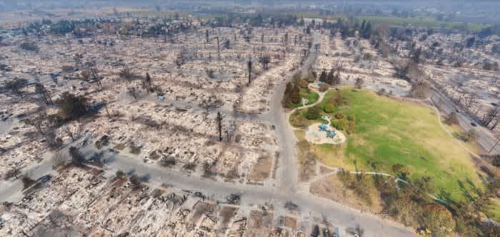
A screenshot of one of the maps created by Alameda County Sheriff's Office using a drone.
Reflecting on the incident at Coffey Park, Commander Madigan said: "The drones provided a quick and easy situational awareness tool.
"But also using drones, we took 10,000 photographs from low level and stitched them together into an orthomosaic map so the citizens who lived there and couldn't get back in could take a look at that map down to their street address and they could see what had happened to their property without going into a danger zone. We learnt that mapping was really important as part of an integrated emergency management strategy."
The interactive map gives a 360-degree view of the scene and users can scroll in to get more detail.
Commander Madigan added: "We learnt that a small drone can be sent up into the sky at 100ft or 200ft and take a quick series of snapshots and stitch together almost instantaneously a model of what happened to the neighborhood which can then be uploaded to the county or city's website and residents can click in and see what's going on in their neighborhood."
The 2018 blaze at Camp Fire was the deadliest and most destructive wildfire in California history.
A total of 15 teams flew 500 flights, collected 70,000 photos and processed the maps in just 48 hours. The information included all streets and property boundaries, giving people the ability to search addresses for damage assessment and view before and after images.
Commander Madigan said that the team also used geospatial tool Survae, which enables the rapid visualization of geolocated video, imagery, and sensor data with context from GIS maps, layers, and third-party data sources.
This meant that residents could click on the map - see below - and watch overlayed video to see the extent of the damage in their area.
"I truly believe that mapping is critical for disaster zones," said Commander Madigan.
Aside from mapping, he told the hearing that he couldn't underestimate the power of a drone with a thermal camera, especially for searching for missing people. He also said that they are an important tool for preserving a scene.
He added: "The value is getting the drones there. The mapping can be done after the fact, but the life-threatening event that is transpiring right now, in real-time, is where they truly add value."
He said that drones can be deployed more cheaply and quickly than a helicopter, before saying: "I think all public safety agencies throughout the state of California should utilize UAS technology for their first responders because it can help them detect dangers that they could not otherwise see and keep them safe and they need to integrate them into the work."
'Your Drone Program Is An Inspiration'
Concluding his testimony, Commander Madigan made an impassioned plea to Senators, urging them to do what they can to empower public safety agencies to use drones.
He said: "Whatever barriers you folks can remove to help them get their drone programs established is important because some agencies, because of politics alone, can't use the technology that can keep their firefighters and police officers from losing their lives."
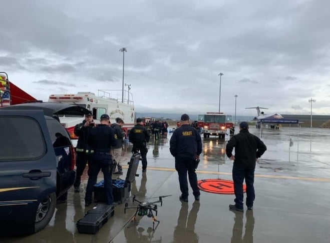
Commander Madigan stressed the importance of a drone program.
Commander Madigan told the panel that some agencies are hesitant to start a UAS program because of the negative connotation around drones.
He said that Alameda's own program was initially met with scepticism and concern from the general public, but transparency was key to allaying fears raised by doubters.
Commander Madigan said: "I still remember the first Board of Supervisors' meeting when we had to give a presentation. There were hundreds of people and every single person spoke against what we were trying to do, mainly because of privacy concerns.
"We committed to being transparent throughout the process and I can tell you that five years later - thousands and thousands of flights - we have received not one single complaint about infringing anybody's privacy.
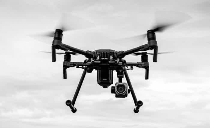
Drones in the DJI M200 Series are key tools for the emergency services.
"So there's local agencies where UAS could add value but they're hesitant to bring it in because of the backlash associated with it.
"We are trying to help people learn from some of our lessons, and also our mistakes, so they won't have to make them."
Committee Chairman, Senator Bill Allen, responded by saying: "In some respects, your model is maybe an inspiration or something to build upon in the State."
DJI Praises First Responders For Highlighting Drone Capabilities
Following the Senate meeting, Romeo Durscher, DJI's Senior Director of Public Safety Integration, took to LinkedIn to praise Captain Gifford and Commander Madigan.
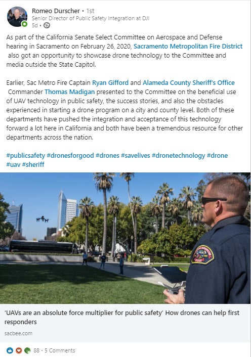
Afterwards, he told Heliguy USA: "As of today, drones have helped to save more than 350 lives, and contributed to many passive lives saved; mitigating risks to our first responders and that has a huge emotional and financial impact.
"Less injuries mean fewer costs to a city or county, and it means teams continue to stay together, be more efficient and effective, and that’s a huge win for taxpayers.
"However, as Commander Madigan pointed out, thereare often times when city or county councils are afraid to approve a department to utilize this technology because of privacy concerns.
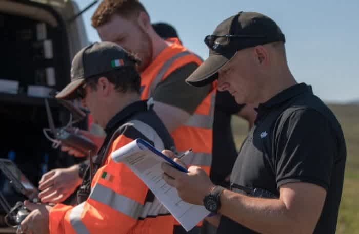
DJI's Romeo Durscher (black T-shirt).
"And while that is an important topic, that’s why departments have very detailed SOPs (standard operating procedures) that outline when and how the technology is being flown and what and what not is being done with drones.
"And the reality is that crewed aircraft have much higher camera systems compared to drones. So pinning privacy concerns to one technology is not a way to move forward. Especially since there are laws already protecting people's privacy, which apply to all technologies."
To find out how Heliguy can start, support or scale your drone program, contact us by emailing info@heliguy.com or call (862) 298-5964.
