
News
Pioneering Drone Survey Accuracy Project Now Live
UPDATE: The second stage of a ground-breaking drone surveying study is live and practitioners and researchers are encouraged to take part and process the datasets. The EuroSDR project centres on drone accuracy, especially without ground con ... Read More

UPDATE (March 4, 2022): Second phase of ground-breaking drone survey trial to measure photogrammetry and LiDAR accuracy is now live;
Practitioners and researchers encouraged to download and process the datasets to feed into the study. The data is being released in three stages;
The project centres on the accuracy of drone data without the use of ground control;
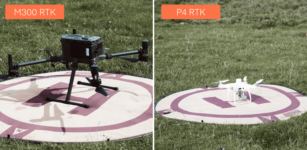
Variety of drone surveying solutions tested, including DJI Phantom 4 RTK and M300 RTK with L1 and P1 payloads;
heliguy™ a key stakeholder in the project and helped collect the data with the DJI solutions.
The second stage of a ground-breaking drone surveying study is now live, and practitioners and researchers are encouraged to take part.
The EuroSDR Commission 1 Benchmark is an independent evaluation of RPAS (remotely piloted aircraft system) geometric survey quality in the absence of ground information.
Click here to register your interest and access the datasets
Data has been collected using a range of drone mapping solutions, including the DJI Phantom 4 RTK, and the M300 RTK-compatible P1 photogrammetry camera and L1 LiDAR sensor - with a view to testing the accuracies of each system.
The data is being released in three batches. The second phase (processing with GNSS base station data) is now available for researchers to download and participate in the benchmark study. It comes after the first phase of data (processing with no GCPs or GNSS base station information) was released towards the end of 2021. Register your interest in the project and request the datasets from here.
The project - funded by EuroSDR - has involved numerous stakeholders, including Newcastle University, heliguy™ and DJI.
About The Project
The benchmark initiative aims to evaluate the true geometric quality of real-world survey data generated from Remotely Piloted Aircraft System (RPAS) photogrammetry and LiDAR under different control configurations, focussing primarily on the geometric quality of data generated in the absence of ground control and local GNSS base station information.
Raw image and LiDAR data for the benchmark is being progressively released over the course of a six-month period, over three phases.
Phase 1: Processing with no GCPs or GNSS base station information. Went live November/December 2021.
Phase 2: Processing with GNSS base station data. Went live March 2022.
Phase 3: Processing with GNSS base station data and/or GCPs. Planned release May 2022.
Collecting The Data - The Survey Site
Guided by a task force of NMCA (National Mapping and Cadastral Agency) experts and academics, in August 2021 Newcastle Geospatial Engineering team established and surveyed a coordinated test field of independent checkpoints (CPs), test surfaces and profiles at the disused Wards Hill Quarry near Morpeth, Northumberland, UK. The survey site is pictured below.

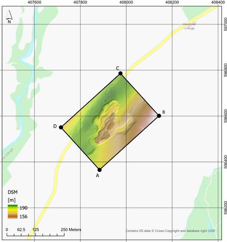
The 350 x 250 m study area was simultaneously surveyed using the following RPAS mounted instruments, each limited to a single flight to represent 'real-world' operation:
Routescene LidarPod
Riegl MiniVUX
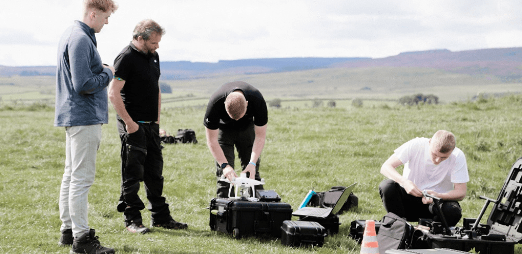
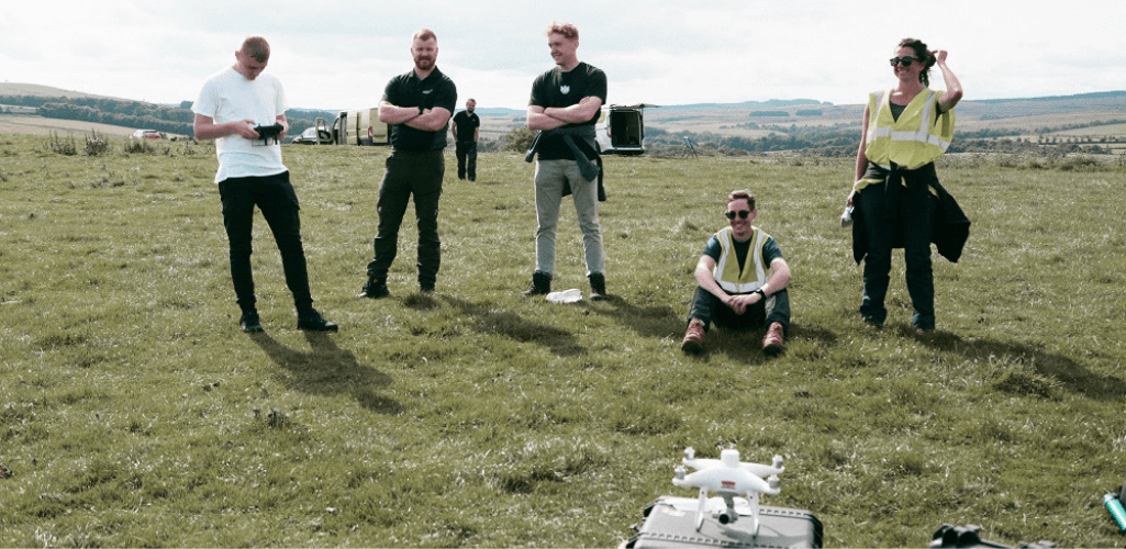
heliguy™ staff, including the in-house GIS team, attended the site to collect the data with the DJI solutions.
heliguy™'s specialist GIS division is led by two Newcastle University recruits - Ben Sangster and Richard Dunlop - who both graduated with BSc honours in Geographical Information Science and have previous surveying experience.
The pair - who gave guest speeches at Digital Construction Week 2021 to highlight drones and GIS for AEC workflows - have recently conducted a major coastal erosion survey with a UK surveying firm at Pagham Harbour, using the M300 RTK and L1.
Thanks to their knowledge of the system and workflow proficiency, they managed to collect data that verified that the L1 can achieve 15mm accuracy - surpassing DJI's product specifications. Read the full report here.

To support this in-house GIS specialism, heliguy™ has accelerated its surveying training provision.
This includes the development of the Aerial Surveying Fundamentals Training Course: An industry-specific closed course to complement the standard GVC/A2 CofC CAA-approved training, to develop pilot expertise in surveying. It has been delivered to the likes of Phillips 66, AB Ports and PD Ports, as well as Balfour Beatty Vinci to support the use of drones on the HS2 development.
heliguy™ has also launched an online geospatial workflow course for the L1. It includes data capture best practices and post-processing in DJI Terra and Terrasolid. It is accompanied by a downloadable course e-book. Find out more about the course here. A similar P1 course is in development.
Have Your Say On The Project
The benchmark is open to all. Practitioners and researchers are encouraged to download and process the data, whether they are using standard commercial off-the-shelf processing software or an innovative research pipeline.
Researchers at Newcastle University will evaluate and collate all submitted results, thereby providing independent assessment against ground truth.
Results will feed into a 2022 EuroSDR workshop, paper, and inform future stages of RPAS EuroSDR studies. At the end of the study, all data utilised, including ground truth, will be made open access.
Further information and the link to the registration form can be found here.
