Products
Published on 27 Apr 2022
James Willoughby
GeoSLAM ZEB Horizon LiDAR Scanner: Hands-on Review
Data sets collected by heliguy™ show the capabilities of the GeoSLAM ZEB Horizon LiDAR sensor and the GeoSLAM Connect and Draw software suite. The ZEB Horizon is versatile, accurate, portable and efficient and can be deployed inside, outsid ... Read More

Data sets collected by heliguy™ show the capabilities of the GeoSLAM ZEB Horizon LiDAR sensor and the GeoSLAM Connect and Draw software suite;
Versatile mobile scanner can be deployed in numerous ways - including by drone, backpack or handheld - and used inside, outside, underground or in the air;
Using the backpack we collected data for a robust and detailed point cloud of a small facility at a sewage treatment works in just one minute, and in 10 minutes for an alternative data set using the DJI M300 RTK drone, covering an area of 0.5km². This data was processed in 20 minutes;
heliguy™ field tests show the GeoSLAM ZEB Horizon creates very detailed point clouds in densely vegetated areas;
The sensor collects 300,000 points per second, has a 100m range, and relative accuracy of up to 6mm;
Some of the data sets were collected by heliguy™ in conjunction with Select Plant Hire (Survey and Monitoring Team) on the Laing O’Rourke project at a sewage treatment works in East London.
Exclusive data sets collected by heliguy™ show the quality, speed and versatility of the GeoSLAM ZEB Horizon LiDAR sensor.
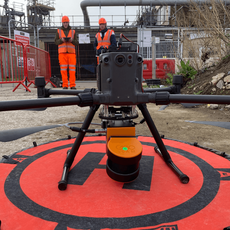
This robust geo-referenced point cloud of a sewage treatment works was built using data collected in just ONE minute by attaching the mobile scanner to a specialist GPS-enabled backpack and walking around the site.
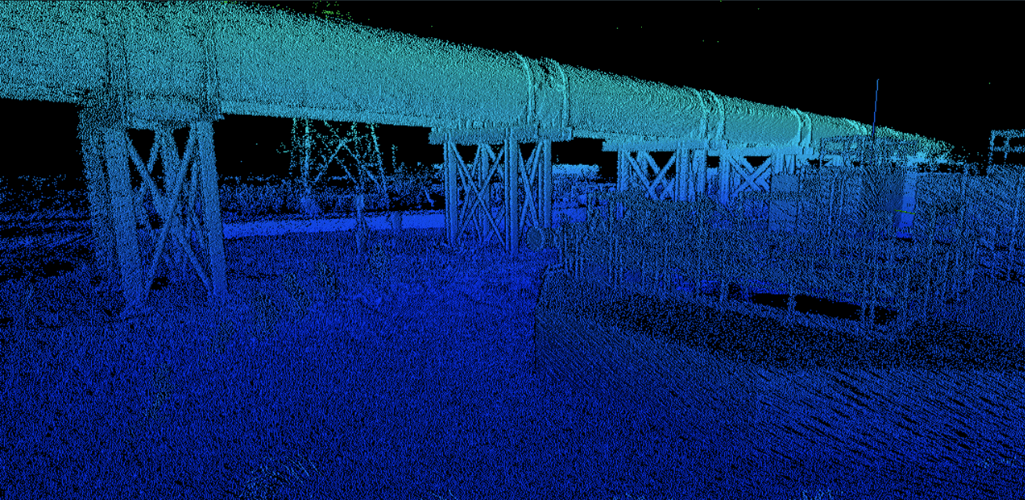
The raw data was then processed in GeoSLAM Connect, which comes as standard with the ZEB Horizon.
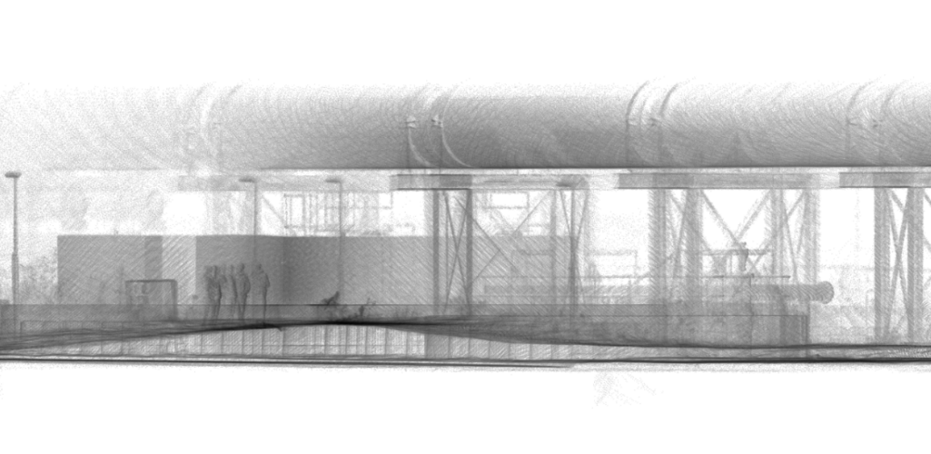
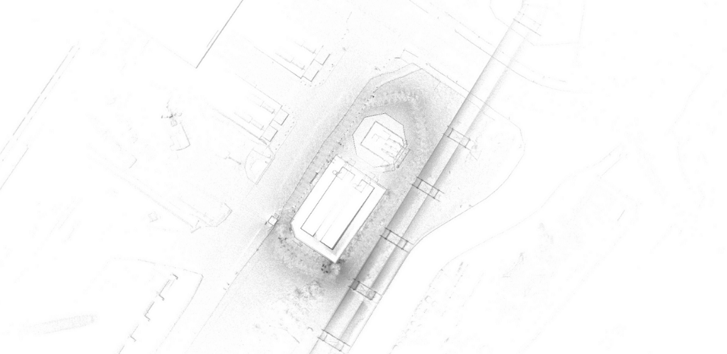
This was then transformed into a highly-detailed 2D drawing with GeoSLAM Draw - an advanced software package. As seen below, GeoSLAM Draw provides a perspective that is very appealing to the AEC industry.
The ZEB Horizon can also be integrated with a drone - in this case the DJI M300 RTK - to capture aerial data. Deployed at the East London sewage facility - currently the subject of a £123m upgrade by Laing O'Rourke - the sensor was flown over this site...
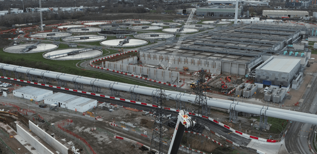
...and took just 10 minutes to gather data, covering an area of 0.5km². This data was first processed in GeoSLAM Connect, before being exported to GeoSLAM Draw for further analysis, as shown below.
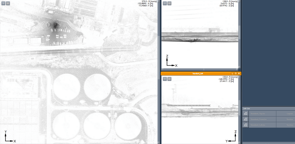
Data from both missions was processed in less than 30 minutes.
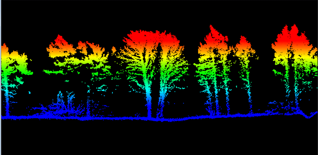
The ZEB Horizon is also a reliable tool for forestry applications, as it is able to penetrate the tree canopy, and build a detailed representation of the ground - as this cross-section shows. This is essential for creating accurate and reliable Digital Terrain Models (DTMs).
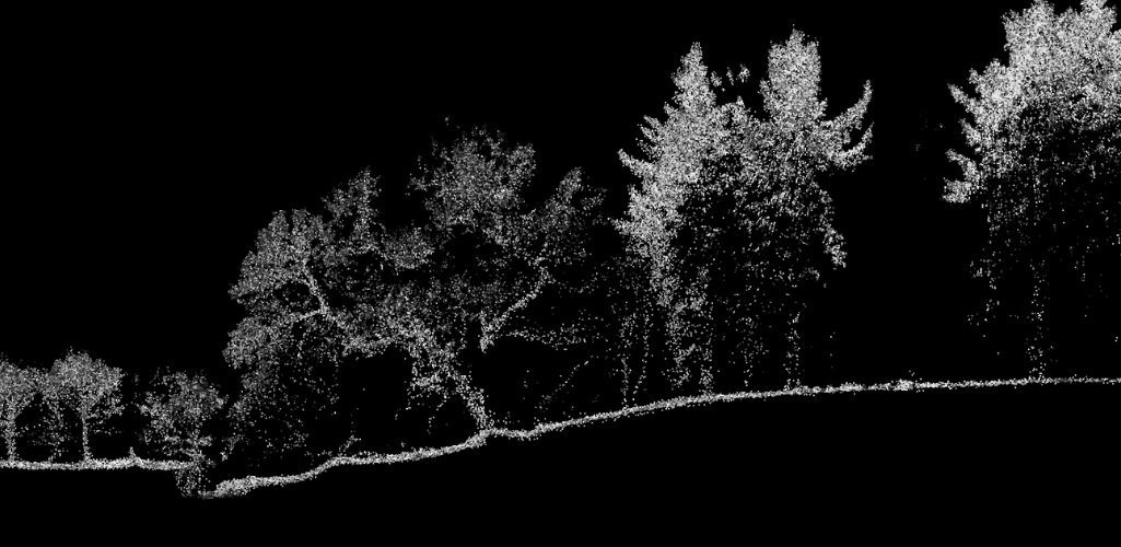
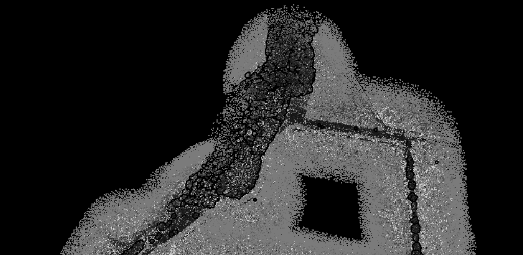
The above image - taken from data captured at a farm site used by Newcastle University's renowned GIS department - demonstrates another key feature of the ZEB Horizon: It is the first GeoSLAM sensor to be able to display data based on intensity.
Crucially, the unit - which can also be handheld, among other deployment options - is capable of achieving up to 6mm relative accuracy (when processed in GeoSLAM Connect V2).
heliguy™ has partnered with GeoSLAM to add the ZEB Horizon to our product portfolio. It is available to buy or rent. Click to view the ZEB Horizon.
GeoSLAM ZEB Horizon: An Overview
The GeoSLAM ZEB Horizon is an industry-leading LiDAR solution which brings speed, portability, accuracy and versatility.
Enabling real-time data collection while on the move, this portable 3D scanner can collect 300,000 points per second, has a range of 100m and features a rotating LiDAR sensor for a wider field of view.
The table below provides an overview of the ZEB Horizon's key specifications.
Range | 100m |
Laser | Class 1 / 903nm |
FOV | 360° x 270° |
Protection Class | IP54 |
Processing | Post |
Scanner Weight | 1.4kg; Up to 3.7kg with UAV mount. |
Colourised Point Cloud | Yes (with ZEB Vision accessory - see later in blog) |
Intensity | Yes |
Scanner Points Per Second | 300,000 |
Number of Sensors | 16 |
Relative Accuracy | Up to 6mm (When processing data in GeoSLAM Connect V2 - see later in blog) |
How It Works: The Science Behind The Sensor
One of the biggest advantages of the GeoSLAM ZEB Horizon is its utilisation of SLAM technology.
SLAM stands for Simultaneous Localisation and Mapping and is the process of computing the position of the device, while building a map of the environment simultaneously.
This process enables surveyors to map an unknown environment as they go, making mobile mapping possible.
As such, SLAM simplifies data collection - removing the dependency on multiple static set-ups of bulky tripod-based systems - and, in the case of the ZEB Horizon, can be used outdoors, indoors, and from the sky, as well as underground, as shown in this GeoSLAM video of a tunnel network.
This leads on to the next point: Versatility.
Versatility: The ZEB Horizon Ecosystem
One of the biggest advantages of the GeoSLAM ZEB Horizon is its versatility.
Not only can it be used to map a variety of environments, but the ZEB Horizon ecosystem enables multiple deployment options.
During our trials, we made use of the GeoSLAM DJI M300 UAV mount...
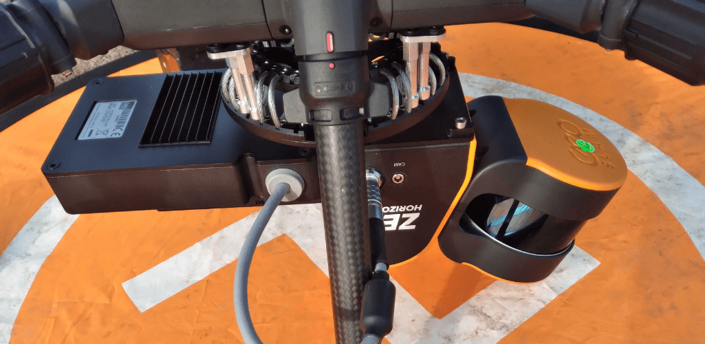
...enabling the sensor to collect quality aerial data. The ZEB Horizon integrates with a range of drones - DJI M600, Freefly Alta 8, Alta 8 Pro and Alta X - via specially designed mounts, which take the weight of the payload to between 2.5kg and 3.7kg.
The DJI M300 RTK mount comes with its own datalogger which powers directly from the UAV, making the payload lighter.
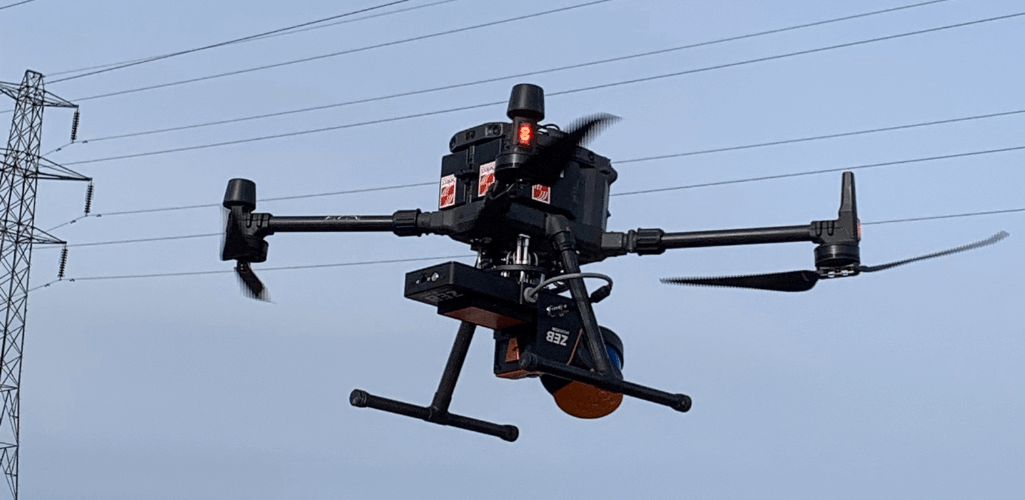
Deploying the ZEB Horizon by drone is especially useful in potentially dangerous surveying areas, such as construction sites or mines. Aerial data collection removes the need for staff to access these hazardous or hard-to-reach locations, improving safety and reducing the length of the survey.
But sometimes, data collection on foot is necessary. And this is where the backpack configuration - utilising the ZEB Locate solution - comes in handy, enabling an alternative method of hands-free surveying, as demonstrated below during our field test with Laing O'Rourke.
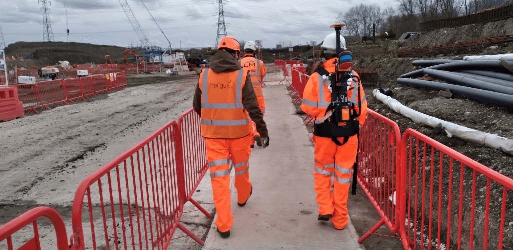
The ZEB Locate accurately georeferences ZEB data by integrating a backpack-mounted ZEB Horizon with precision GPS. This helps to connect point clouds to the real world, without the need for external control points - improving the speed of the survey.
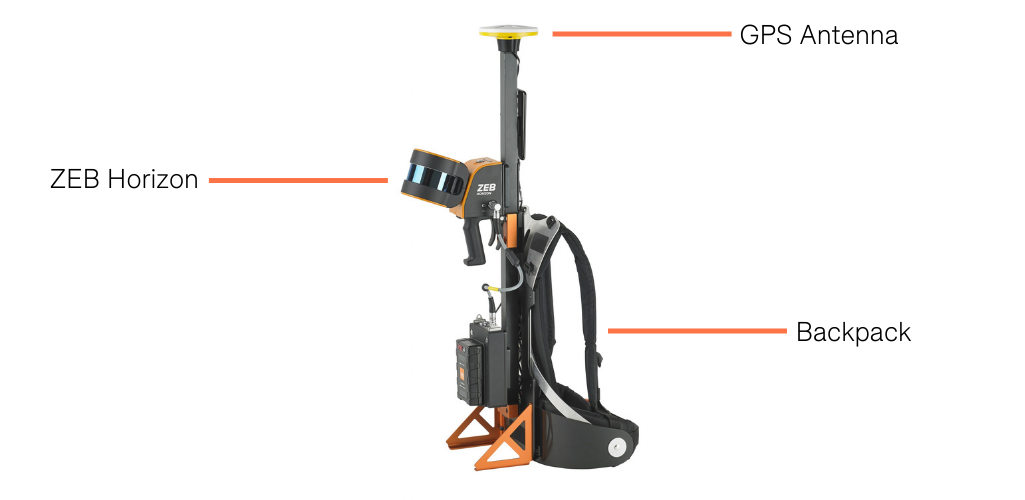
The ZEB Locate provides a more mobile option to conduct maintenance or inspection assets on foot, and supports outdoor applications where location data is important.
A range of other accessories are available for the ZEB Horizon, to widen its scope as a surveying tool. These include:
Discovery: Ultra HD imagery from the NCTech iStar Pulsar camera.
ZEB Vision: Colourise your point cloud.
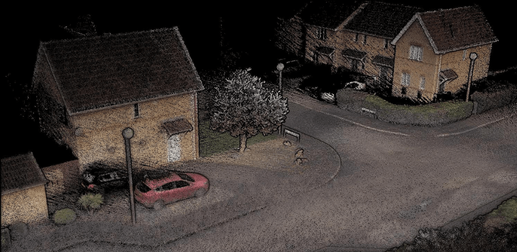
ZEB Pano: 360° panoramic imagery.
Cradle: Lower your device into shafts.
Pole: Elevate your device into ceiling voids.
Car Mount: Car-mounted data collection for urban road layouts, features and signage - as this video by GeoSLAM shows.
GeoSLAM ZEB Horizon: Point Cloud Data Sets
The quality of the data is crucial, and we were impressed with the ZEB Horizon's outputs and the way the GeoSLAM software suite allows the extraction of information from point clouds.
For instance, having collected data with the M300 RTK at GeoSLAM's Demo Site, we processed the information in GeoSLAM Connect and were able to view the point cloud in four different modes: Solid, elevation, time and intensity.
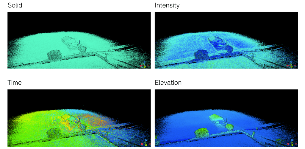
Incidentally, the data collection process of the ZEB Horizon is very streamlined and requires very little expertise or experience to understand its operation.
Further data sets, captured by GeoSLAM, reiterate the speed and capabilities of the ZEB Horizon.
For instance, this model of the Angel of the North took six minutes to capture and 10 minutes to process...

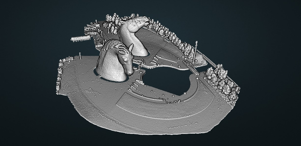
...while this digital representation of The Kelpies, in Scotland, took 20 minutes to capture and 40 minutes to process.
GeoSLAM Vegetation Penetration
By its very nature, LiDAR is a highly-effective method for surveying in densely vegetated areas, with its pulses able to penetrate foliage.
This is especially crucial for creating accurate and detailed DTMs.
And the GeoSLAM ZEB Horizon duly delivers in this department, as this cross-section (coloured by elevation) shows. Notice how the ground profile is thick and strong, even in areas below the tree canopies.
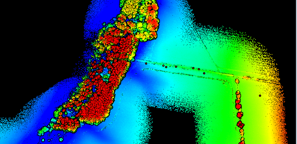
For the record, this is what the cross-section looks like from above.
Data collected by the ZEB Horizon can then be manipulated further and transformed into a DTM, as demonstrated by the ground classification, and the Raster DTM presented below:
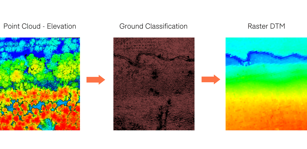
This was conducted in Terrasolid, using data that was initially processed in GeoSLAM Connect.
GeoSLAM Software: Hub, Connect And Draw
The GeoSLAM ecosystem is not confined to hardware, with high-quality software available to make the most of your data.
Up until September 2021, GeoSLAM Hub was GeoSLAM's primary processing platform. This has now been superseded by GeoSLAM Connect. New customers will receive both a Hub and Connect licence, but Connect - which automatically creates clean and georeferenced point clouds - is recommended for all of the new features and faster processing.
The table below shows the differences between the two, as well as highlighting their functionality.
GeoSLAM Hub | GeoSLAM Connect | |
Processing | ||
✓ | Data Import (drag & drop) | ✓ |
Automated workflows | ✓ | |
Data management | ✓ | |
GeoSLAM BEAM | ✓ | |
✓ | Point cloud viewer | ✓ |
SLAM environment presets | ✓ | |
Colourising | ||
✓ | Elevation | ✓ |
✓ | Intensity (ZEB Horizon only) | ✓ |
Geospatial | ||
✓ | Stop-and-Go alignment | ✓ |
✓ | Stop-and-Go Georeferencing | ✓ |
✓ | GPS Georeferencing (closed loop) | ✓ |
GPS Georeferencing (open loop) | ✓ | |
✓ | Point cloud data filtering | ✓ |
Change detection | ✓ | |
Floor slices | ✓ | |
Measurements between points | ✓ | |
General | ||
✓ | Online and offline licence activation | ✓ |
✓ (V3.6) | GeoSLAM Draw integration | ✓ (V4.0) |
✓ | Third-party software integrations | ✓ |
User account & online authentication | ✓ | |
Phone app | ✓ |
GeoSLAM Connect is a starter package, but point clouds can be enhanced with GeoSLAM Draw - an optional add-on software which can be purchased in addition to GeoSLAM Connect.
GeoSLAM Draw takes the processed point cloud file from Geoslam Connect, allowing for deeper dataset analysis and data manipulation. In Draw, users can goereference, vectorise and take measurements across the dataset.
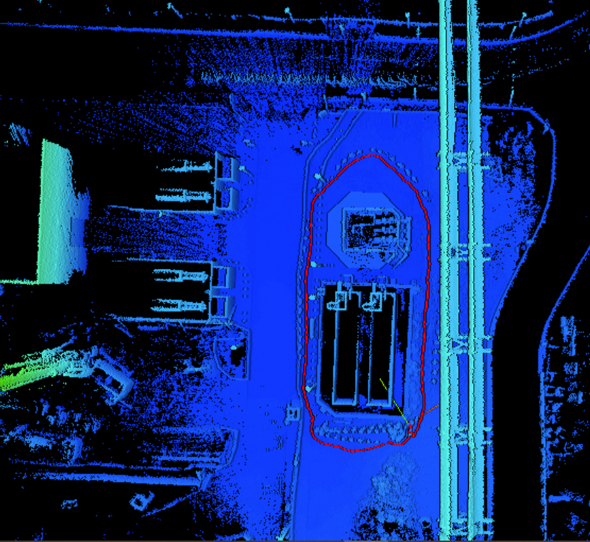
For instance, the below point cloud - taken from the sewage treatment works - has been processed in GeoSLAM Connect, with the red line denoting the route we took with the Geoslam Locate ...
...and then turned into a usable 2D drawing in GeoSLAM Draw.
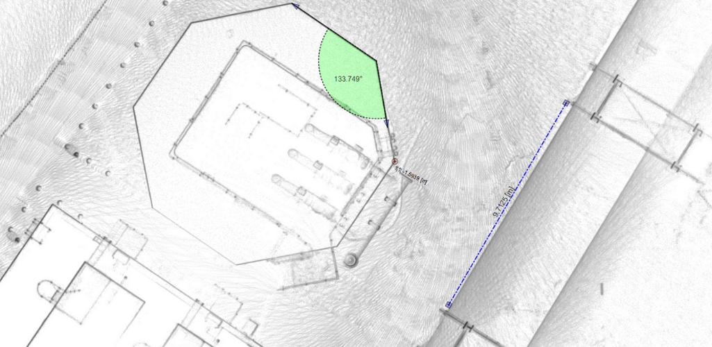
The same dataset was then annotated...
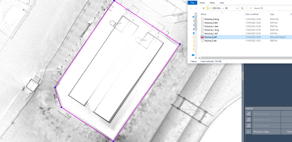
...and vectorised using the create line tool, before exporting it as a DWG file for integration into a range of CAD packages.
Taking our data sets of the vegetation penetration as a further example, this top-down view of the forest canopy shown in Terrasolid in terms of intensity...
...looks like this after being processed through Draw.
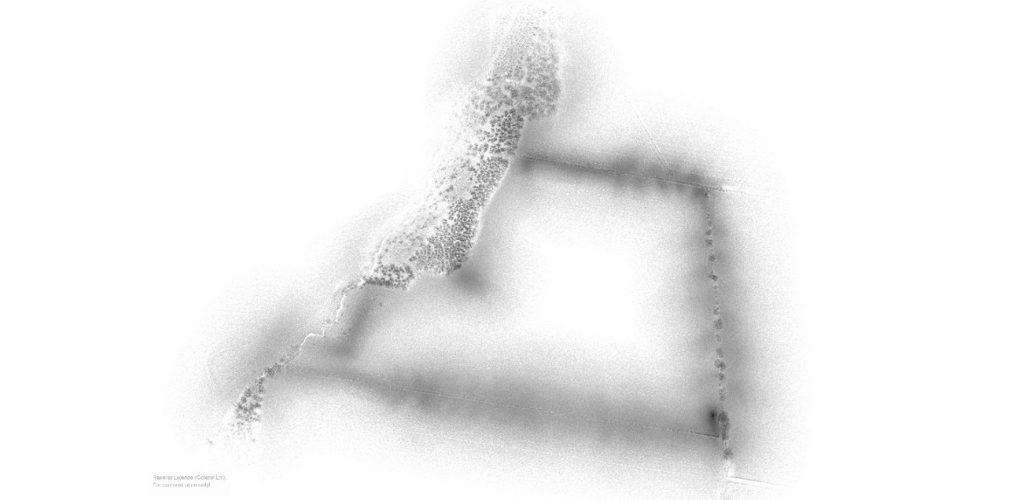
This data can then be shared quickly and easily with colleagues and clients for detailed collaborations.
Five GeoSLAM Draw packages are available, offering different functionality and industry-specific applications - as set out by the table below.
Start | Plan | BIM | Mining | Pro | |
Import non-proprietary | ✓ | ✓ | ✓ | ✓ | ✓ |
3D View | ✓ | ✓ | ✓ | ✓ | ✓ |
Layout/Section | ✓ | ✓ | ✓ | ✓ | ✓ |
WebExport | ✓ | ✓ | ✓ | ✓ | |
Registration | ✓ | ✓ | ✓ | ||
Virtual Pano | ✓ | ✓ | ✓ | ✓ | ✓ |
Sketch | ✓ | ✓ | ✓ | ✓ | ✓ |
Merger | ✓ | ✓ | ✓ | ✓ | |
Volume | ✓ | ✓ | |||
Proprietary Formats | ✓ | ✓ | ✓ | ||
Mesh | ✓ | ✓ | |||
Align/Transform | ✓ | ✓ | ✓ | ✓ | ✓ |
Vectoriser | ✓ | ✓ | ✓ | ✓ | ✓ |
Profiler | ✓ | ✓ | |||
PhotoMatch | ✓ | ✓ | |||
RCP Import & Export | ✓ | ✓ | ✓ | ✓ | |
Elliptical Section | ✓ | ✓ | ✓ | ✓ | |
Polygonal Section | ✓ | ✓ | ✓ | ✓ | |
Curved Section | ✓ | ✓ | ✓ | ✓ | |
Cloudexport | ✓ | ✓ | ✓ | ✓ | ✓ |
4CAD | ✓ | ✓ | |||
4Revit Plugin | ✓ | ✓ | |||
Who Is It For? | Best suited for those wishing to create quick and easy floorplans, conduct area surveys or to visualise images captured within scans (e.g. architects, planners). | Best suited for those wishing to share data between colleagues, create reports or visualise a variety of shaped objects (e.g. CAD users, architects). | Best suited for those wishing to create CAD models, georeference scan data or use terrestrial data to enhance projects (e.g. BIM users, architects). | Best suited for those wishing to collect volume data (e.g. mining, tunnelling, stockpiling) or visualise aspects of point clouds in 3D. | Best suited for those wishing to have full flexibility of point clouds. |
GeoSLAM ZEB Horizon Review: Summary
The GeoSLAM ZEB Horizon is a powerful LiDAR sensor, capable of capturing data quickly and on the go to create dense point clouds.
With a wide scope of deployment options, it can be used above or below ground, from the skies or indoors, making it a highly versatile solution.
Its accuracy provides data you can rely on, while its suite of software packages help to make the most of these digital assets.
LiDAR surveying is an effective application and the GeoSLAM ZEB Horizon facilitates reliable mobile laser scanning for a range of industry use cases.
To discuss the GeoSLAM ZEB Horizon and to add it to your surveying applications, contact our in-house GIS specialists.
