Products
GeoSLAM ZEB Go vs ZEB Revo RT Vs ZEB Horizon
ln-depth comparison between GeoSLAM's mobile LiDAR scanners: The ZEB Go, ZEB Revo RT, and ZEB Horizon. The guide includes details about the performance and accessory compatibility of each sensor to help you pick the right one for your surve ... Read More

ln-depth comparison between the three GeoSLAM LiDAR scanners: The ZEB Go, ZEB Revo RT, and ZEB Horizon;
The ZEB Go is an ideal beginner's scanner, the ZEB Revo RT enables real-time data processing, and the ZEB Horizon - described as the 'ultimate mobile mapping solution' - is the most powerful and versatile;
The ZEB Go has the highest IP Rating; the ZEB Go and ZEB Revo RT can collect 43,000 points per second and have a range of 30m; the ZEB Horizon has a 100m range, can collect 300,000 points per second and can measure intensity values;
All three sensors can be hand-held and used in GPS-denied environments - ideal for mapping indoors or underground;
Find out which accessories each sensor is compatible with, including drone-mounted options.
heliguy™ has expanded its surveying portfolio by partnering with GeoSLAM to offer its industry-leading laser scanners and accessories.
But with three GeoSLAM sensors to choose from - namely the ZEB Go, ZEB Revo RT and ZEB Horizon - which one is best for you?
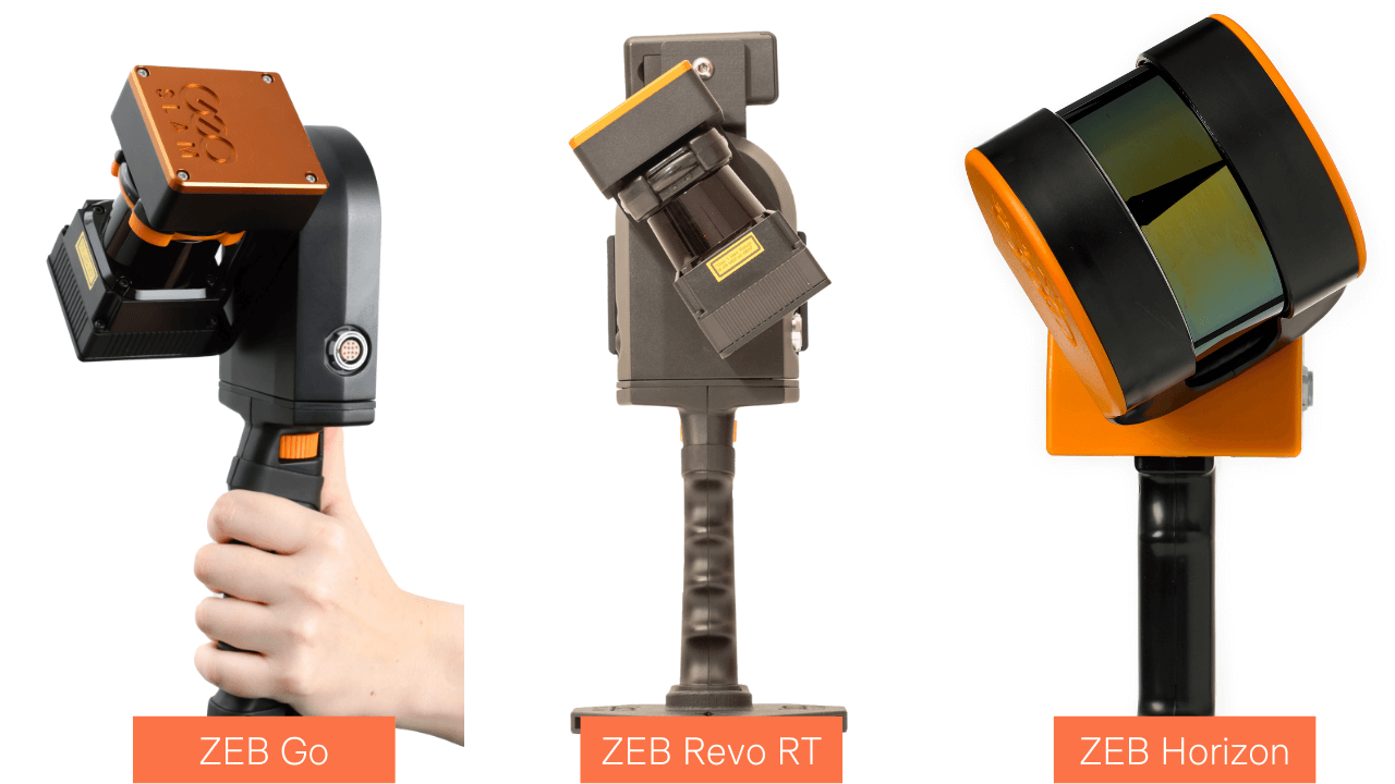
We've put together this in-depth comparison to help.
GeoSLAM ZEB Horizon Vs ZEB Go Vs ZEB Revo RT: Key Specs
This specification table provides an at-a-glance overview of each scanner's vital statistics and individual capabilities.
ZEB Go | ZEB Revo RT | ZEB Horizon | |
Range | 30m (features <15m) | 30m (features <15m) | 100m |
Laser | Class 1 / λ 905nm | Class 1 / λ 905nm | Class 1 / λ 903nm |
FOV | 360° x 270° | 360° x 270° | 360° x 270° |
Frequency | 40Hz | 100Hz | 160 lines/s (16 lines @ 10Hz) |
Protection Class | IP 64 | IP 54 | IP 54 |
Processing | Post | Real time | Post; Real-time data preview with the ZEB Horizon RT (available separately) |
Datalogger Carrier | Backpack | Shoulder pack | Backpack or shoulder strap |
Scanner Weight | 950g | 1.05kg | 1.45kg |
Datalogger Weight (including battery) | 1.7kg | 1.4kg | 1.4kg |
Colourised Point Cloud | Yes (with ZEB Cam) | Yes (with ZEB Cam) | Yes (with ZEB Vision) |
Intensity | No | No | Yes |
Scanner Points Per Second | 43,000 | 43,000 | 300,000 |
Number of Sensors | 1 | 1 | 16 |
Relative Accuracy | 1 - 3cm (environment depending) | Up to 6mm (when processing data in GeoSLAM Connect V2) | Up to 6mm (when processing data in GeoSLAM Connect V2) |
Raw Data File Size | 100 MB/ minute | 100 MB/ minute | 100-200MB /minute |
Can Be Drone-mounted | No | No | Yes |
Battery Life (based on continuous use) | 4Ah: 2 hours 8Ah: 4 hours | 90 mins | 3 hours |
Operating Temperature | 0°C to 50°C | 0°C to 35°C | 0°C to 40°C |
GeoSLAM ZEB Go Vs ZEB Revo RT Vs ZEB Horizon: Mobile And Rapid Data Collection
All three GeoSLAM sensors are LiDAR-based - a remote sensing technology that uses the pulse from a laser to collect measurements. It can be used to create 3D models and maps of objects and environments. You can find out more about LiDAR here.
The ZEB Go, ZEB Revo RT, and ZEB Horizon are handheld scanners and enable go-anywhere mapping.
They can be used in GPS-denied environments making them perfectly suited to map indoors, underground or outside. The ZEB Horizon can also be integrated with a drone to capture aerial data - more on that later.
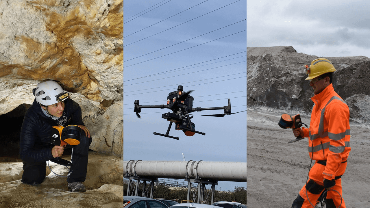
The three sensors utilise SLAM (Simultaneous Localisation and Mapping) technology which is the process of computing the position of the sensor, while building a map of the environment simultaneously. This enables surveyors to map an unknown environment as they go, without the need for static or bulky systems, making mobile mapping possible. Find out more about SLAM here.
All three GeoSLAM LiDAR scanners enable rapid data collection and processing - as these datasets show.
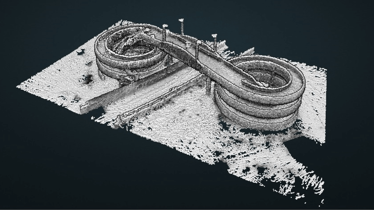
For instance, the ZEB Go was used to create this point cloud of a spiral bridge. The asset was captured in 10 minutes and the data processed in 15 minutes.
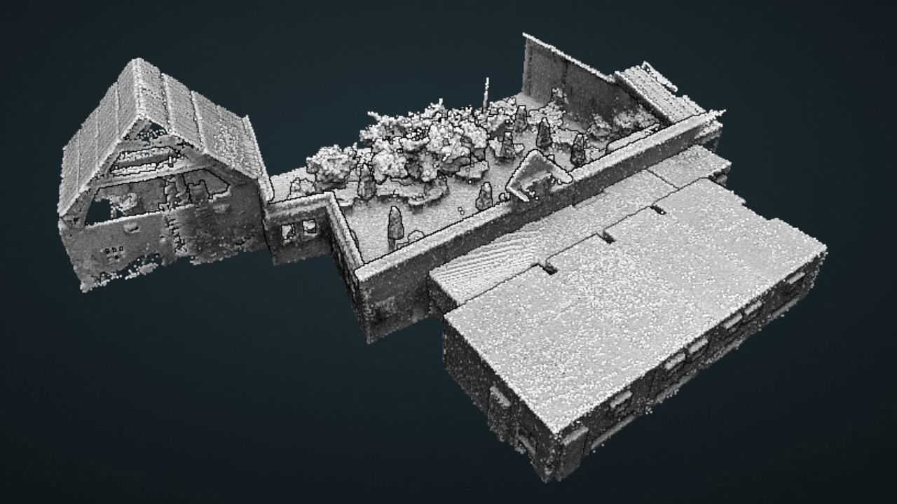
Meanwhile, this distillery was captured with the ZEB Revo RT (and ZEB Pano accessory - more on accessories later in this blog). The scan took 20 minutes, followed by a quarter-of-an-hour processing time.
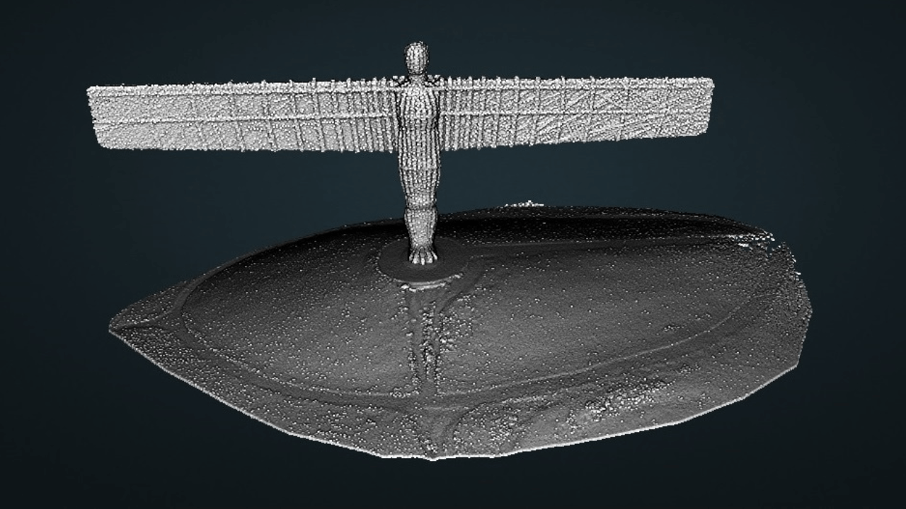
And the iconic Angel of the North was captured in just six minutes with the ZEB Horizon. The data processing took 10 minutes.
While all three GeoSLAM sensors share rapid, mobile and go-anywhere data collection capabilities, there are key differences between them which will influence your preference.
GeoSLAM ZEB Go Vs ZEB Revo RT Vs ZEB Horizon: Key Differences
It's fair to say that the GeoSLAM sensors fit into a sliding scale, starting with the ZEB Go and going through to the ZEB Horizon which is the most advanced, both in terms of versatility and performance. The ZEB Revo RT fits somewhere in the middle - but having the distinct advantage of offering real-time data collection.
So, let's take a look at each sensor in detail, highlighting their unique capabilities and performance benefits.
ZEB Go
As the most cost-effective of the three GeoSLAM scanners, the ZEB Go is designed to be a first step into SLAM handheld technology, thanks to its user-friendly nature.
Its 30m maximum range, ability to capture 43,000 scan points a second, relative accuracy of 1-3cm (environment depending) and its light weight (the lightest of all three GeoSLAM sensors) enable it to capture decent data at high speed.
Particularly useful for mapping smaller spaces, the ZEB Go is ideal for applications such as mining and building rapid floor plans, and is capable of building datasets like this:
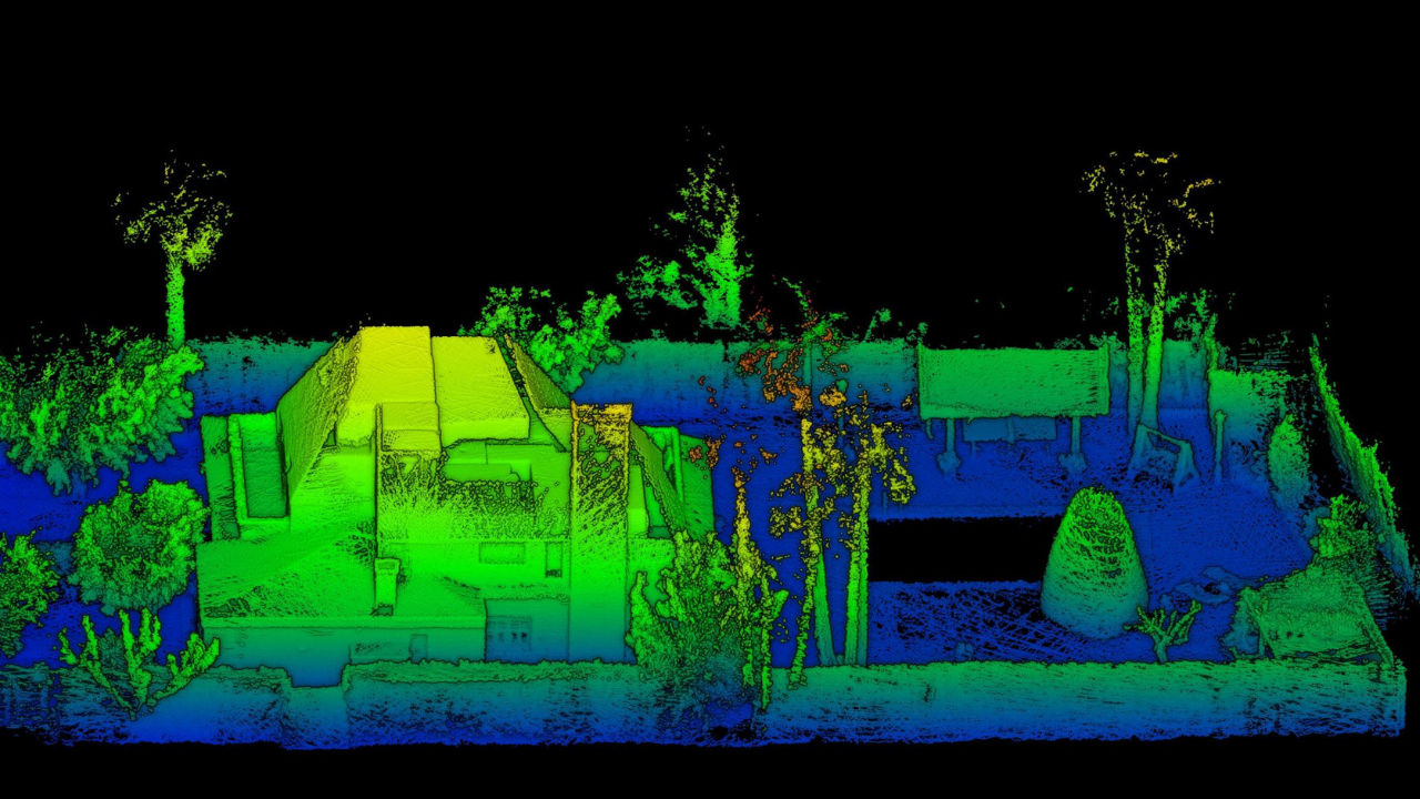
Interestingly, the ZEB Go has the best IP rating out of the three (IP64 vs IP54 on the Revo RT and Horizon) and has the widest operating temperature range.
ZEB Revo RT
The ZEB Revo RT is something of a middle-ground sensor compared to the ZEB Go and the ZEB Horizon.
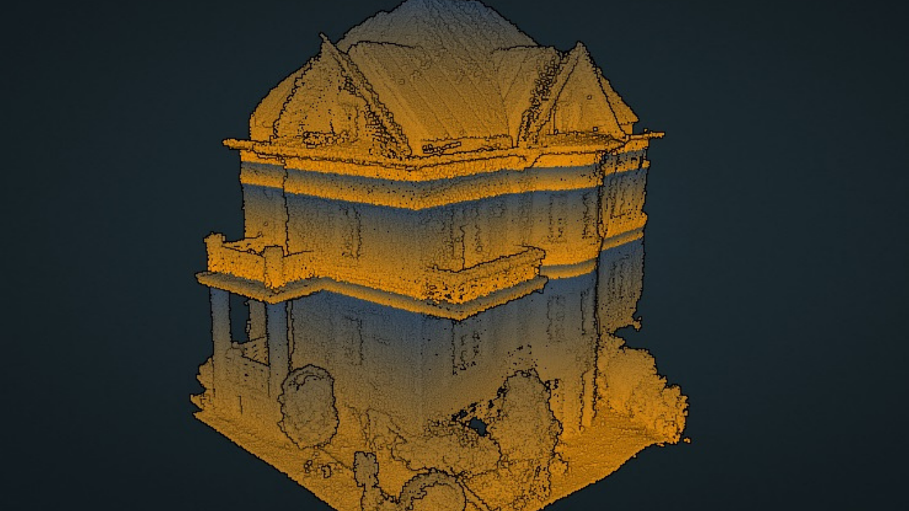
The ZEB Revo RT does share some specific data-capture qualities with the ZEB Go, such as the 30m maximum range and the 43,000 scanner points per second. However, the ZEB Revo RT has a higher frequency than the ZEB Go (100Hz vs 40Hz) which helps to create a more dense point cloud - as these two images show.
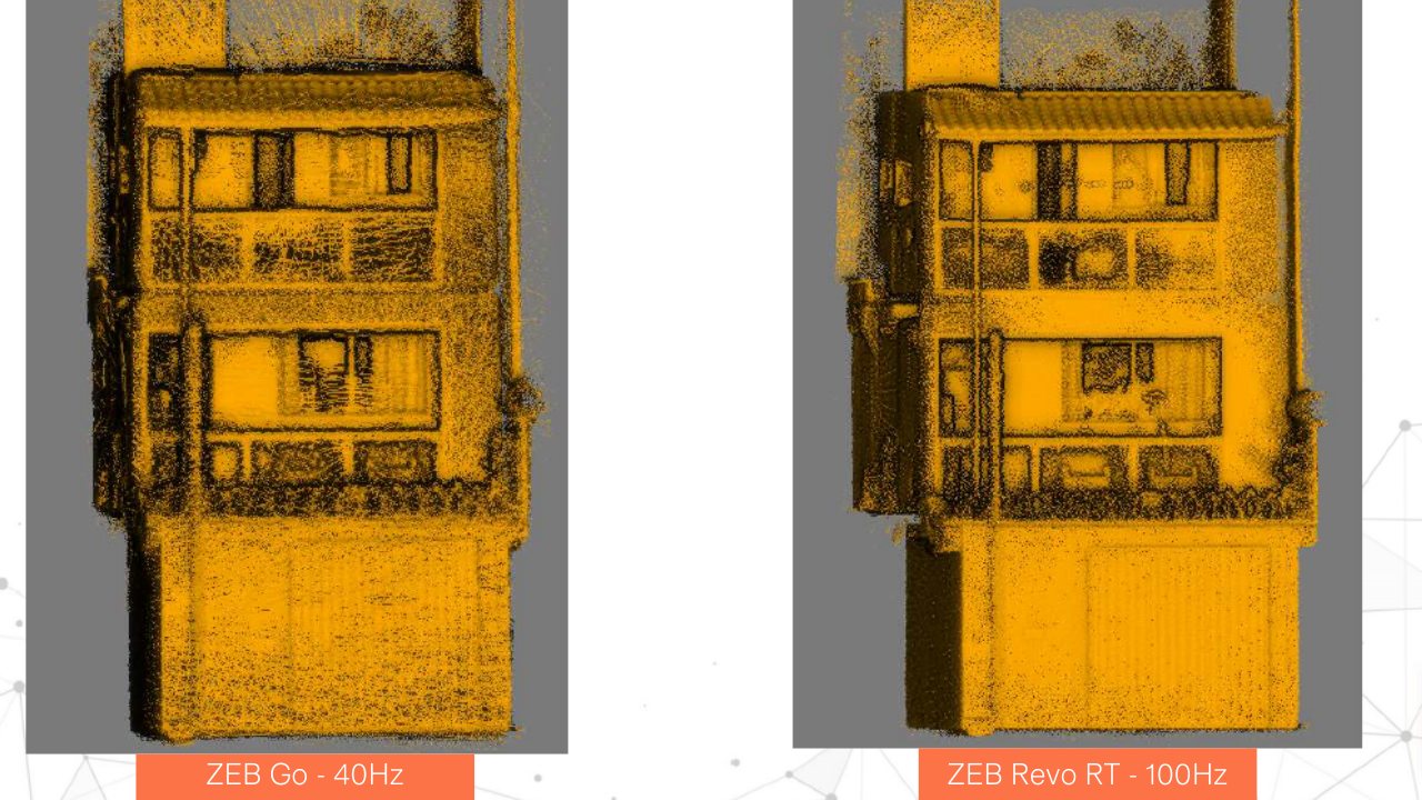
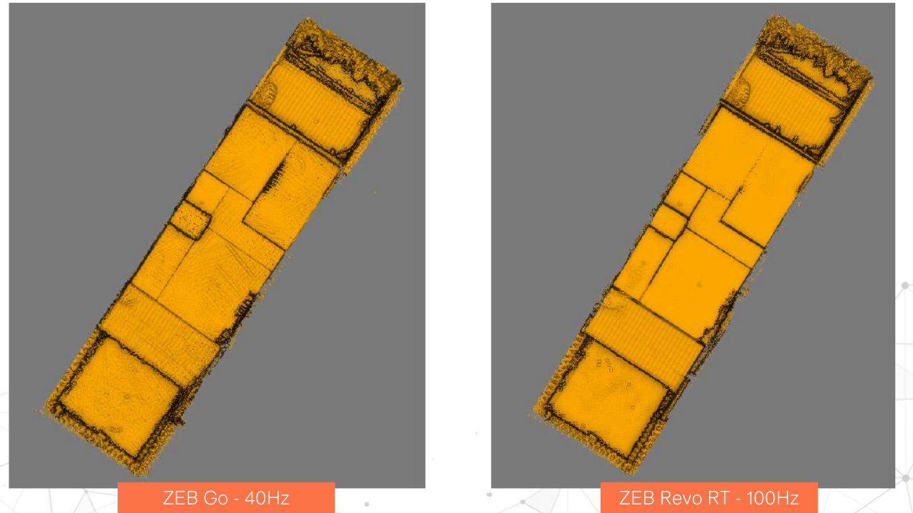
Notice how the datasets are more robust and the lines are more pronounced with the Revo RT, compared to the ZEB Go. However, the data collected by the ZEB Go is more than useable.
However, as we'll discuss shortly, it lacks some of the power and versatility of the ZEB Horizon.
But, the real string to the ZEB Revo RT's bow is its ability to process data in real-time. This ensures surveyors obtain real-time insights into the scan, to see areas covered (or missed) and the route taken before leaving site.
ZEB Horizon
GeoSLAM describes the ZEB Horizon as the ultimate mobile mapping solution.
The company's most recent addition to its family of sensors is its most powerful - epitomised by its enhanced range, number of sensors, increased scanning points per second and added versatility.
For instance, the ZEB Horizon has 16 sensors, compared to the single sensor on the ZEB Go and ZEB Revo RT, while its 100m range enables greater mission diversity and efficiency - detecting finer details from further afield. This is particularly useful for drone work.
Its ability to collect 300,000 scanner points per second - versus the ZEB Go and ZEB Revo RT's 43,000 points per second - helps surveyors conduct even higher-quality scans in even quicker time.
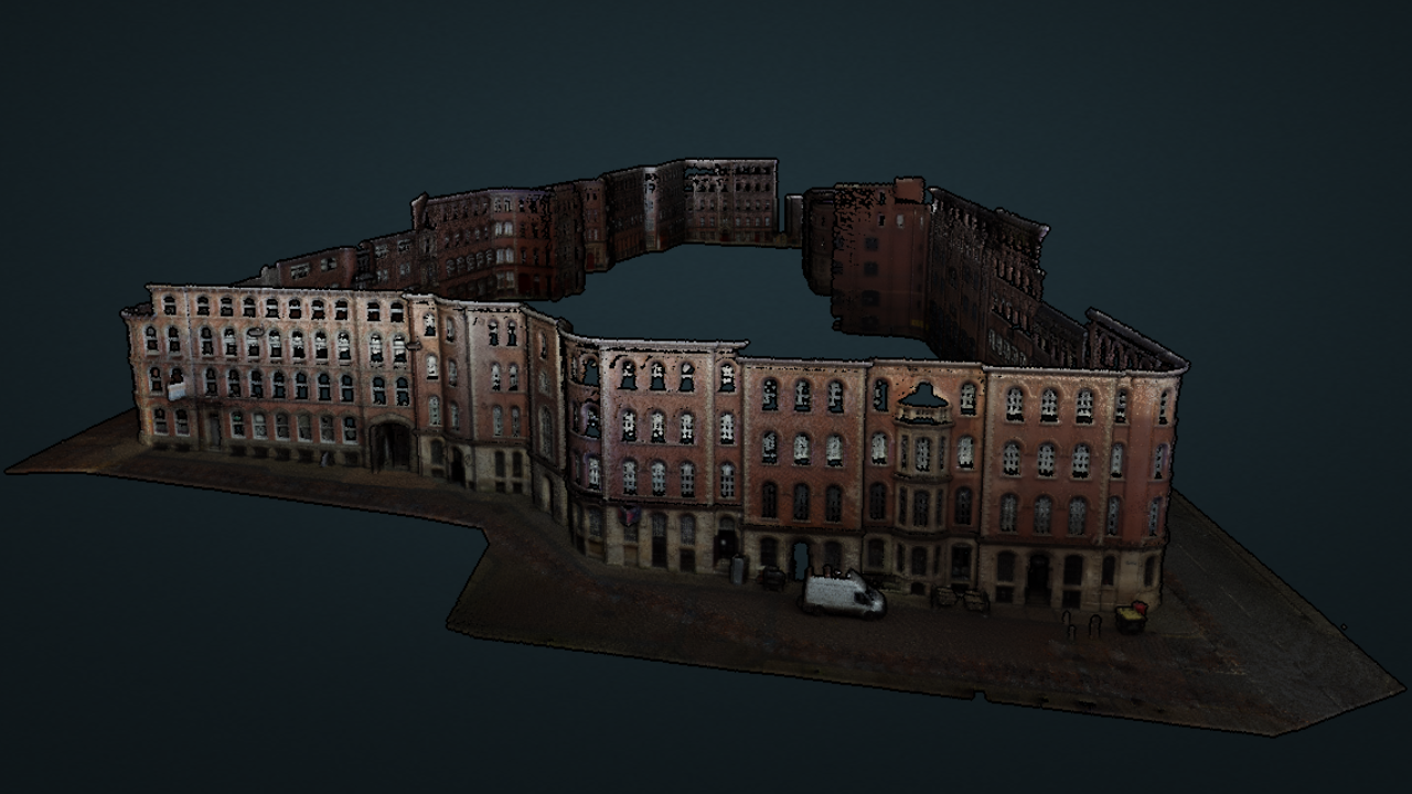
For instance, this point cloud of Nottingham's Lace Market was captured with the ZEB Horizon and ZEB Discovery accessory in just 15 minutes. This was followed by 20 minutes of SLAM processing and 45 minutes Orbit processing.
On the subject of accessories, the ZEB Horizon can integrate with the widest array of GeoSLAM extras, making it the most versatile of the sensors. We'll discuss this in more detail in the next section of this blog.
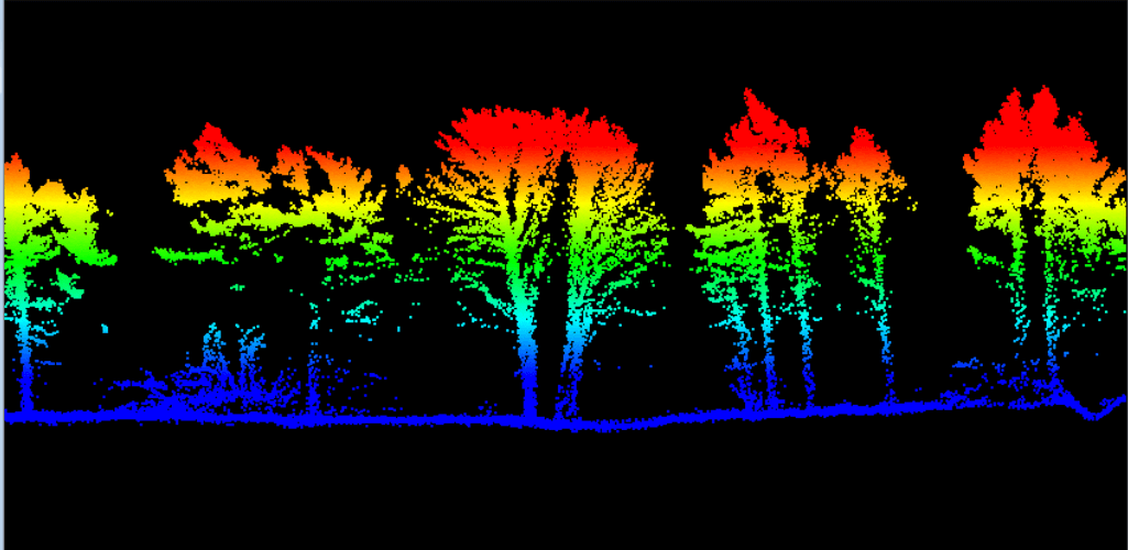
The ZEB Horizon's increased number of scan points per second also helps it create dense DTMs - including in highly-vegetated areas. This cross-section - collected using a drone - shows the ability of the ZEB Horizon to penetrate the vegetation canopy to build a robust terrain model.
And when it comes to datasets, the ZEB Horizon is the only sensor of the three to be able to record LiDAR intensity values - useful for numerous applications such as feature detection and point cloud classification, land cover classification, identifying wet areas in forested areas, and vegetation classification. The image below shows the various modes that ZEB Horizon data can be viewed in.
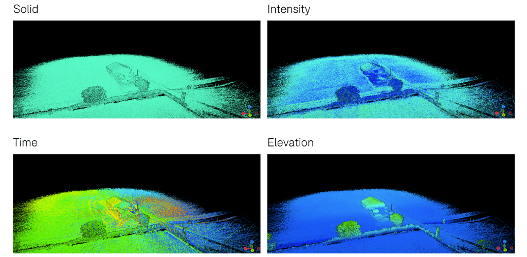
Data can be viewed in real-time with the ZEB Horizon RT (available separately).
GeoSLAM ZEB Go Vs ZEB Revo RT Vs ZEB Horizon: Accessories
A big part of the GeoSLAM offering is its ecosystem of accessories, which provide more from each survey - such as point cloud colourisation, point cloud georeferencing, and HD imagery. Other accessories include drone or vehicle mounts, and poles/cradles to elevate or lower your device.
Bu not all accessories are compatible with each GeoSLAM sensor - as shown in the table below.
Accessory | ZEB Go | ZEB Revo RT | ZEB Horizon |
ZEB Discovery Ultra-high definition imagery. | X | X | ✓ |
ZEB Locate Georeferenced point clouds. | X | X | ✓ |
ZEB Pano Add 360° panoramic photos to scans. | ✓ | ✓ | ✓ |
ZEB Cam Colourised point clouds: Add contextual video and imagery to your 3D scan data. | ✓ | ✓ | X |
ZEB Vision Colourised point clouds: 4K RGB sensor to capture colourised data and 360° panoramic images. | X | X | ✓ |
UAV Mount Flexible airborne integration. | X | X | ✓ |
Car Mount Flexible urban scanning. | X | X | ✓ |
Cradle Lower your device into shafts. | ✓ | ✓ | ✓ |
Pole Elevate your device into ceiling voids. | ✓ | ✓ | ✓ |
Guard Increased protection for vertical deployment. | X | ✓ | ✓ |
Accessory compatibility is a key consideration when choosing a GeoSLAM sensor, as it can impact your mission versatility and data collection capabilties.
For instance, the ZEB Horizon is the only GeoSLAM sensor which can be integrated with a drone. The specialist UAV mounts enable compatibility with aircraft such as the DJI M300 RTK and M600, to collect and build unique aerial insights and datasets.

The ZEB Horizon can be vehicle-mounted, ideal for capturing data for tasks such as urban planning.
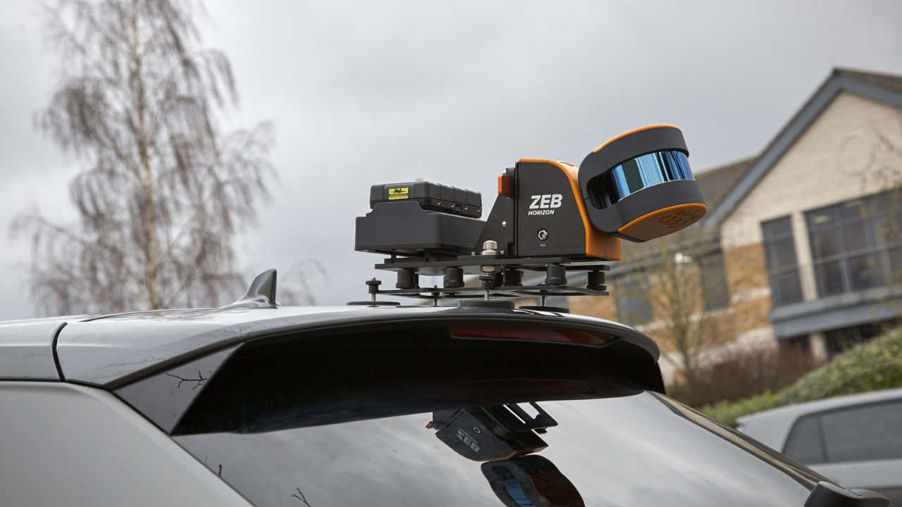
The ZEB Horizon can also be backpack-mounted to integrate with accessories such as the ZEB Discovery...
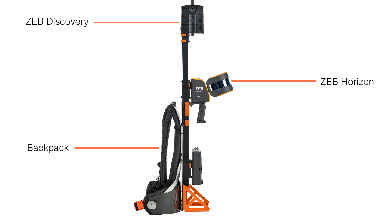
...which enables ultra-high definition 11K, 360° imagery to offer data like this...
...as well as the ZEB Locate, to geoference your point cloud on the move without the need for external control points.
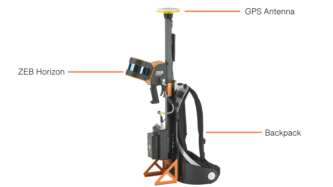
The backpack solution is particularly ideal for when maintenance or inspection is needed on assets that should be inspected on foot.
The ZEB Horizon, ZEB Discovery and ZEB Locate can also be used together, producing point clouds like this one of The Kelpies, in Scotland, which was captured in 20 minutes, with the data processed in 40 minutes.

Point cloud colourisation can be an important requirement - showing the dimensional measurements and the RGB value and making the dataset easier to interpret and more visually appealing. All three GeoSLAM sensors are able to utilise this, but require different accessories to do it.
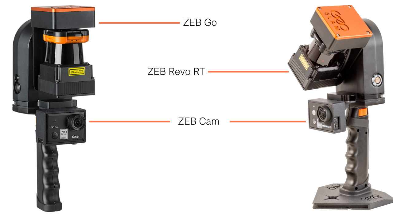
For instance, the ZEB Go and ZEB Revo RT are compatible with the ZEB Cam, which is an add-on camera to add contextual video and imagery to 3D scan data and apply texture information to point clouds and mesh.
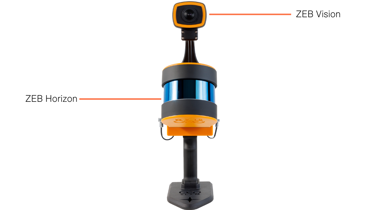
In contrast, the ZEB Horizon can be paired with the ZEB Vision, which captures colourised data and 360° panoramic images.
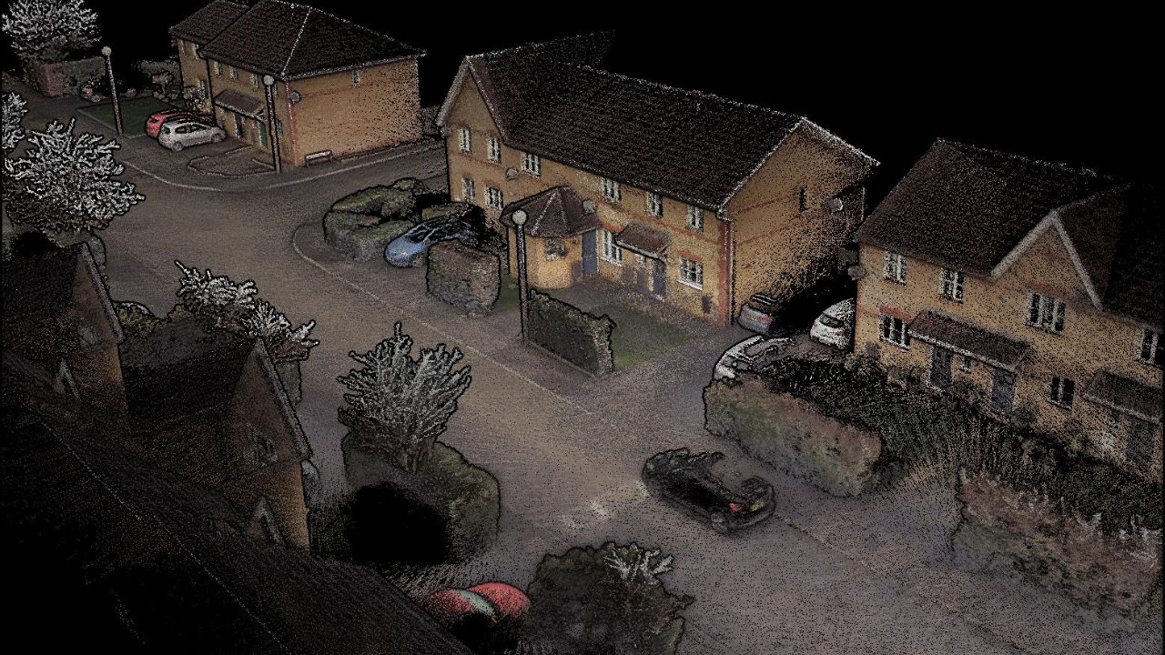
According to GeoSLAM, the ZEB Vision provides better than ever colourisation...
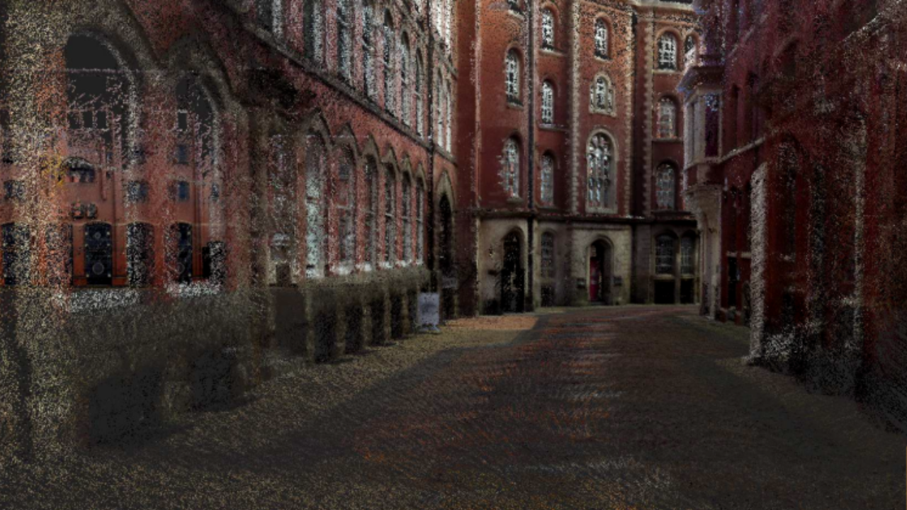
...and enables immersive point cloud walk-throughs, as demonstrated by this series of images showing various locations of Lace Market, in Nottingham.
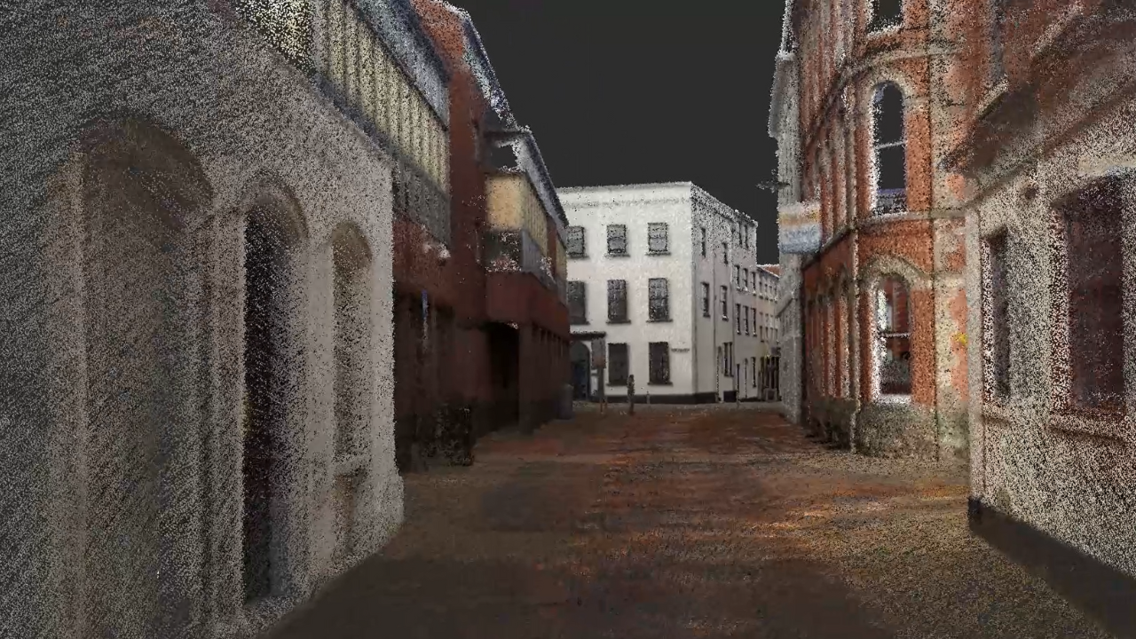
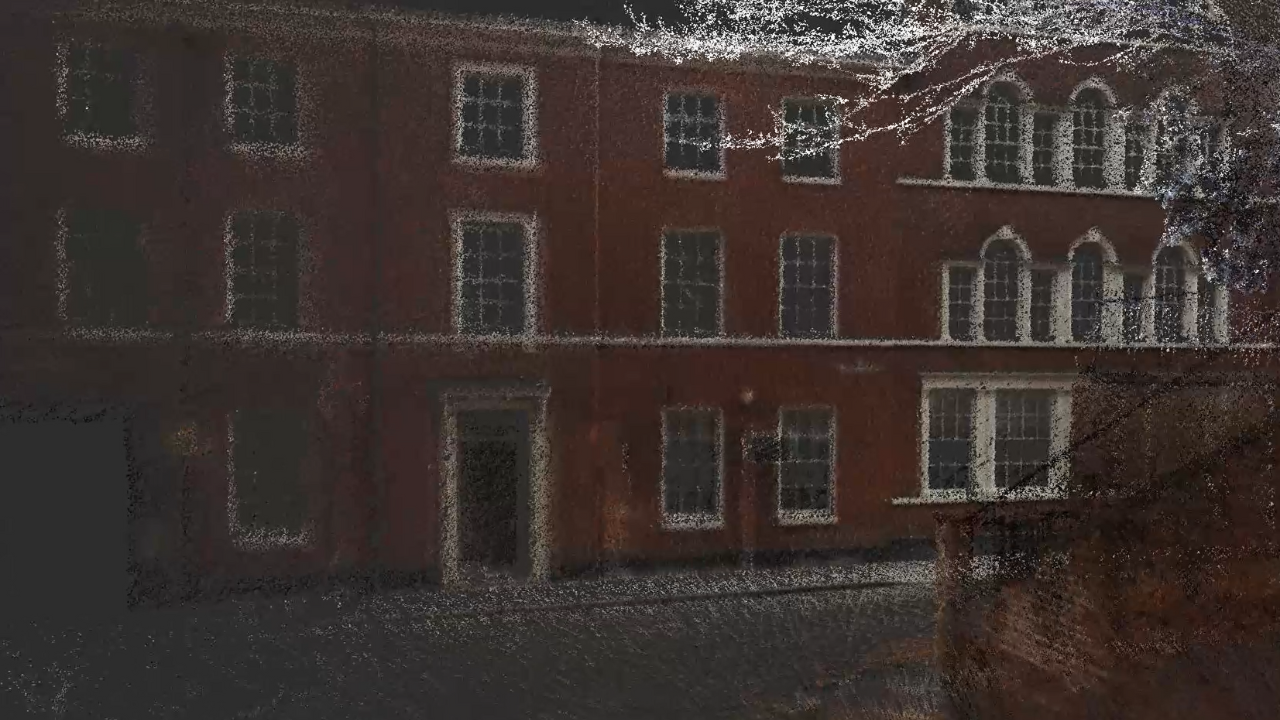
A powerful tool for a range of industries, including construction and surveying, the ZEB Vision features a forward and rear-facing lens on the camera to provide a full 360° field of view for colourisation and visualisation of the data.
Looking at the specs, the ZEB Vision yields a resolution of 4K imagery, while the ZEB Cam has a 1440p video resolution and 1920 x 1440 photo resolution.
Meanwhile, the three sensors can be integrated with the ZEB Pano, which adds 360° panoramic photos to scans and is particularly useful for capturing real estate and property floorplan data. For instance, the average time to scan athree bedroom house (85 sqm) is five minutes.
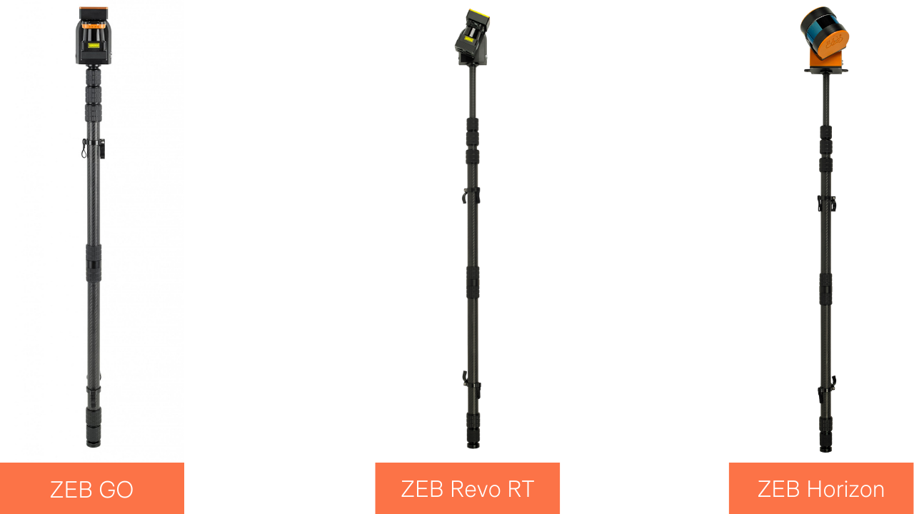
The ZEB Go, ZEB Revo RT, and ZEB Horizon can also be used with a cradle to lower the scanner underground or in difficult-to-reach/unsafe areas, such as manholes, vent shafts and sinkholes...

...or a pole, for mapping at height or reaching areas such as ceiling voids, stockpiles and infrastructure inspection.
GeoSLAM ZEB Go Vs ZEB Revo RT Vs ZEB Horizon: Software
All three sensors come with GeoSLAM Connect (superseding GeoSLAM Hub): A baseline software package which can be used to create clean, georeferenced point clouds.
Additionally, data collected by GeoSLAM's scanners can be processed through GeoSLAM Draw: A bolt-on package to enhance point clouds. Draw comes in the following industry-specific packages:
Start | Plan | BIM | Mining | Pro | |
Import non-proprietary | ✓ | ✓ | ✓ | ✓ | ✓ |
3D View | ✓ | ✓ | ✓ | ✓ | ✓ |
Layout/Section | ✓ | ✓ | ✓ | ✓ | ✓ |
Web Export | ✓ | ✓ | ✓ | ✓ | |
Registration | ✓ | ✓ | ✓ | ||
Virtual Pano | ✓ | ✓ | ✓ | ✓ | ✓ |
Sketch | ✓ | ✓ | ✓ | ✓ | ✓ |
Merger | ✓ | ✓ | ✓ | ✓ | |
Volume | ✓ | ✓ | |||
Proprietary Formats | ✓ | ✓ | ✓ | ||
Mesh | ✓ | ✓ | |||
Align/Transform | ✓ | ✓ | ✓ | ✓ | ✓ |
Vectoriser | ✓ | ✓ | ✓ | ✓ | ✓ |
Profiler | ✓ | ✓ | |||
PhotoMatch | ✓ | ✓ | |||
RCP Import & Export | ✓ | ✓ | ✓ | ✓ | |
Elliptical Section | ✓ | ✓ | ✓ | ✓ | |
Polygonal Section | ✓ | ✓ | ✓ | ✓ | |
Curved Section | ✓ | ✓ | ✓ | ✓ | |
Cloud Export | ✓ | ✓ | ✓ | ✓ | ✓ |
4CAD | ✓ | ✓ | |||
4Revit Plugin | ✓ | ✓ | |||
Who Is It For? | Best suited to those who want to create quick and easy floorplans, conduct area surveys or to visualise images captured within scans. | Best suited for those wishing to share data between colleagues, create reports or visualise a variety of shaped objects (e.g. CAD users, architects). | Best suited for those wishing to create CAD models, georeference scan data or use terrestrial data to enhance projects (e.g. BIM users, architects). | Best suited for those wishing to collect volume data (e.g. mining, tunnelling, stockpiling) or visualise aspects of point clouds in 3D. | Best suited for those wishing to have full flexibility of point clouds |
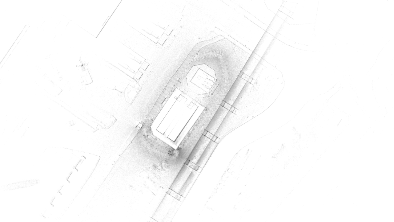
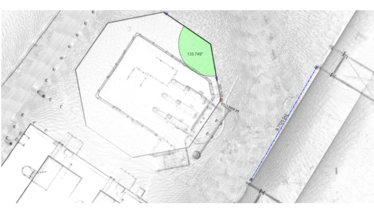
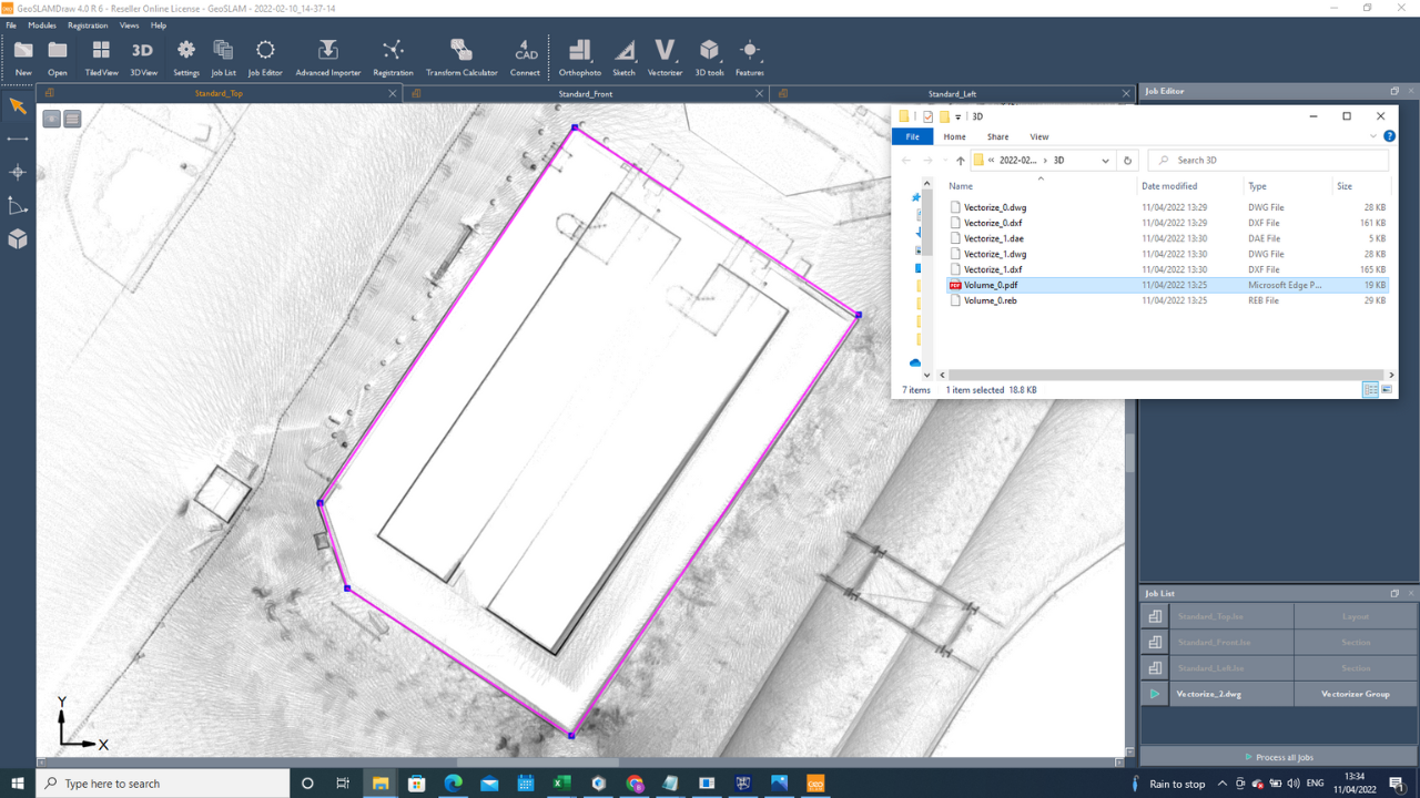
Depending on the application, the GeoSLAM Connect and Draw suite can work really well together - as this series of images demonstrates.
Using datasets collected by heliguy™ with the ZEB Horizon and ZEB Locate, the point cloud was processed in GeoSLAM Connect...

...before being uploaded to Draw and transformed into usable 2D drawings...
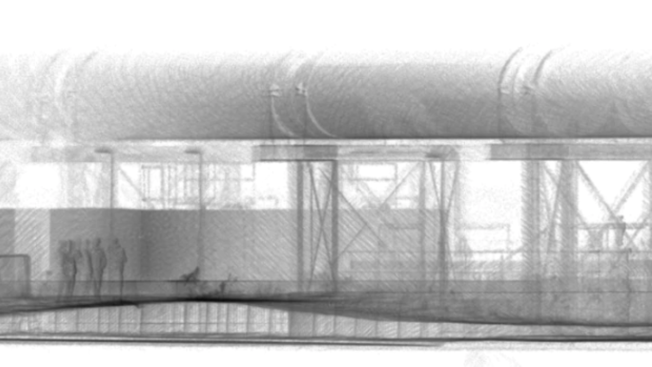
...where the dataset was annotated...
...and vectorised, before exporting it as a DWG file for integration into a range of CAD packages.
However, GeoSLAM data isn't confined to the GeoSLAM software suite of Connect and Draw. Built for flexibility, data collected with the ZEB Go, Revo RT and Horizon can be used with the following third-party software:
Autodesk: Navisworks, Revit
Bentley: ContextCapure, Microstation, Orbit
Deswik
Esri
Micromine
MineRP
Pointfuse
Pointerra
SketchUp
Terrasolid
Veesus Arena 4D
Unreal Engine
Floorplanner
GeoSLAM ZEB Go Vs ZEB Revo RT Vs ZEB Horizon: Summary
GeoSLAM's laser scanners and accessories provide a comprehensive ecosystem which enables rapid, accurate, on-the-go mapping.
Their ability to map GPS-denied environments increase their versatility, meaning they can be used underground, indoors and outside, as well as from above in the case of the ZEB Horizon.
With three sensors to choose from, understanding their capabilities and accessory compatibility is key.
The ZEB Go is a great introductory sensor - with impressive specs and the most cost-effective of the GeoSLAM sensors - while the ZEB Revo RT is a quality middle-ground option. However, the ZEB Horizon is the most powerful of the three with its enhanced specs and versatility, offering a well-rounded and advanced surveying sensor.
Talk to the heliguy™ in-house surveying team to add GeoSLAM sensors to your programme, including the drone-mounted options. heliguy™ offers a full ecosystem of support, including free consultancy and GIS specialists to help with the sensor, accessories, data processing and end-to-end workflows. If you are pursuing the drone-mounted option, heliguy™ support includes in-house repair centre, drone training and rental fleet.
