News
Industry-first LiDAR Drone Trial Conducted At Shell Gas Terminal
Industry-first UK trial of DJI’s Zenmuse L1 LiDAR held at Shell’s Bacton site with Bilfinger, RUAS & Heliguy.
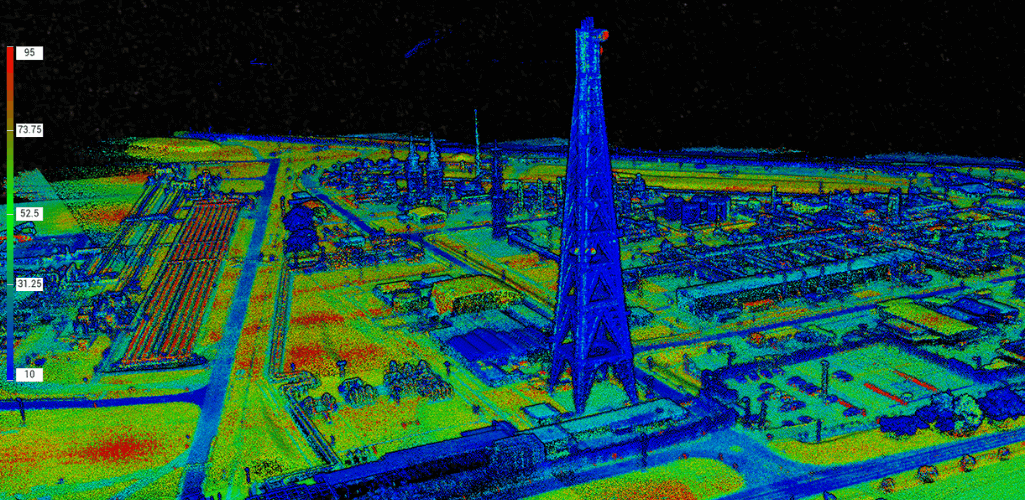
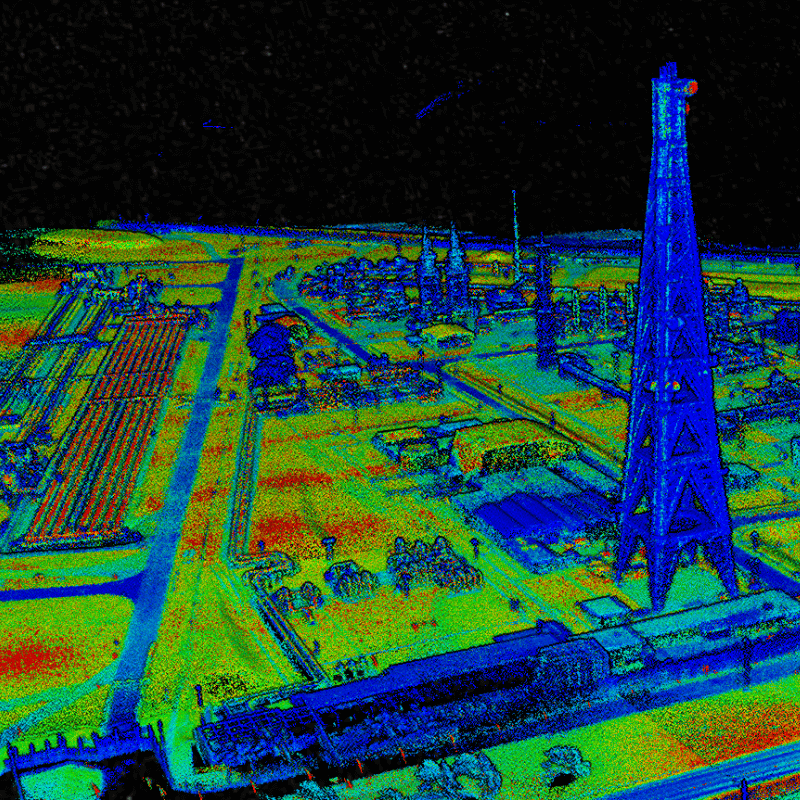
Industry-first UK trial of Zenmuse L1 LiDAR sensor conducted between DJI, Bilfinger, Shell UK, RUAS, and heliguy™ at Shell's Bacton Gas Plant, Norfolk;
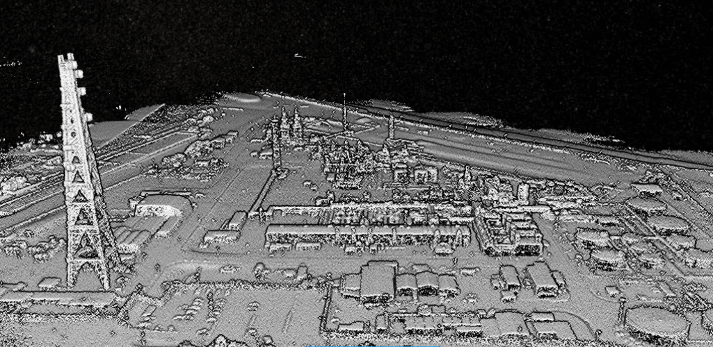
The trial showed that the L1's scans are highly accurate - with renders of reconstructions accurate to within 5mm - enabling ultra-dense digital twin creation;
Bilfinger says that the L1 can 'revolutionise' integrity planning and predictive maintenance in the energy industry;
Trial showed the efficiency of the DJI M300 RTK drone and L1; Taking just two hours to survey Shell's large and complex Bacton Gas Plant.
The L1 LiDAR drone sensor can 'revolutionise' digital twin creation, integrity planning and predictive maintenance in the energy industry.
That's the verdict following an industry-first trial of the pioneering payload conducted at Shell UK’s Bacton Gas Plant.
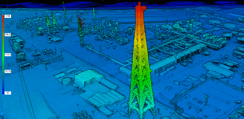
The trial showed the efficiency of the L1, which can also generate renders of reconstructions accurate to within 5mm.
And Shell says that the datasets help improve situational awareness for staff and contractors and enhance logistic optimisation.
On behalf of DJI (the world’s largest drone manufacturer), and in conjunction with heliguy™, commercial drone provider RUAS approached Bilfinger - a leading operations, maintenance and asset integrity contractor - to source a client who could facilitate a UK-first drone inspection with the Zenmuse L1.
Shell UK agreed, and the trial took place earlier this year, with the results being published recently.
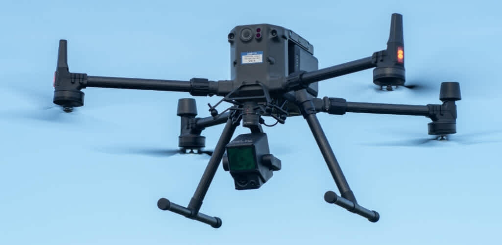
Mounted to the Matrice 300 RTK - DJI’s latest commercial drone platform - the L1 provides real-time 3D data, efficiently capturing the details of complex structures and delivering highly-accurate reconstructed models.
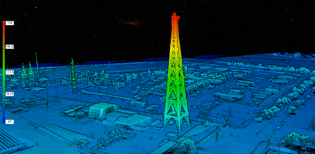
This comprehensive data enables digital 3D modelling and highly-accurate measurements for digital twins to enable predictive maintenance and inspection.
Dr David Hall, operations director at Bilfinger Salamis UK, said: “We’re delighted to have collaborated with Shell UK to support the first commercial trial of this innovative technology.
"Bilfinger is committed to identifying and applying technical innovation, and focus on exceeding client and market expectations through investment in our people and in research and development.
"This trial has demonstrated that the Zenmuse L1 could revolutionise digital twin creation and integrity planning in the energy industry."
Erwin Loonen, Shell Projects and Technology said: “Shell believes that digitalisation enables higher asset efficiency and lower human exposure.
"Bilfinger and partners have successfully executed a high resolution point cloud scan of Shell’s gas processing facility in Bacton, using state-of-the art equipment.
“The information gathered will be stored as a digital twin in our cloud environment, improving the situational awareness of our staff and contractors, enhancing logistic optimisation and enabling the use of advanced analytics to support our asset integrity strategy.”
Drones For Industrial Inspection
The use of drones is now established as a preferred method of remote survey and close visual inspection of assets across many industrial sectors.
Drones are capable of producing high definition images or thermographic data safely and efficiently without the need to shut down plant or rely on traditional scaffolding or highly skilled rope access teams.
Traditionally, site data would be captured through terrestrial methods including photogrammetry to create orthomosaics, which would see large numbers of images stitched together to provide datasets for planning maintenance. Building information modelling such as these datasets and original blueprints would then be used to create a digital twin.
LiDAR technology has been in use for many years, evolving from a heavy, static technology used by the military for ground sampling from aircraft, to more recent iterations - such as the L1 - where developments in design have reduced weight, size and cost, making it ideal for mobile uses, including infrastructure planning, and in autonomous vehicles.
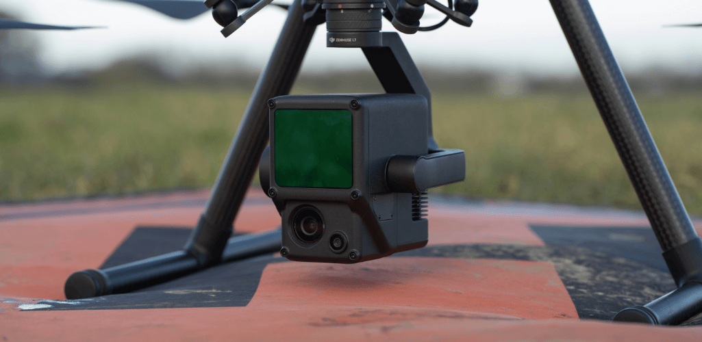
Tim Harris, director of operations and compliance at RUAS, said: "The Zenmuse L1 revolutionises datasets, capturing up to 328,000 points of interest per second, and generating true-colour point cloud models in real-time with renders of reconstructions accurate to within 5mm. This structural information is invaluable for creating maintenance strategies.
"The L1, which also has a 20MP camera for photogrammetry, has been favourably reviewed and delivered excellent outputs for our needs. It is generally regarded as quality equipment and I look forward to using it on future tasks. When compared to previous LiDAR datasets, the L1 appears to match the quality of that data and in some instances, exceed it."
Trial Shows L1's Efficiency
As incumbent operations and maintenance contractor to Shell UK, Bilfinger delivers a number of advanced inspection and integrity services at Bacton Gas Plant, located 20 miles from Great Yarmouth.
Built and commissioned in 1968, Bacton is a hydrocarbon gas processing plant of strategic national importance supplying up to a third of the UK's gas supply, as well as importing and exporting gas from Europe.
“This trial has shown us that a complex, large site like Bacton could be surveyed in around two hours, providing huge cost savings for operators over traditional inspection methods,” added Mr Harris.
RUAS has been utilising the M300 RTK extensively over the last few months, and the trial was further proof of the drone's capabilities, which include up to 55 minutes of flight time and the ability to carry up to three payloads simultaneously.
Mr Harris said: "It is an excellent piece of equipment and works really well in difficult environments. When used in conjunction with the L1 sensor, or the DJI Zenmuse P1 45MP full-frame photogrammetry sensor (both pictured below), we have been able to obtain extremely useful data for our clients and I would say this combination of equipment will likely become the workhorse of our fleet.
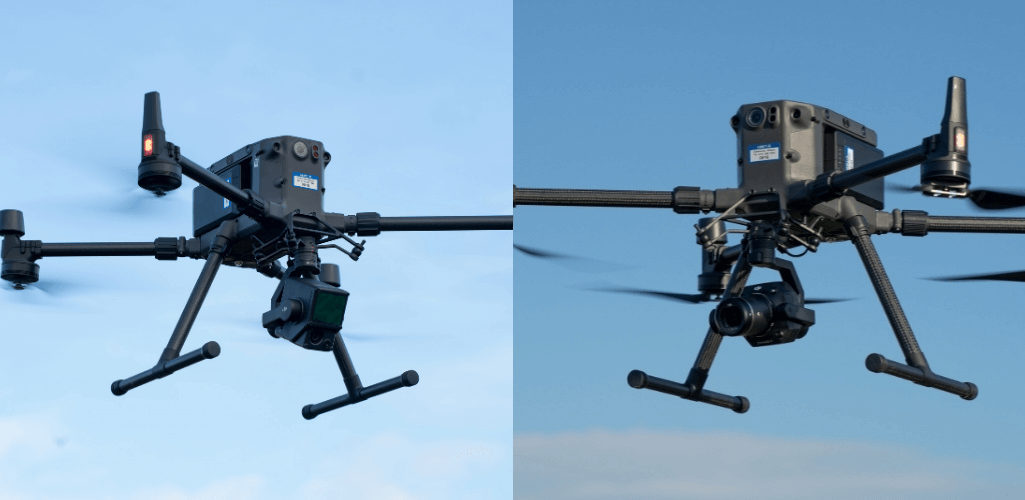
"When used in conjunction with these sensors, the M300 RTK has produced excellent deliverables and really gives us an advantage in supplying superior data to our clients over our competitors.
"The flight endurance of the M300 really does make a difference when flying larger areas and the sensors allow for us to fly the area at a higher speed whilst still achieving quality imagery.
"This, in turn, reduces our time on site and allows us to operate more efficiently."
