News
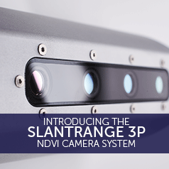
Introducing The SLANTRANGE 3P NDVI Camera
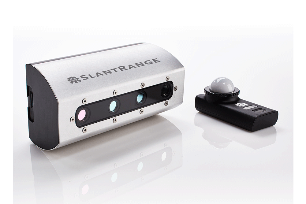
Heliguy is now able to offer professional surveyors the SLANTRANGE 3p NDVI solution for agriculture. Read on to find out how this impressive sensor array can fit into your surveying workflow and also how it integrates with DJI’s product e ... Read More
slantrangebanner-700x366.png
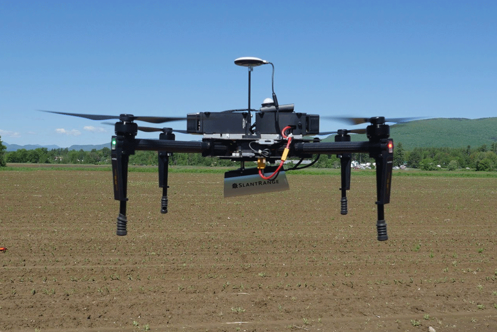
Heliguy is now able to offer professional surveyors the SLANTRANGE 3p NDVI solution for agriculture. Read on to find out how this impressive sensor array can fit into your surveying workflow and also how it integrates with DJI's product ecosystem. First off, let's look at the specifications.
#### Spectral Channels (Vegetation Sensor) | 4 Channels |
#### Spectral Channels (Ambient Illumination Sensor) | 4 Channels |
#### Processor Type | Qualcomm Snapdragon 801 |
#### Processor Speed | Quad-Core 2.26GHz |
#### On-Board RAM | 2.0 GB |
#### Detector Type | Si CMOS |
#### Available Spectral Range | 410 - 950 nm |
#### Band Positions | Selectable |
#### Shutter Type | Global |
#### Positioning & Pointing | Integrated GPS/IMU with Extended Kalman Filter |
#### GSD @ 120 m AGL | 4.8 cm |
#### Recommended Image Overlap | 20.0% |
#### Linear Coverage Rate @ 120 m AGL, 20 m/s | 1,000 Acres/Hour |
#### 160 Acre Survey @ 120 m AGL, 20 m/s | 17 Minutes |
#### Available Information Layers | Population Density, Population Size Distributions, Weed Coverage, Stress, Vegetation Fraction, Yield Potential, GNDVI, RNDVI, Red Edge NDVI, Color, User-Defined Smart Detection |
#### On Board Data Storage (Removable) | 64 GB (4 hours) |
#### Output Formats | KML, SHP, GeoTIFF |
#### Size (Vegetation Sensor) | 14.6 x 6.9 x 5.7 cm |
#### Size (Ambient Illumination Sensor) | 8.1 x 3.5 x 1.7 cm |
#### Weight | 350 g |
#### Power | 11 W @ 9.0-28.0 VDC |
For more information on pricing or how this SLANTRANGE solution is applicable to your business - contact the Heliguy team on 0191 296 1024 or email info@heliguy.com.
An Interview with SLANTRANGE
We sat down with Abe Roder, Sales Manager at SLANTRANGE, to ask what differentiates their product and why it's such a powerful solution for agricultural use cases.
Who do you think your sensors are most useful for?
Where do you see the future of remote sensing?
From a hardware perspective, the reduction in cost and weight of more advanced sensors, such as thermal, hyperspectral, and LIDAR, will enable these technologies to be more easily integrated into smaller, low-cost drones. This will make the technology more accessible to growers and agronomists and allow the use cases to be more fully developed. However, the real value of any remote sensing solution is obviously within the data itself, and the information that can be generated from it. While the sensors are a critical component, we'll see a continuing shift of focus toward the analytics. This is certainly true at SLANTRANGE, where we spend approximately 80% of our efforts on advancing our software, algorithms, and analytics. We also see a trend toward "Digital Farming" and "The Connected Farm". Growers and agronomists will be able to extract even more value from remote sensing solutions when they can communicate with other devices on the farm to aggregate data and automatically provide insights and recommendations. The architecture of our 3p sensor was specifically designed with this vision in mind. Leveraging the power of it's Qualcomm Snapdragon processor, the 3p will soon be able to host all of our analytics onboard the sensor itself, eliminating the need for any ground-based processing or human interaction.
What drew SLANTRANGE towards working with drones?
Most of our team came from General Atomics, where we were developing sensor and analytics solutions for unmanned aircraft in defence applications. As the commercial drone industry began to develop, we saw a huge opportunity to leverage our drone-based remote sensing expertise and apply it to agriculture.
What are best features of the 3P?
There are 3 main components that differentiate the 3p and SlantView from other multispectral sensor options:
The accuracy and repeatability of our sensor measurements. Our patented calibration sensor and algorithms ensure accurate measurements over time and under varying sunlight conditions.
The speed and efficiency of our workflow. With the ability to process data collected with only 20% overlap, our systems provide 4x the area coverage of a comparable sensor and 16X less data. Coupled with our rapid, in-field processing, typically completed 10-15 minutes after a flight with no internet connection, the 3p and SlantView can provide rapid results and also improve the efficiency and profitability of a service provider business.
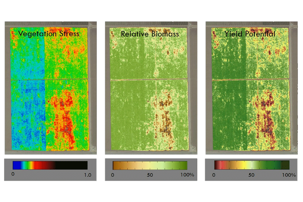
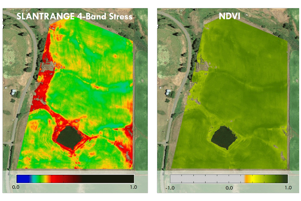
The unique and high-value data products generated. Our analytics goes well beyond NDVI and provide very high-value information that can only be generated from the high-resolution imagery achievable with a drone, such as plant counts, plant size maps, weed maps, stress maps, chlorophyll content, emergence fraction, vegetation fraction, yield potential, and user-defined Smart Detection. And we are adding new data products to SlantView on a regular basis.
What challenges have you encountered in this market?
We've certainly learned that the needs of agronomists and growers vary widely based on location, crops, management practices, and many other factors. It's clear that a "one size fits all" approach will not work for this market, which is why we focus so much effort on our analytics and how to make it adaptable for many different use cases. As an example, our Smart Detection feature allows a user to highlight a region of interest on a map and automatically find all the other locations in the field with the same characteristics. This has been successfully used to identify weeds, separate plant species, locate irrigation leaks, and many other specific use cases. This effectively pushes the development of custom analytics out to the user to address their specific needs. Another challenge is overcoming the amount of misinformation that was prominent in the early days of this market. There was a lot of overpromising and under-delivering with early drone-based remote sensing systems and this has certainly slowed the adoption of the technology. However, the advancement of both the hardware and software components has proven the true value and long term potential. Coupled with the implementation of formal drone regulations across the globe, we see a great trajectory for the technology moving forward.
What are the opportunities available to those interested in using the SLANTRANGE 3P?
The 3p and SlantView provide a tightly integrated, drone agnostic agricultural information platform for a variety of users, from growers and agronomists to drone service providers and researchers. The system will provide accurate, high-value information with a workflow that's efficient and highly scalable for any location across the globe.
A Powerful Sensor With 4x More Flight Area
Instant Results & Simple Integration
Always Accurate
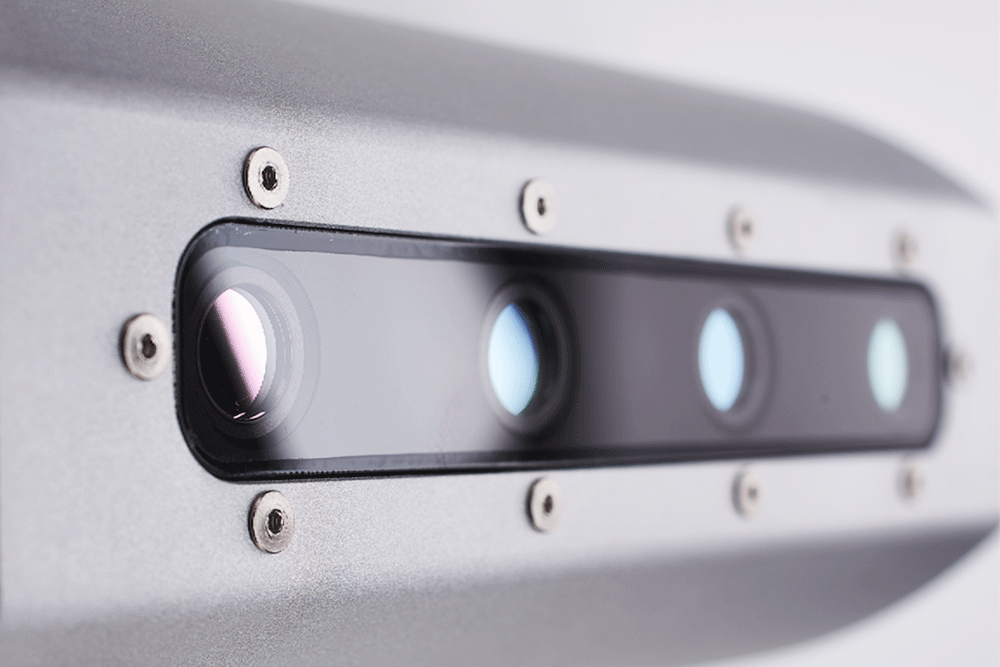
An integrated solar spectrometer for frame-to-frame radiometrically accurate reflectance measurements
Individual lens characterization for precise de-warping and de-vignetting
Optimised algorithms for dynamic cross-channel registration
Smart Filtering, which selectively samples scene elements to avoid the contaminating effects of background soils, shadows, specular reflections, or other noise sources.
Pinpoint Analytics
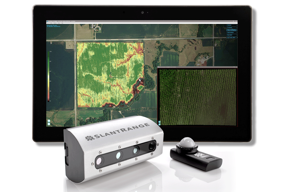
SlantView is the analytics toolset from SLANTRANGE that analyses raw data from airborne sensors and collates it into valuable information for farmers. SlantView was architected from the start to deliver the highest value information, and that includes two fundamental differences from other analytics packages:
Diverse and customisable information types can be tailored to the user’s immediate needs through advanced computer vision and machine learning techniques
Those information layers can be delivered in a matter of minutes
There are three service levels of SlantView available - see below for what you get with each package:
**SlantView Lite – (**FREE) This default version comes with the 3p as standard with image pre-processing and calibration for analysis with 3rd party applications
SlantView Basic – (Contact for Pricing) The basic level comes with all the capabilities of 'Lite' plus access to Vegetation Stress maps and multiple NDVI products allowing for as little as 20% overlap and rapid in-field processing
SlantView Pro – (Contact for Pricing) This is the complete suite of SlantView analytics tools which combine spectral imaging with powerful computer vision and machine learning tools
...
For more information on pricing or how the SLANTRANGE 3p is applicable to your business - contact the Heliguy team on 0191 296 1024 or email info@heliguy.com. If you're interested in reading more about commercial applications for drones and their peripherals, keep checking back to Heliguy's Insider Blog for the latest news, reviews and insights.
SLANTRANGE 3p FAQs
See below for a list of FAQs to answer any questions you may have on the SLANTRANGE 3p camera.
Sensor
What is the resolution or ground sample distance (GSD) of the sensor? At 120 m AGL, the resolution is 4.8 cm/pixel. Flying lower provides higher resolution, flying higher provides lower resolution. What is the pixel resolution of the individual cameras? 1280 (cross-track) x 1024 (along-track), 4.8 micron pixels, global shutter. Do the sensors have their own GPS and IMU? Yes. The sensor does not require any communication interfaces with the aircraft. The only required connection is power. Does the sensor have onboard storage? Yes. The sensor includes 64 GB of onboard storage on a removable SD card. This is enough for ~4 hours of flight time. How do I download imagery from the sensor? The SD card can be removed and inserted into a laptop, tablet, or card reader. The images can be transferred and processed using SlantView. How is the sensor triggered? The sensor is internally triggered and does not require a trigger input. The only required connection is power. The trigger rate can be configured using the SLANTRANGE companion mobile app. What is the size and weight of the sensor? 3p Size: 14.6 x 6.9 x 5.7 cm 3p Weight: 350g
Analytics
Is the SlantView software required? Yes. Our sensor and software are tightly coupled to enable the unique capabilities of our system, such as flying at 20% overlap and producing a full suite of maps in a few minutes after completing a flight. However, we provide a variety of export options for both the images and the maps to allow you to use the data in other software tools. Can you really fly with just 20% overlap? Yes! This is our recommended overlap for an average flight; this is not a “best case” or “ideal conditions” recommendation. Overlap can be increased for very windy conditions but 20% should be sufficient for most flights. How long does it really take to process the data locally in the field? The image processing begins on the sensor itself while still in flight. Final processing time on the ground depends on the area coverage of your data set and the processing power of your computer but a typical 160-acre flight will process in approximately 15 minutes on a mid-grade laptop. This is completely local processing with no internet connection or uploads to the cloud required. Does sunlight calibration really matter? Yes! Sunlight calibration allows you to collect accurate, repeatable data under a variety of lighting conditions. Sunlight calibration also allows you to make comparisons of data sets over time, unlocking the true potential of airborne agricultural imagery. What data products does SlantView provide? SlantView provides a suite of customised data products to provide accurate, actionable, information to growers, agronomists, and scouts…much more than just aerial images. The current set of data products includes high-resolution images and maps of Stand Counts, Weed Detections, Stress, Canopy Closure, Yield Potential, Red NDVI, Green NDVI, Red Edge NDVI, Color, and User-Defined Smart Detection. What are the computer requirements to run SlantView? The only requirement is 64-bit Windows. As a rule of thumb, we recommend having twice as much RAM as your largest data set; 8 GB should be OK, more is always better. What types of file output format does SlantView offer? Both the individual images and the completed maps can be exported as KML (Google Earth), SHP (Shapefile), and GeoTIFF. Can I use DroneDeploy to share data with my colleagues and clients? Yes. Our GeoTIFF exports are fully compatible with DroneDeploy’s map upload tool. Can the data be imported into farm management software packages? Yes. All of the data products can be exported as a shapefile, which is the most common file format for use with farm management software packages. Can I process the data in a software package I already have? Yes, but you’ll need to use SlantView to apply all of the optical and calibration corrections to the imagery. Once complete, you can export the imagery in GeoTIFF format and process the data in any other software package. However, processing in SlantView provides significant advantages, including flying at 20% overlap, rapid offline processing, and access to a unique set of valuable data products.
Integration
What drones can I use with SLANTRANGE sensors? Our sensors are fully self-contained and are designed to be mounted on almost any drone, both multi-rotors and fixed wings. The only requirements are 1) physical space for the Vegetation Sensor and Ambient Illumination Sensor, 2) payload capacity to carry the sensor and 3) input power for the sensor. How much power does the sensor require? The sensor can accept 9 VDC to 36 VDC and typically draws ~11W. Power can be provided directly from the aircraft or with a dedicated battery. What flight planning software can I use? For DJI drones, we recommend DroneDeploy or GS PRO and for PixHawk-based drones, we recommend Mission Planner. How is the sensor mounted on a drone? The sensor is typically hard-mounted and does not require a gimbal. For multi-rotors, the sensor should be mounted at an angle to compensate for the pitch of the aircraft while in forwards flight. We sell a variety of simple mounting kits for the most common drone platforms. Does the sensor require a gimbal? No. The sensor is designed to look straight down. All of the cameras use global shutters and are thus not sensitive to vibration like rolling shutter cameras. However, you can use a gimbal if you’d like. What is the recommended flight altitude for the sensor? It depends on what data you are trying to generate. For early-stage stand counts, you typically need higher resolution and may fly lower than normal. For late-season stress maps, you may not need high resolution and can fly higher to achieve larger area coverage. We provide a flight calculator to determine recommended altitude and flight speed based on the characteristics of the crop you’re flying and the data you’d like to generate. Always check your regional regulations for drone flight rules.
