Case Studies
Natural England revolutionises SSSI management with drones
Drones are helping Natural England transform SSSI monitoring, collecting data more efficiently and building detailed 3D models to enhance conservation efforts.
Natural England benefiting from drones to conserve, manage, and protect SSSIs;
Team using detailed, georeferenced 3D models to shape data-driven reports and plans, and enhance visualisation;
Drones have benefited data collection: Increasing efficiency, accessing hard-to-reach areas to build a complete picture of the site, and enabling more streamlined change monitoring;
In one example, the drone took 62 minutes to survey a 3.76-hectare site. It would have taken a day using manual methods;
Dr Jonathan Hall says drones 'have helped us see previously inaccessible geological features that we have never seen before and in more detail';
heliguy™ has supported Natural England, providing consultancy, equipment supply, and instructor-led practical training.
Drones are helping Natural England revolutionise vital work to conserve, manage and protect Sites of Special Scientific Interest (SSSIs).
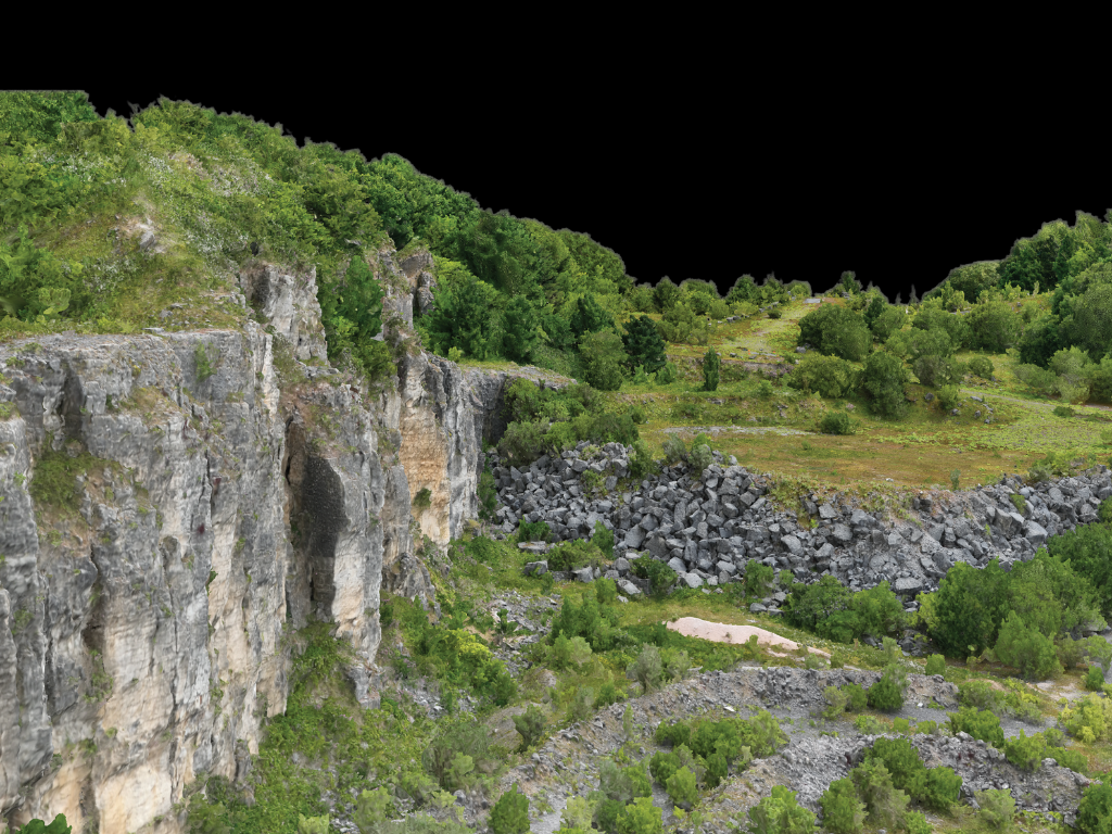
The non-departmental public body deploys drones to efficiently survey and digitise the geology of SSSIs. The aerial imagery enables the Geology Team to create detailed, georeferenced 3D models of these important sites.
These 3D photogrammetric models provide novel insights and help enhance visualisation of the geological features to shape data-driven monitoring reports and management plans.
Dr Jonathan Hall, a Senior Specialist in Geology at Natural England, said: “Our objective is to achieve Favourable condition status for all our SSSIs - meaning that the geological features of interest are exposed or can easily be re-exposed if required.
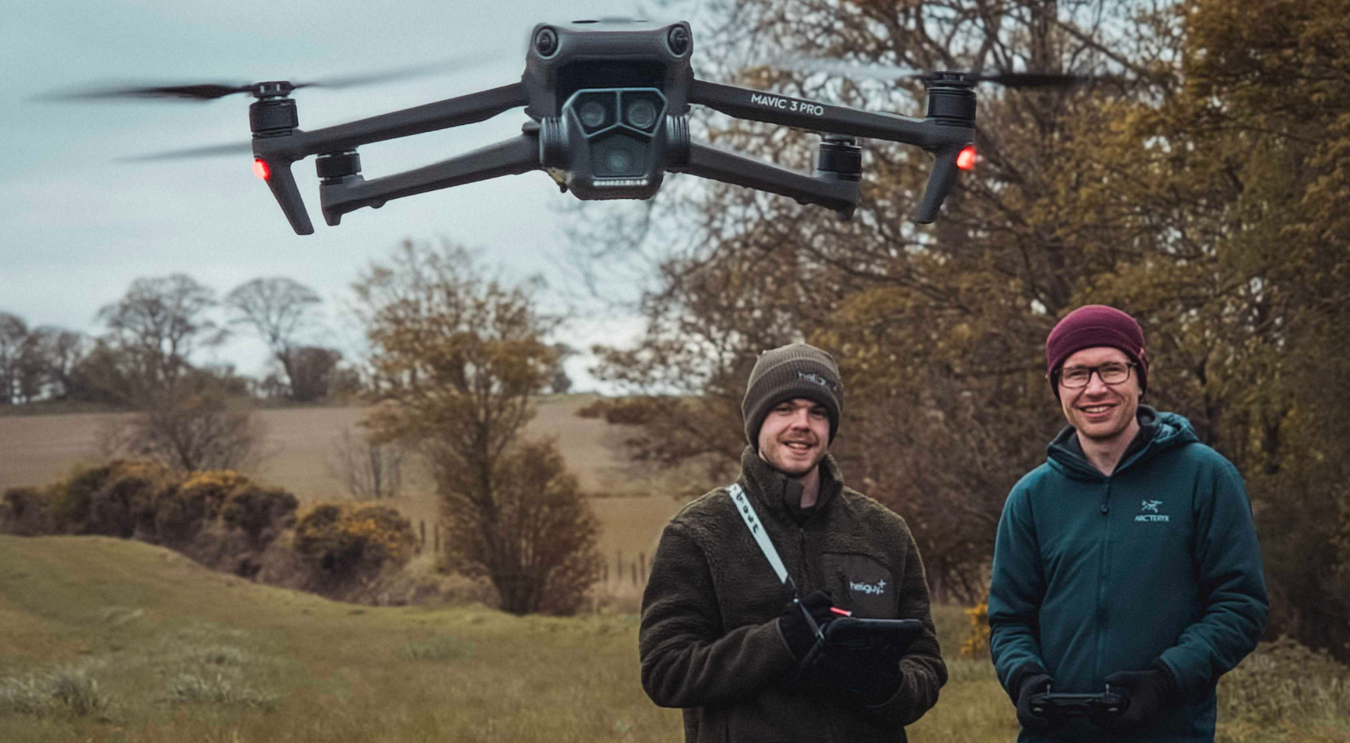
"Previously, we relied on limited data collected by a hand-held camera or a phone, but the drones have changed this and provided us with huge capability.
"The drones increase the speed of surveys, allow us to reach inaccessible areas to build a more comprehensive picture of each site, and enable repeatable data collection for accurate comparisons to observe changes in condition over time.
"Before the drones, we didn’t have 3D models of our geological sites, but now, these digital assets offer a whole new perspective by allowing us to see the entire site in one model and analyse the geometry of the geological features in more detail.
"This provides better insights to feed into our monitoring and management plans.”
Natural England Drone Maps Dale Quarry: The Benefits of Drone Survey Data
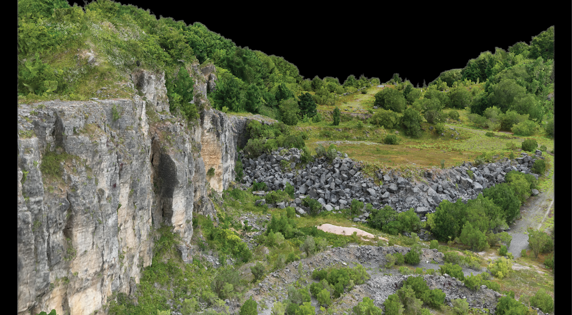
Dale Quarry is a disused quarry in Derbyshire, showing important exposures of the Monsal Dale and Bee Low Limestone Formations deposited during the Carboniferous Period, about 330 million years ago. It was one of the first sites to be drone-mapped by Natural England's geologists.
The team surveyed 3.76 hectares in 62 minutes, collecting almost 3,500 images. It would have taken a day to map the site using manual methods.

And the subsequent drone model provided rich and detailed insights.
Jonathan said: “The data acquisition was very quick, and the 3D model allowed us to see the true scale of the site, and the thickness and lateral extent of the limestone beds up close.
"We have never had anything like this before and it offers a unique perspective you can’t necessarily achieve from 2D images taken with a hand-held camera or a phone.
"For an SSSI to be in a Favourable condition, it needs to have limited amounts of scrub as we want as much rock visible as possible so people can study these sites without having to clear the vegetation.
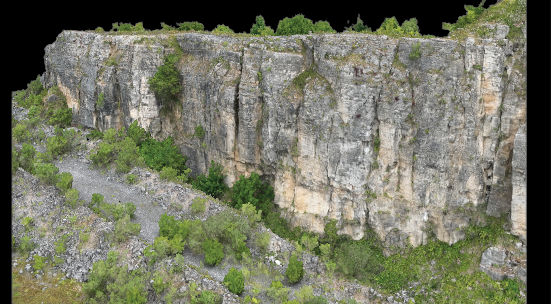
"Using the 3D model, we could quantify how much of the rock face was visible and exposed, and use the georeferenced data to take measurements, such as bed thickness and length. This information has helped inform our management of the site to ensure it reaches the benchmark of being in a Favourable condition.”
Accessing tough areas
Using the drone to survey the quarry enabled Natural England to map the whole site - including tough-to-access areas - and present it in one easily accessible model.
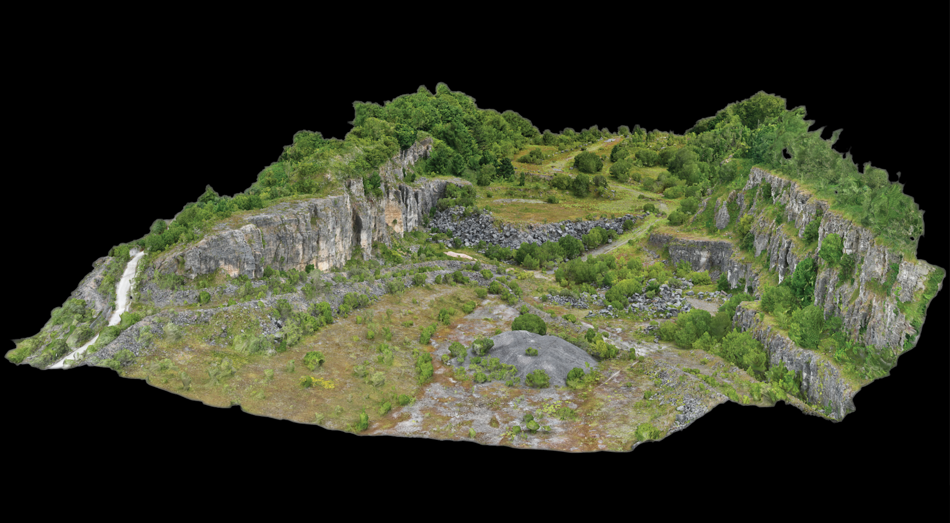
Jonathan said: “Previously, the higher parts of the cliff face would have generally been out of reach, and would have required the team to stand at a safe distance from the base of the cliff and take a photo with a hand-held camera or a phone while looking upwards - which in many cases would mean you couldn’t see the uppermost rocks found at the top of the cliff.
"Or there would need to be some scrambling involved, which brings safety issues. But the drone has resolved these accessibility issues, offering comprehensive coverage of the whole cliff face.
"This has helped us see previously inaccessible geological features that we have never seen before and in more detail.”
Tracking changes over time
A key part of managing a SSSI is monitoring the condition of the site over time. Drone data simplifies this process.
Jonathan said: “Using the drones, we can conduct automated, repeatable missions - saving the route and then re-flying it again in a year or so to obtain accurate, like-for-like comparable data.
"This enables us to see, in 3D, how the condition of the site has changed over time, and assess whether factors, such as vegetation growth or the build-up of scree, are obscuring or damaging the features of interest.”

The model can also be shared with colleagues, landowners, and the public for enhanced visibility, communication, and coordination.
Jonathan said: “We have never had a third dimension before, unless we have physically visited the site, but a 3D model has changed this, as colleagues and members of the public can now access and explore these SSSIs digitally, without having to necessarily visit the site in person.
"It’s ground-breaking technology and it allows a lot more people to view the site, as well as creating digital reconstructions for current and future use.”
Drone mapping and photogrammetry workflow
The Dale Quarry model comprises 3,426 images, captured during three drone flights, totalling 62 minutes.
The mission was planned by exporting the SSSI’s boundary shapefile as a KML, saving it to an SD card, and programming it into the drone controller ready for an automated mission.
The quarry was mapped with the gimbal at a top-down nadir angle (−90°) and at oblique angles of −65° and −45°.
Nadir mapping is ideal for creating robust 2D orthomosaics, while oblique surveying is essential for capturing texturing and detail on 3D models.
The drone was flown at an altitude of 50 m, with a front/side overlap of 90%, and achieving a GSD (Ground Sample Distance) of 1.63 cm.
“It was decided that this provided a good balance between image density and the total area that could be feasibly surveyed in the time available,” said Jonathan.
The aerial imagery was then imported into Agisoft Metashape for processing into a 3D model, following the Structure from Motion (SfM) photogrammetry technique.
This involved aligning the images, filtering the tie points, building the point cloud, filtering the point cloud, building the model, and applying texturing.
Longer-term, the geologists aim to export and share their photogrammetric models on an online 3D hosting platform, such as Sketchfab or the geological repository V3Geo.
Equipment and training
Natural England’s Geology Team is responsible for more than 1,200 SSSIs, which are designated primarily for their geological features of interest.
Having a drone designed for aerial surveying and inspection, with a foldable and easily transportable form factor, made the DJI Mavic 3 Enterprise a logical choice to meet the team's requirements.

Jonathan said: “We are often working in remote or challenging environments, so having a compact and robust aircraft, which offers sufficient flight time and good outdoor performance, was our top priority.
"Whilst surveying a site we usually take a combination of wide and zoomed-in images of the geological features of interest to ensure that they are captured in their entirety, so having a dual camera payload was another important criterion.
"Some of our SSSIs contain distinctive landforms, such as steep cliffs, undulating ridges or narrow gorges, so choosing an aircraft equipped with omnidirectional obstacle avoidance was considered to be advantageous and provides additional reassurance during flight.”
heliguy™ has helped the Geology Team commence its aerial surveys by providing consultancy, supplying equipment, delivering instructor-led practical tuition, and conducting General Visual Line of Sight Certificate (GVC) examinations.
The GVC is a Civil Aviation Authority-accredited training qualification which has enabled the geologists to safely and legally operate unmanned aerial vehicles up to 25kg within Natural England’s existing Operations Manual.
Contact heliguy™ to find out how we can help you start and scale your drone operations through wide-ranging support, consultancy, and training, including a dedicated survey division.
