News
Published on 1 Sep 2021
James Willoughby
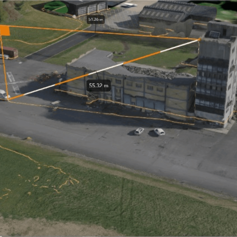
London Fire Brigade Drone Mapping With Esri ArcGIS
Drone mapping and GIS is a powerful solution for public safety. Find out how London Fire Brigade plans to use Esri ArcGIS for enhanced incident response. ... Read More

Drone mapping is the future of public safety, says London Fire Brigade;
Combining DJI drone data with Esri's ArcGIS software, LFB sees the advantages of drone mapping;
Maps and models can be used to conduct analysis and obtain calculations;
This data can be shared to improve situational awareness, draw-up effective incident response, and keep personnel safe;
Watch webinar between Esri UK, London Fire Brigade and heliguy™ to find out more about drone mapping for public safety.
Drone mapping is the future of public safety - improving crew welfare and enhancing situational awareness and post-incident investigation.
That's the view of London Fire Brigade Station Officer Lee Newman after seeing how GIS and location intelligence can benefit fire and rescue operations.
LFB - one of the world's largest firefighting and rescue organisations in the world - has been trialing Esri UK's ArcGIS software to turn DJI drone photogrammetry data into 2D orthomosaics and 3D models.
These digitised assets - which can be shared quickly and easily to drive decision-making and streamline workflows - can be used to obtain deep insights, such as conducting volume calculations following a building collapse or providing up-to-date maps to facilitate effective HazMat response.
Speaking during a joint webinar between LFB, its drone supplier heliguy™ and Esri UK, Station Officer Newman said: "Drone mapping is the future for the fire service and public safety. It can be used on live and major incidents, urban search and rescue, and for asset management.
"In this day and age, firefighter safety is paramount. Combining drones and drone mapping software - and the information and the accuracy they give you - is a gamechanger.
"Drones themselves have changed the game for firefighter safety, putting the drone into an incident or location where you might have previously put a firefighter. But drone mapping is another layer of safety that can be added to incident response."
While LFB has not currently used drone mapping at a live incident, the team has conducted tests at its Moreton-in-Marsh training centre and can see its huge potential for public safety.
3D Models For Incident Response
LFB has demonstrated how drone mapping can be used for urban search and rescue missions, such as following a building collapse.
Using the DJI Mavic 2 Enterprise Advanced, the team flew over the damaged structure, captured 100 images and processed the data to create this 3D model.
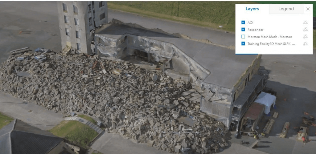
Station Officer Newman said: "The model was created within no time at all. Such a quick turnaround is useful, especially during live incidents."
This 3D model can then be used to conduct vital calculations. The below image shows how the software can calculate the volume of the debris. This provides insights such as the size and weight of the pile, and how long it would take to clear.
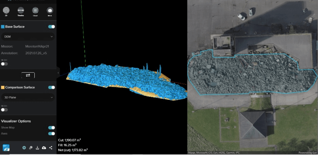
The model can also be used to measure and calculate potential fall zones and exclusion areas, which not only helps with the response to the incident, but also improves officer safety.
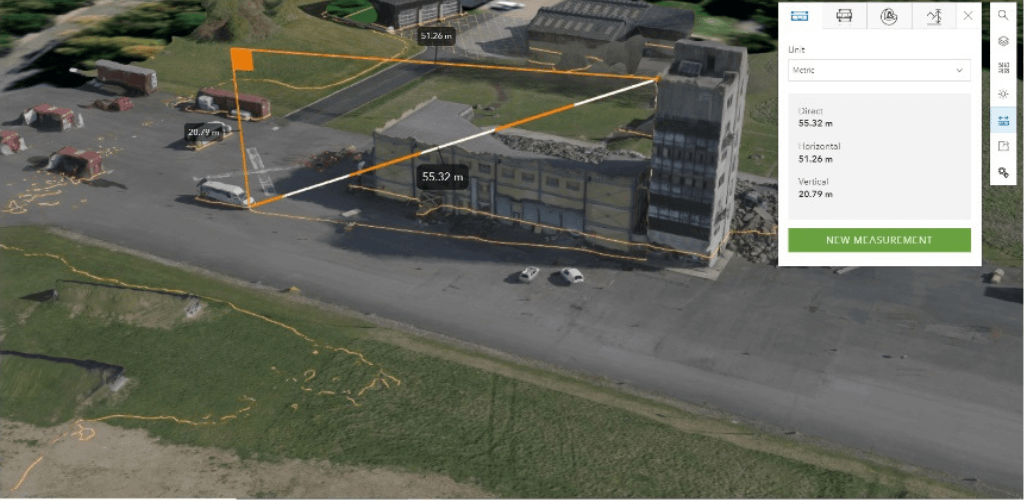
For further analysis, the photo inspection tool within the Esri software enables teams to look at high-resolution images of specific parts of the drone map.
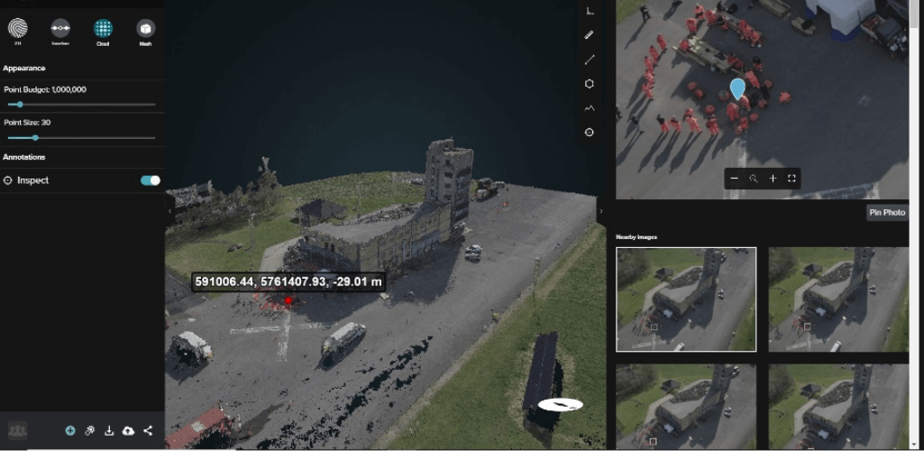
Station Officer Newman said: "The 3D visualisation and measure tool can be used on live incidents, major fires and for urban search and rescue operations.
"It can help incident commanders gather information on the size and scale of the operation, enabling better and quicker plans to be drawn up of how to approach an incident.
"Crucially, this information can be shared with agencies, like the Dangerous Structure Engineers, to improve communication and collaboration.
"They could even use this information remotely, along with the live feed we are giving them, to enable them to start working on a plan straight away; instead of waiting for someone to turn up on site."
These maps and models can also be used to build a disaster timeline, dipicting the state of affairs before, during and after an incident. This is a vital resource for post-incident investigation and training.
Drone Mapping For HazMat Response
Station Officer Newman said that drone mapping is a great tool for HazMat incidents.
Drones have already shown their worth for this type of operation - collecting vital information to keep officers away from danger. Drone mapping further enriches this process.
For instance, this 2D orthomasaic captures the scene of a simulated HazMat incident at LFB's test site.
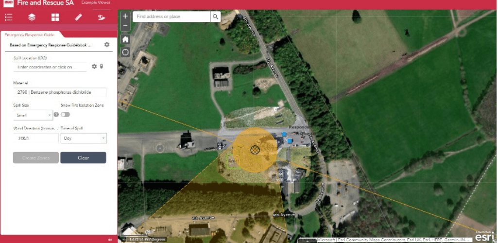
The first benefit of using drone mapping is that it produces up-to-date maps - instead of relying on data from Google Maps which could be years old and no longer accurate.
This drone mapping data can be quickly collected and rendered and re-edited as the incident progresses.
The map can then be used to highlight key information: In the above image, the diamond shows the area of the chemical spill, the orange circle shows the cordon, and the lines display the entry/exit points.
This information - which provides vital situational awareness - can be uploaded and shared with other agencies to help coordinate incident response.
Drone Mapping For Asset Management
Station Officer Newman believes drone mapping will be a vital tool for fire safety and fire engineering.
He said: "This is all part of the new building regulations and controls: A process to make sure buildings are safe.
"Using the Esri software, you can map what the building site is like and you can then manually build 3D models to render what the building will be like, once completed. You can also collect data post-build, and then within the tool box you can highlight where there might be fire escape routes, RV points and risk areas within those buildings.

"I think, going forward into the new age, this is where we need to be with fire safety and fire engineering. We need to be digitalising all of this information so we have got access to it."
Station Officer Newman believes LFB will use drones to map high-risk buildings to build effective fire-response plans, should an incident happen.
He said: "As a firefighter, you can use this information to get an early heads up of what the layout is of a particular building, so if that building does catch fire, you already have information about the internals and externals - and you can do all of that within the comfort of your fire station."
The Esri UK Drone Mapping Workflow
Esri ArcGIS provides an end-to-end workflow for drone image capture.
1: Plan and Capture
Collect drone data using Site Scan Flight: An iOS, cloud-based app.
This enables you to plan automated mapping and inspection flights (bottom, left) and view the flight plans in 3D (bottom, right).

The tool can also be used for fleet management.
2: Process, Map and Analyse
The data can then be uploaded into the cloud and can be turned into 3D models and 2D orthomosaics via Site Scan Manager - a web application - for analysis to be conducted.
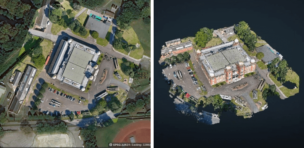
3: Disseminate/Collaborate
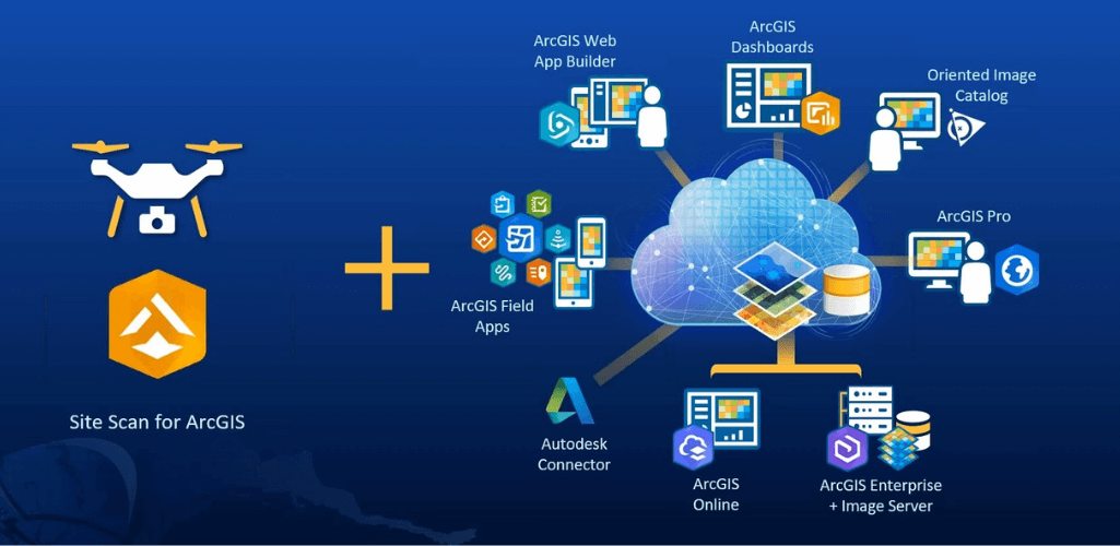
Once the data has been converted into useful maps and models, and information has been gleaned from it, the important next step is to share it. This is particularly important for public safety as this can be used for incident response.
This Site Scan for ArcGIS data can be leveraged within the wider ArcGIS platform for collaboration and sharing.
Summary
Once thought of as a tool for the AEC industry, London Fire Brigade's trials show that drone mapping is also an effective solution for public safety.
Drones have already revolutionised this industry sector, but drone mapping adds another layer to this process, enabling deeper insights and analysis to draw up more effective incident plans. This in turn enhances situational awareness, for better incident response and improved crew safety.
And as an industry-leader, Esri's software offers an end-to-end drone-mapping solution for public safety crews.
