News
Published on 13 Oct 2020
James Willoughby
SUEZ Using DJI Drones For Waste Management
Global utility giant SUEZ is using drones across its UK waste management sites to replace ‘time-consuming and costly surveying methods’. ... Read More

World-renowned utility firm SUEZ is using drones on its UK landfill sites;
HELIGUY.com™ is helping SUEZ Recycling and Recovery UK grow its drone programme, and has supplied a Phantom 4 RTK surveying aircraft;
SUEZ says drones replace 'time-consuming and costly surveying methods';
Read the blog to see P4 RTK data set, collected by SUEZ;
Drones collect data for landfill cell management and monitoring and help to streamline project management.
Global utility giant SUEZ is deploying drones across its UK waste management sites to replace ‘time-consuming and costly surveying methods’.
Drone specialist HELIGUY.com™ is helping SUEZ Recycling and Recovery UK build its UAS division, centered on the DJI Phantom 4 RTK.
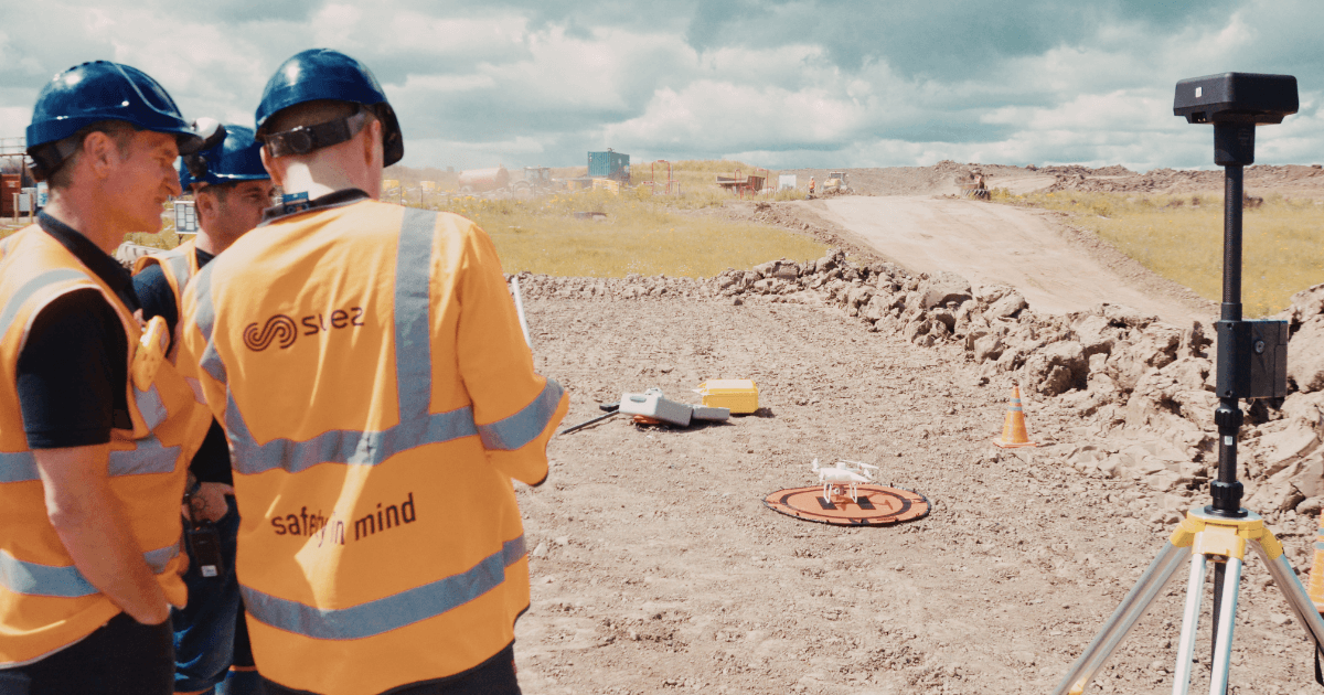
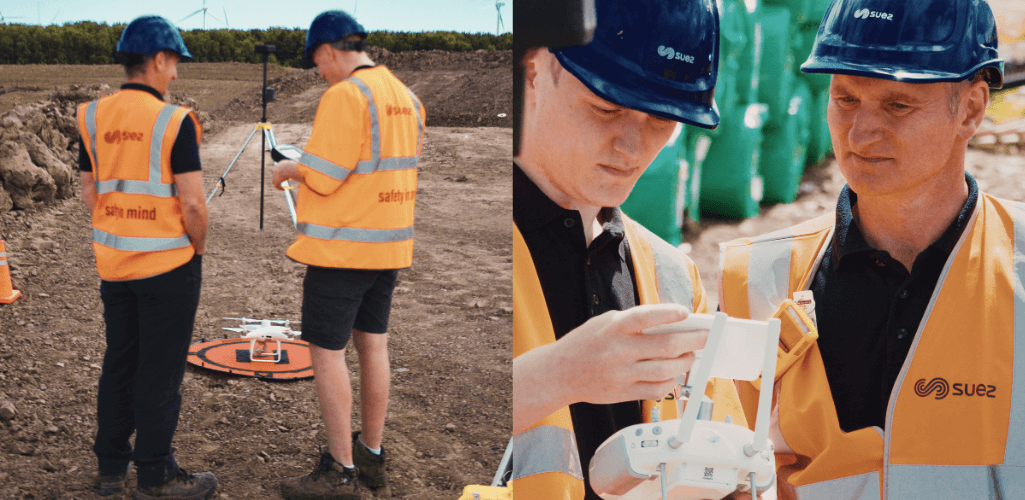
A recent demonstration and technology handover day - attended by Heliguy’s resident surveyor Ben Sangster, and the SUEZ team - highlighted the aircraft’s capabilities.
The drone was used to capture this interactive data set of SUEZ’s plant in Ashington, Northern England. Move the image around to look at the site, and zoom in for a closer look.
Click here to view a larger version.
Collect Quality Data With A Drone
The data set shows the advantages of drone surveying for landfill operations.
The drone flew over the site quickly, easily, cheaply and at far less risk than traditional manual methods.
It collected consistent and accurate survey-grade data, to be used in a variety of ways.
As the high-resolution data set shows, the aerial imagery - captured in just 15 minutes - provides a comprehensive and detailed real-time picture of SUEZ’s Ashington operation.
The geo-referenced 2D orthomosaic map allows the team to identify problems, track productivity, decide where to deploy machinery or build a new cell for landfill, and manage/monitor environmental areas.
Staff can even zoom in on specific sections of the site.
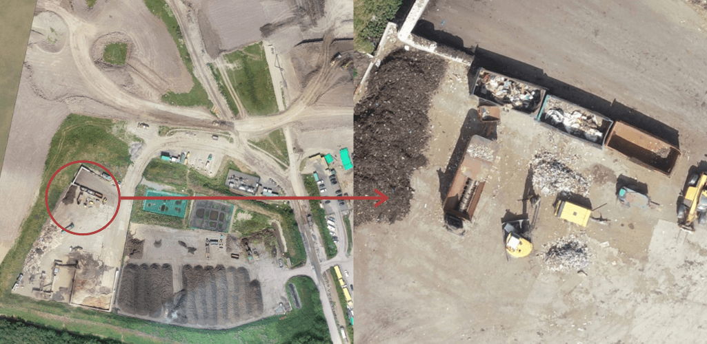
This data was collected without staff setting foot on site, clambering over dangerous stockpiles, or trying to access difficult-to-reach areas.
It can then be downloaded or saved to the cloud, and subsequently shared with staff, managers, and stakeholders.
This improves communication, project management, and reduces misinterpretation. The data can also be accessed remotely.
Build 3D Models For Volumetric Calculations
The drone data can be transformed into fully-navigable and measurable 3D models - to build a richer picture of the site for more informed decision-making.
For instance, SUEZ is able to use the information to conduct volume surveys; crucial for evaluating landfill before building a new cell, and measuring overfill capacity and compaction rates.
The graphic below shows how aerial photogrammetric drone data can be used to do this.
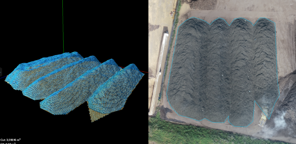
Taken from the orthomosaic data set, and processed through cloud-based drone-mapping software ArcGIS: Site Scan, SUEZ quickly built a 3D Digital Elevation Model to gather vital insights about this specific stockpile.
For instance, just a few clicks on the computer enabled SUEZ staff to identify these key measurements:
Cut: 3,518.16 m3
Fill: 0.97m3
Net Volume: 3,517.20m3
Area: 1,531.57 m2
Adopting this approach is quicker and easier than traditional methods.
Before drones, this data would have to be collected by using an expensive aircraft for aerial photography or via staff spending painstaking hours walking the site to collect topographic survey data.
Traditional methods are time-consuming, labour intensive, and dangerous.
A drone eliminates all of this.
Using drone data and software, teams can build accurate 3D surveys and calculate volumes.
This enables staff to view cross-sections of a cell or site over time and against design - all while keeping staff safe and increasing efficiency.
Why Is SUEZ Using Drones?
For these reasons, SUEZ has turned to drones for waste management on several of its sites across the UK.
The aim is to minimise operational costs and risks, and drive up efficiency and productivity.
Richard Adams, Project Engineer – Landfill Energy, said: “Traditional survey techniques are becoming costly and time-consuming.
"We currently use a third-party terrestrial survey team to carry out our surveys and need to give two-to-three weeks of notice.
"Therefore, bringing this in-house gives us more flexibility and hopefully saves costs.
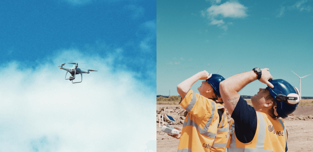
“Our colleagues in other countries (Australia, Hong Kong, Belgium and France) have been using drone surveys for a number of years to monitor the waste volumes entering their landfill sites.
"We do this to keep track of the settlement and ensure we are filling to the correct levels.
“In the UK, we currently use traditional survey techniques but these are time-consuming and we only do them six-monthly or quarterly depending on the sites’ input rates.
"The frequency is not always ideal as a site approaches final levels.
“We’ve seen that drone surveys are much quicker in terms of the actual survey and processing time.”
The Phantom 4 RTK For Drone Surveying
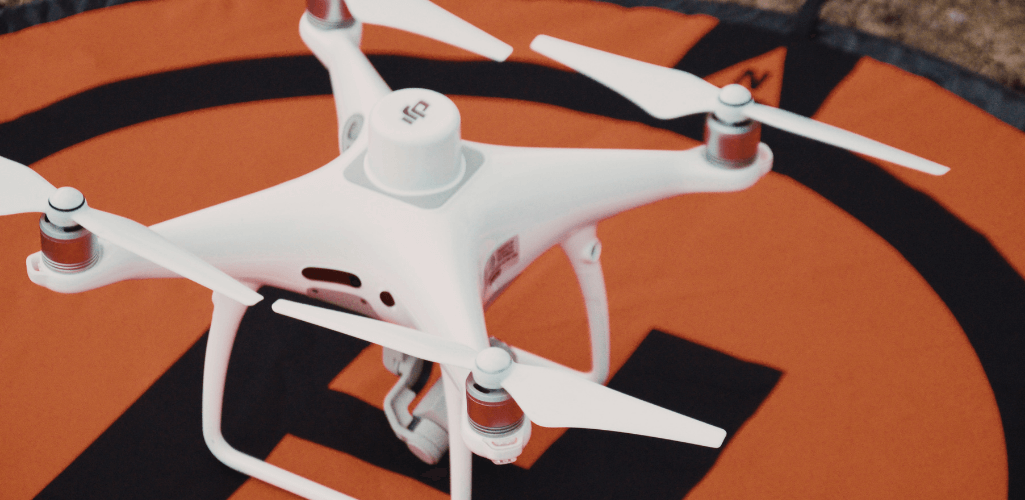
The next-generation Phantom 4 RTK is a compact and low altitude drone-mapping solution.
It can capture centimetre-accurate data while requiring fewer ground control points than traditional surveying methods - saving time and reducing on-site risk.
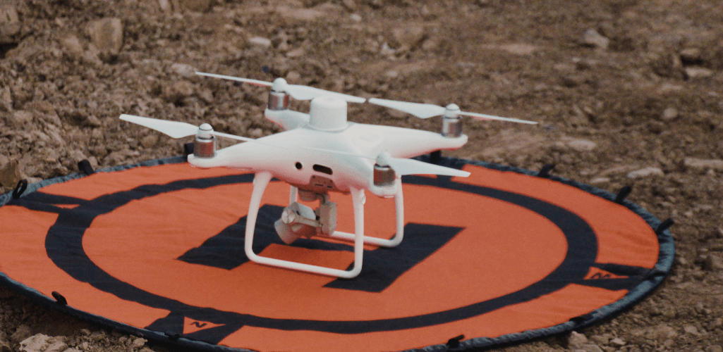
The drone’s key features include:
Integrated RTK module providing real-time, centimetre-level positioning data for improved absolute accuracy on image metadata.
One-inch, 20MP CMOS sensor and mechanical shutter to eliminate rolling shutter blur while P4 RTK in motion. It can achieve a ground sample distance (GSD) of 2.74 cm at 100 m flight altitude.
TimeSync system aligns the flight controller, camera, and the RTK module. It also ensures each photograph uses the most accurate metadata.
OcuSync transmission enables stable and reliable HD image and video transmission at up to 5 km (CE) and 7 km (FCC).
DJI GS RTK app and Remote Controller with built-in screen provides operators with a streamlined control scheme for surveying. The GS RTK app allows pilots to intelligently control the drone with multiple planning modes, including Photogrammetry (2D and 3D), Waypoint Flight, and Terrain Awareness.
Compatible with a range of industry-leading drone photogrammetry and drone-mapping software.
How The Phantom 4 RTK Fits Into SUEZ's Workflows
Richard said: “The DJI Phantom 4 RTK impressed us during the demonstration day.
"The data it collected certainly met our requirements.
"We are looking forward to using it on-site for real.”
The Phantom 4 RTK is compatible with the D-RTK 2 Mobile Station.
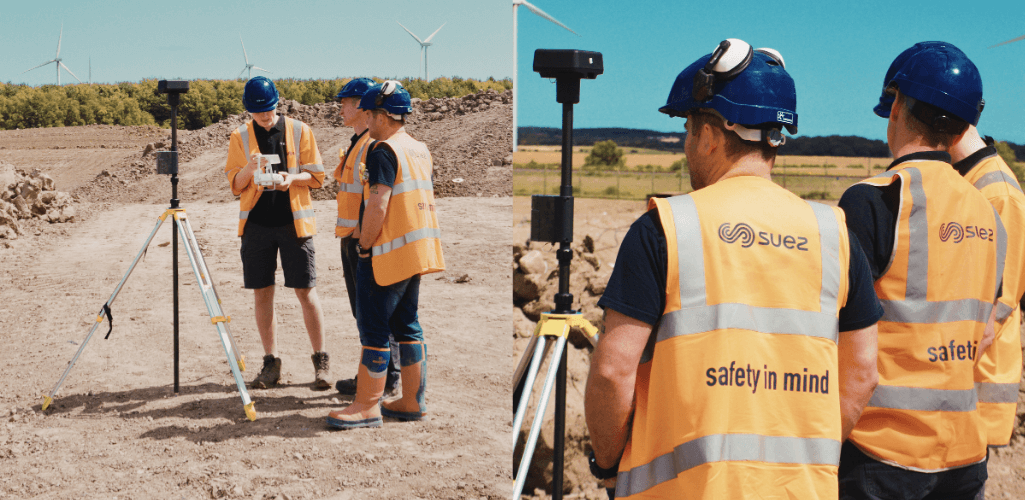
This provides real-time differential data to the drone and forms an accurate surveying solution, enabling centimetre-level accurate data collection with the Phantom 4 RTK in any condition.
Richard added: “We had a few options from our HQ in Paris. All used Phantom 4s but a couple without the RTK module.
"We made the decision to run with the RTK option with a base station, which may also give us the benefit of using the D-RTK 2 as a traditional topographic survey tool.”
SUEZ’S UK Drone Programme
The addition of the Phantom 4 RTK is an exciting chapter for SUEZ as the company looks to utilise AI and robotics to enhance operations.
While the drone programme is in its infancy, Richard has high hopes for UAS and believes the division will scale in the future.
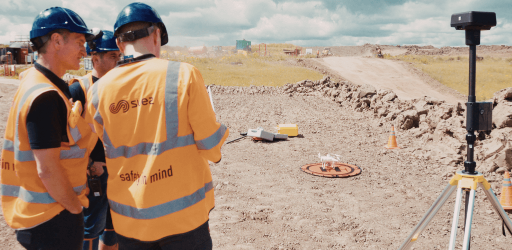
He said: “In the short term, our aim is to have four pilots to cover the North East of England and Scotland.
“The intention is to then add another four or five next year in the North West of England - hopefully with two extra drones.
“Being able to cover our three northern regions by summer 2021 with drones will give us great flexibility with one operational site in each region and the opportunity to use the drones on our closed sites (approximately 25 in the north).”
Heliguy Helps SUEZ Grow A Drone Programme
Richard praised HELIGUY.com™ for its support to help SUEZ adopt drone technology.
He said: “I found Heliguy via a web search and the fact that the company was based in the North East of England was a bonus.
“There are some good reviews on the website and all information was easily accessible.
“Heliguy’s GIS expert Ben has been very helpful throughout the process and has always been on hand to assist.”
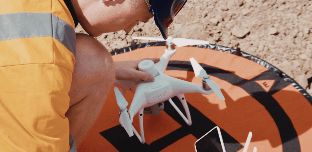
HELIGUY.com™’s Ben Sangster said: “The Phantom 4 RTK is an excellent drone and is proving a popular way to bring aerial surveying in-house.
“We are pleased that a company such as SUEZ chose Heliguy as their prefered Phantom 4 RTK supplier.
"I believe the drone will be an asset to SUEZ, helping to monitor landfill and calculate volumes more safely, efficiently and cheaply than the company’s previous methods.”
HELIGUY.com™ is an industry-leading supplier of commercial DJI drones.
We also deliver UK CAA-approved drone training, and in-house repairs and custom builds.
This comprehensive package empowers companies to start and scale successful drone programmes.
Contact us for more information.
Drones For Landfill And Waste Management
As SUEZ has seen, drones can enhance and simplify waste management operations.
A successful drone programme on a landfill site can provide accurate and real-time information on progress and productivity, and key data insights to ensure high-quality work and reduce operational risks and costs.
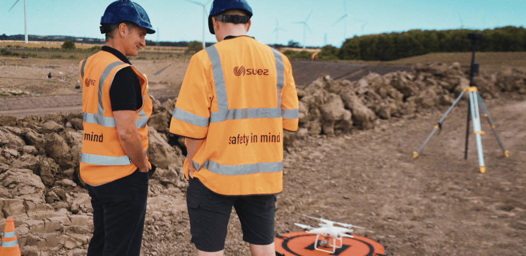
Here are some of the most important reasons to adopt drones for waste management.
Calculate Remaining Airspace
To achieve superior landfill performance, waste management operators need to keep most of the waste under the top-of-waste (TOW) level.
Based on this level, organisations select specific cells to overfill if required. Mistakes can be disastrous for the surrounding environment.
So a reliable method for airspace calculation is necessary.
Drones can do this, helping to measure overfill capacity and the remaining airspace by capturing data that can be turned into 3D models to visualise volumes of waste overfill.
This data allows organisations to see cross-sections of certain cells or entire landfills over time.
And it is much quicker and easier to collect than traditional methods.
Landfill cell management
When it comes to waste management, compaction rate is key; filling as much waste as possible in a single cell.
Drones can calculate compaction rates while surveying a landfill.
This data can be coupled with weighbridge data to calculate the density of waste in every cell.
This is used to calculate and compare the volume of waste in every cell.
Aerial Landfill monitoring
Environmental area monitoring is vital for any landfill, but it can be a complex process.
This includes planning, equipment, and compliance to ensure the surroundings and nearby water sources aren’t contaminated.
A drone can help with this, providing real-time visual data to highlight any issues through high-resolution imagery and 3D models.
Because drones are quick, safe, and easy to deploy, regular aerial footage of your site can be acquired.
About SUEZ
Part of the global SUEZ group, SUEZ Recycling and Recovery UK employs more than 5,500 people.
Over the course of a year, it handles over 10 million tonnes of waste.
The company’s diverse activities are guided by a vision to engineer a society where there is no more waste.
Established in the UK in 1988, SUEZ Recycling and Recovery UK helps to reduce the environmental impact of customers’ waste by recycling and extracting the value from it.
The goal is to help create a circular economy in which nearly all waste materials are given a second life and reused, recycled or recovered for their energy content.
Headquartered in Maidenhead, SUEZ Recycling and Recovery UK operates in over 300 locations throughout the UK.
This including offices, civic amenity sites, transfer stations, landfills, and energy-from-waste, material recycling, composting and security shredding facilities.
