D-RTK 3 Multifunctional Station
£0.00
Tax included in UK & Shipping calculated at checkout
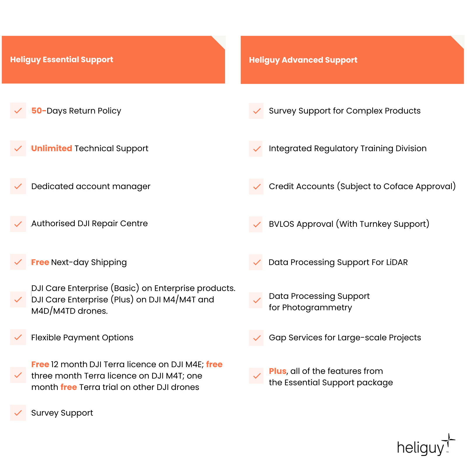
50-days return policy
Next-day delivery - order before 3 pm
The D-RTK 3 Multifunctional Station provides centimetre-level positioning for multiple drones or extends their operational range in relay mode. Equipped with advanced antennas and an inertial measurement unit, it integrates seamlessly with the DJI Enterprise app and DJI Terra for high-precision aerial surveying. It is compatible with a range of DJI Enterprise platforms. Please refer to FAQs for a full breakdown of compatibility.
Overview
Contents
Specifications
Support
FAQ
Heliguy Services
Precision and Durability Redefined
Compact, powerful, and reliable for precise positioning in any environment.
Compact and Lightweight: Measures Φ 163mm × 89mm and weighs just 1.26kg, making it easy to carry in one hand.
User-Friendly Controls: Equipped with physical buttons and indicator lights for power, mode switching, and status display.
Versatile Compatibility: Features a standard 5/8-inch mount for third-party poles and a USB Type-C port for charging and debugging. It is compatible with a range of DJI drones. Please refer to FAQs for full compatibility list.
Advanced OcuSync 4 Enterprise: Utilises four external antennas for a maximum range of 25 km.
High-Performance Core: Includes a self-developed RTK chip, air dielectric antenna with physical filtering, and phase-centre accuracy of ≤ 2mm.
Extended Battery Life: Offers up to 4 hours as a relay, 7 hours as a base, and 10 hours as a rover.
Rugged Durability: Built to IP67 standards, operates in temperatures from -20°C to 55°C (-4°F to 131°F), and withstands a 2m pole drop.

Versatile Precision for Complex Missions
A multifunctional station offering advanced positioning, enhanced transmission, and seamless integration.
Base Station Mode: Supports 5 GNSS systems and 19 frequencies for RTK broadcasting to multiple drones, with dm-level accuracy via PPP* and PPK compatibility. Covers up to 15 km (9.32 mi, FCC).
Rover Mode: The high-precision IMU enables tilt measurement and GCP collection, seamlessly integrating with the DJI Enterprise App and built-in coordinate systems aligned with DJI Terra.
Relay Station Mode: This mode boosts video transmission in challenging environments with real-time signal occlusion analysis for optimal communication. (PPP supports BeiDou PPP-B2b; more GNSS systems are coming in updates.)
*Please note that different functions are available for different DJI platforms. See FAQs for feature and compatibility information.

Multiple Ways of Calibration
Three precise methods to suit diverse operational needs.
Custom Network RTK: Use your own CORS account for location calibration PPP:
PPP: Free self-developed PPP solution that provides decimetre-level positioning with no network connection. Manual Calibration:
Manual Calibration: Similar to D-RTK 2 operation, deployed at known points, manually input Base coordinates and pole height

Recommended Extras for the D-RTK 3 Multifunctional Station
Complete your purchase with...
Accreditation
![UK CAA Recognised Assessment Entity (RAE)]()
UK CAA Recognised Assessment Entity (RAE)
Authorised GVC/A2 CofC Training Courses
![UK CAA Permission for BVLOS Flights: Operational Authorisation UAS 15435]()
UK CAA Permission for BVLOS Flights: Operational Authorisation UAS 15435
Helping companies unlock BVLOS missions in an AAE with DJI Docks
![The UK's only DJI Gold and S-Level Partner]()
The UK's only DJI Gold and S-Level Partner
Trusted supply on DJI products
![ISO 9001 Certification]()
ISO 9001 Certification
Driving industry standards through robust operational protocols for enhanced safety and reliability
![Training Qualifications UK]()
Training Qualifications UK
Accredited training courses endorsed by TQUK.
![Ofqual-regulated Training]()
Ofqual-regulated Training
Recognised quality mark for meeting accreditation criteria.
![Cyber Essentials]()
Cyber Essentials
Verified data security
![Financial Conduct Authority]()
Financial Conduct Authority
Authorised to conduct regulated financial services
![Armed Forces Covenant Defence Employer Recognition Scheme - Silver Award]()
Armed Forces Covenant Defence Employer Recognition Scheme - Silver Award
Proud supporter of our Armed Forces
![D-U-N-S Registered: 77-916-1210]()
D-U-N-S Registered: 77-916-1210
Verified to conduct international business


