Rental XGRIDS Lixel K1
£0.00
inc VAT weekly
Enquire now for availablility
Rent the XGRIDS Lixel K1 - a lightweight handheld scanner for pro-level 3D reality capture and modelling.
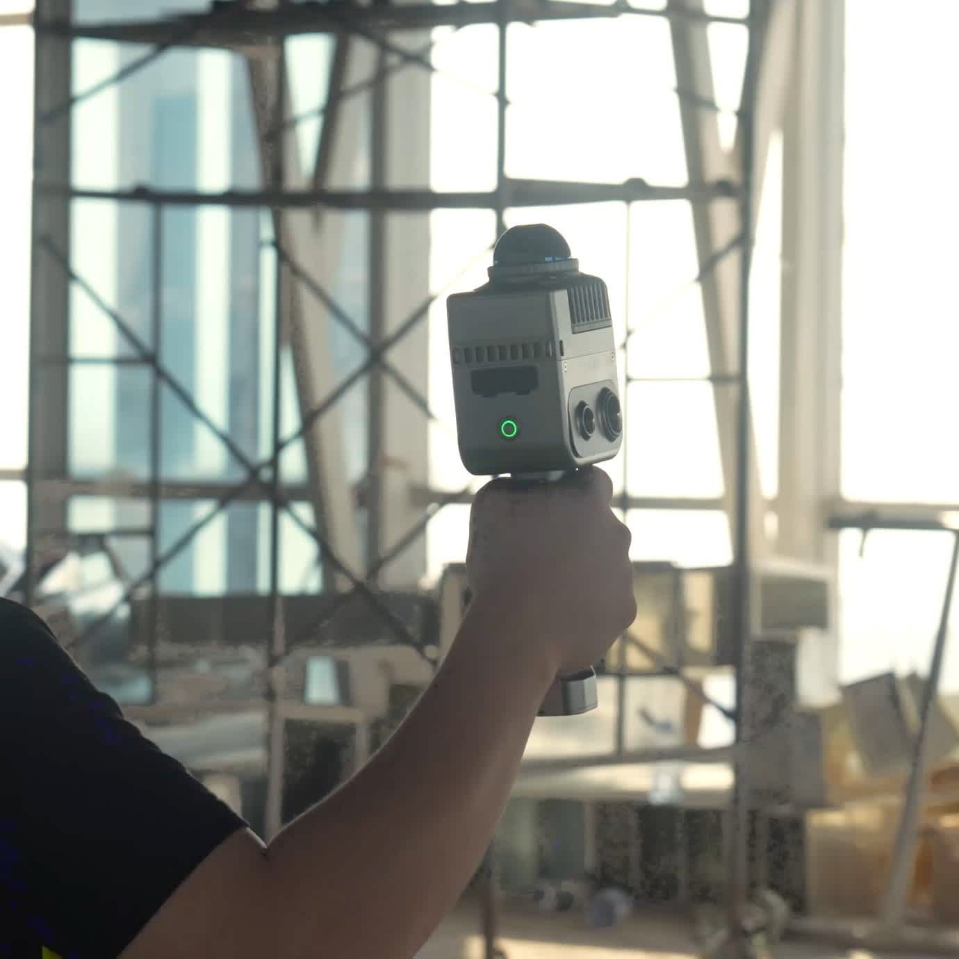
XGRIDS Lixel K1 The K1 360° scanner features a 56MP camera for panoramic views and a SLAM-based laser module with a 40-metre range. Generate cm-level true-colour 3D models in real-time.
In-house Survey Support Access advice from our geospatial specialists to help you maximise your drone mapping operations.
Rental Benefits Hiring this handheld scanner is more cost-effective than an outright purchase and enables you to access it only when you need to.
What Do I Need To Book A Rental?
Provide us with some key documents - then enjoy your hire
Insurance
Insure your rental under a Hired-in (non-owned) equipment cover policy - to the full cost value of the equipment and for the duration of your hire period.
Proof of ID
After check-out, we'll ask for a copy of your passport or driving licence, plus a utility, bank, or council tax statement matching your name/delivery address.
Flyer ID
If you hire a drone from heliguy™, you also need a valid Flyer ID and Operator ID. We don't require proof of drone registration or training (A2 CofC/GVC).
Overview
Contents
Specifications
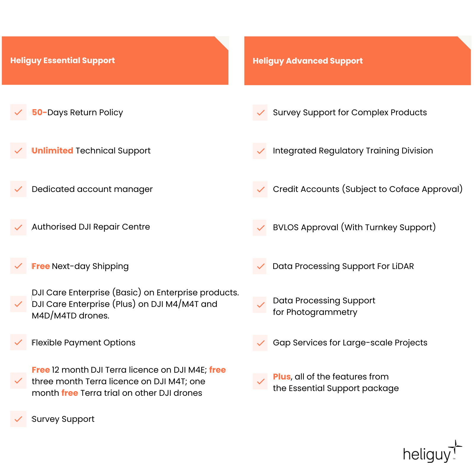
Support
Rental Process
FAQ
Heliguy Services
Quality Data In Complex Environments
XGRIDS K1: On-The-Go Mobile Mapping
Panoramic Camera: 56MP, 360*360 True Panoramas.
LiDAR Module: 40 channels, 200,000 points/s; Accuracy 1.2cm; Scanning distance 40m; 360° horizontal FOV.
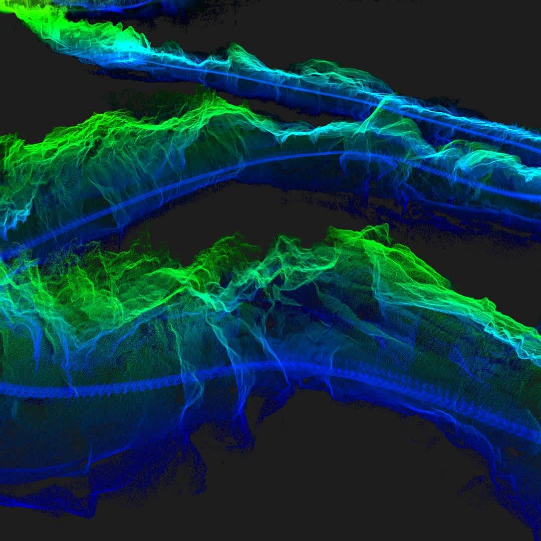
True-colour Point Clouds: Generate finely-detailed true-colour point clouds in real-time.
Updated Multi-SLAM: Multi-sensor data fusion, including laser, vision, GNSS data, and high-performance computing, ensures stable scanning with enhanced scene adaptability.
Complex Operations: Collect data indoors, in the dark, and in complex environments. The Lixel K1 is IP54 rated.

Industry Applications
One Camera, Multiple Use-Cases
The XGRIDS Lixel K1 benefits multiple industry applications and scenarios. These include:
Real estate surveying
Topographic mapping
Agricultural and forestry survey
Engineering survey
Digital twins
Smart city
Media and gaming
Culture and tourism.
Lixel CyberColor
Groundbreaking Advancement in 3D Content Generation
Ultra-realistic Model Generation: Based on multi-SLAM algorithms and 3DGS technology, Lixel CyberColor uses Gaussian Splatting to enable the creation of true-to-life, vast 3D models and overcomes the challenges associated with modelling large spaces and complex environments.
Enhanced 3DGS Algorithm: Realistic rendering in diverse environments, reducing model sizes by 90% (compared to open-source 3DGS algorithms) through proprietary data-compression technology.
Infinate-scale Rendering: Supports large-size 3D scenes for various platforms.
Seamless Integration: Combine with professional 3D software and platforms. Lixel CyberColor plugins and SDKs will be available for platforms such as Unity, UE, Web and Mobile.
Immersive Experience: Unparalleled VR interaction experiences.
LiDAR Integration: Use in conjunction with the XGRIDS K1 scanner for cm-level model precision.
AI-powered Dynamic Object Removal: Reconstruct highly-detailed digital twins and remove objects from the scene.

LixelStudio
Intelligent 3D Processing Software
One-stop Processing Services: Developed by XGRIDS, LixelStudio provides viewing, editing, and one-stop processing services for laser point clouds and other data.
Massive Data Loading: Load large point clouds simultaneously, with no pressure on clipping, measuring, and rendering.
Data Vectorisation: CAD, BIM, 3D white model, and other data can be more compact and user-friendly.
AI Spatial Understanding: Monolithic and semantic segmentation, and dynamic object removal help with space information.
Industry Plugins: Abundant and expandable plugins meet the data needs of various industries.
Remote Sync: 5G network for real-time viewing and downloading enables remote operations.
Complementary Software: LixelStudio is included in the cost of the Lixel K1.
LixelGo App
Simplified Control
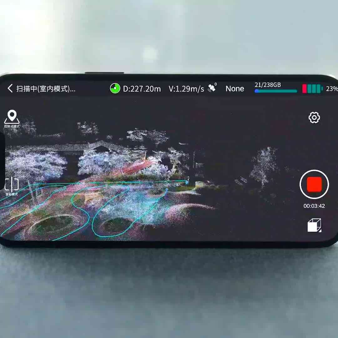
Companion App: LixelGO is a companion app for your XGRIDS scanner, enabling easy control and one-click operation via a mobile phone, facilitating on-the-go mapping. At this time, the LixelGo App only supports Android devices.
Real-time Insights: View camera images, elevation information, and true-colour point clouds in real-time to avoid missing or incorrect data collection.
Status Updates: The app displays a range of status information, such as battery power, network, memory, and range.
Accreditation
![UK CAA Recognised Assessment Entity (RAE)]()
UK CAA Recognised Assessment Entity (RAE)
Authorised GVC/A2 CofC Training Courses
![UK CAA Permission for BVLOS Flights: Operational Authorisation UAS 15435]()
UK CAA Permission for BVLOS Flights: Operational Authorisation UAS 15435
Helping companies unlock BVLOS missions in an AAE with DJI Docks
![The UK's only DJI Gold and S-Level Partner]()
The UK's only DJI Gold and S-Level Partner
Trusted supply on DJI products
![ISO 9001 Certification]()
ISO 9001 Certification
Driving industry standards through robust operational protocols for enhanced safety and reliability
![Training Qualifications UK]()
Training Qualifications UK
Accredited training courses endorsed by TQUK.
![Ofqual-regulated Training]()
Ofqual-regulated Training
Recognised quality mark for meeting accreditation criteria.
![Cyber Essentials]()
Cyber Essentials
Verified data security
![Financial Conduct Authority]()
Financial Conduct Authority
Authorised to conduct regulated financial services
![Armed Forces Covenant Defence Employer Recognition Scheme - Silver Award]()
Armed Forces Covenant Defence Employer Recognition Scheme - Silver Award
Proud supporter of our Armed Forces
![D-U-N-S Registered: 77-916-1210]()
D-U-N-S Registered: 77-916-1210
Verified to conduct international business
