Updated on • 9 Sep 2024
DJI Phantom 4 RTK: Survey-grade accuracy confirmed!
Save time and money and improve site safety - study shows you get great results with the Phantom 4 RTK without having to put out lots of ground-control points ... Read More
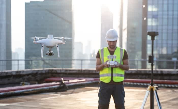
A new study has proven the accuracy of the DJI Phantom 4 RTK - showing it can meet survey-grade requirements WITHOUT having to go through the laborious process of laying a whole load of ground-control points (GCPs).
The test was carried out by DroneDeploy and demonstrated how the next-gen mapping drone can deliver 2cm relative vertical accuracy and 1.20cm relative horizontal accuracy.
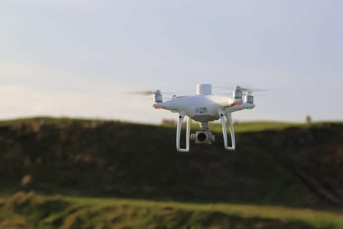
The DJI Phantom 4 RTK
It means that this aircraft - sold by Heliguy - will help industrial users save money, increase productivity, achieve greater collaboration and increase job-site safety.
Based on these results, DroneDeploy recommends using the Phantom 4 RTK to create accurate maps for the measurement of point‑to‑point distances. Not only can you get accurate results, but in most cases using the Phantom 4 RTK to survey will reduce costs associated with traditional methods
To test the accuracy of the Phantom 4 RTK, DroneDeploy created a control point system for a rooftop building survey. Then, 30+ flights were logged - each exploring the effect of flight altitude, overlap and number of images - and processed using DroneDeploy's Map Engine.
These data sets were then used to calculate both the horizontal and vertical accuracy of the measured points, along with the accuracy of linear measurements.
Now, DroneDeploy has published a white paper containing the results in full. Read on to find out:
The measurement accuracy results of the DJI Phantom 4 RTK compared to the Phantom 4 Pro
How the Phantom 4 RTK can reduce costs associated with traditional survey workflows
The best practices for producing highly accurate drone maps with DroneDeploy and the DJI Phantom 4 RTK
How to capture ground control data and ensure the accuracy of your drone maps
If you would like to flick quickly to various parts of this blog, click on the relevant header in the summary below.
P4 RTK delivered 2cm relative vertical accuracy and 1.2cm relative horizontal accuracy
Phantom 4 RTK control distances within 0.1% of Phantom 4 Pro with GCP measurements
Phantom 4 RTK control distances within 0.27% of Trimble Catalyst measurements
2D and 3D flights did not significantly affect measurement accuracy
Conclusion - Phantom 4 RTK measurement accuracy can meet survey-grade requirements
Background to the test
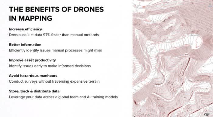
Over the last few years, deploying drones for construction, surveying and mining missions has become increasingly popular. And it's easy to see why more and more industries are turning to this technology.
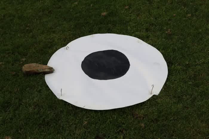
Traditional mapping methods involved using ground-control points, which are defined points on the surface of the earth that have a known geo-referenced location.
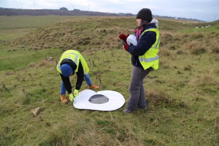
By using GCPs in conjunction with aerial photogrammetric data, you’re able to achieve centimetre-level accuracy by pinning those points on an aerial map. While accurate, GCPs tend to be a time-consuming process - often taking longer to put out than flying the drone itself.
When GPS was first used for surveying back in the 1980s, the only way to obtain sub-centimetre positioning with GPS was via post-processing with GCPs, which could take entire days to accurately capture.
In the early 1990s, Real Time Kinematic technology (RTK) was introduced, and allowed surveyors to obtain centimetre-level positioning in real-time, with no post-processing required.
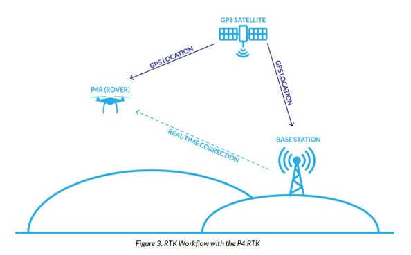
To process RTK data with a drone, you will need both an RTK Base Station and a RTK Rover, in this case, the Phantom 4 RTK.
For relative positioning, the common method used in surveying is the 'Stop and Go' technique. RTK processing, on the other hand, does not require post-processing to obtain accurate positioning.
A radio at the reference receiver - either a local base station or a network base station - broadcasts its position to the rover in real time. This allows for in-field surveying and eliminates the need to check measurement quality during post processing.
PPK (Post Processed Kinematic) surveys are similar to RTK surveys, but the positions are not corrected in real time. It usually involves placing a stationary base station over a known control point, or a monument to allow for geolocation. GPS data is then simultaneously collected by the base station and the drone as it flies.
That data is then downloaded from the base station, and the rover (drone), and post-processed using a GPS software. These images can then be uploaded to DroneDeploy’s Map Engine for processing.

When choosing between RTK or PPK methods, you need to make a choice between productivity and accuracy of the resulting imagery.
The RTK workflow can be a very quick way to obtain accurate imagery but relies on a real-time connection to produce accurate maps.
A PPK solution takes more time to set up, but relies on its signal backup data to ensure positional accuracy of the flight.
More about the drones used in the study
The primary drone model used in this study is the DJI Phantom 4 RTK, which was released in October 2018. The drone was designed to use RTK processing to produce highly accurate aerial maps.
In addition to the RTK unit, the Phantom 4 RTK also uses a redundant GNSS (Global Navigation Satellite System) module that provides additional flight stability when flying in dense regions with poor RTK signal.
DJI claims 1cm RTK horizontal positioning accuracy and 1.5cm RTK vertical positioning accuracy. In terms of absolute measurements on photogrammetric models, DJI claims 5cm accuracy when flying at 100 meters with 2.7cm GSD (Ground Sampling Distance).
The RTK module, pictured below, is integrated directly with the drone to provide centimetre-level accuracy for stable flight and accurately georeferenced imagery.
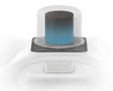
A new TimeSync system was added to continually align the flight controller, camera and RTK module - ensuring each photo uses the most accurate metadata and fixes the positioning data to the centre of the CMOS sensor.
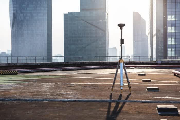
The Phantom 4 RTK also has the ability to connect to the D-RTK 2 Mobile Station, NTRIP (Network Transport of RTCM via Internet Protocol), or store the satellite observation data to be used for PPK. The D-RTK 2 Mobile Station, pictured below, was not measured in this study, instead the NTRIP method was used.
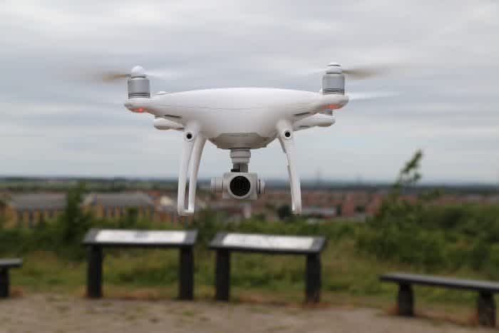
As well as the Phantom 4 RTK, DroneDeploy used the Phantom 4 Pro (pictured below) in conjunction with GCPs to serve as the control data.
Methodology for the test
The test site comprised seven different 1’ x 1’ GCPs, which were placed at varying elevations, latitudes and longitudes on the surface to be able to best capture differing scenarios.
Additionally, four checkpoints were placed on the roof and the distances between each were measured with a tape measure to establish the length between the points.
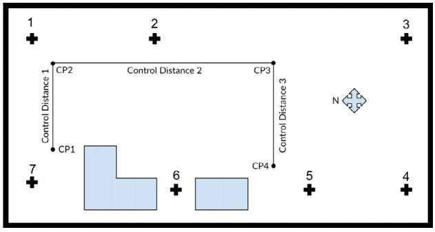
They were then tagged and measured using a Trimble RTX GPS unit to identify the lat, long and elevation of each of the points.
To capture the aerial data, DroneDeploy flew 30+ individual flights using the DJI Phantom 4 RTK and DJI GS RTK App for the RTK flights, and the Phantom 4 Pro V2.0 and DJI GS Pro app for the Phantom 4 Pro with GCP flights.
SmartNet, a third-party corrections service, was used for the RTK controller in conjunction with a mobile hotspot.
A total of 20 flights were flown with the Phantom 4 RTK at 100 feet above the surface of the roof, in both 2D and 3D photogrammetry modes and then processed with DroneDeploy’s Map Engine.
Similarly, 12 flights were flown with the Phantom 4 Pro and processed with GCPs with DroneDeploy’s Map Engine to serve as the control to compare the results against.
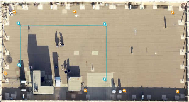
One of the processed aerial maps with checkpoints and GCPs.
Slight variations in flight planning, lighting and altitude were introduced to simulate a real-world environment when collecting this data.
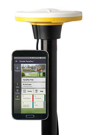
To capture the GCPs for the control, DroneDeploy tagged the geographic centre of the targets placed on the roof with a Trimble Catalyst.
The targeted points had a horizontal standard deviation of 0.24cm and a vertical standard deviation of 0.49cm across the seven ground control points and checkpoints tagged on the test site.
These points were also used to serve as control points when measuring the accuracy of the P4 RTK against GCP measurements.
DroneDeploy would recommend using a high accuracy GNSS receiver, such as Catalyst, when processing maps with DroneDeploy to verify the accuracy of the maps on your jobsite for auditing and assurance.
Key findings
P4 RTK delivered 2cm relative vertical accuracy and 1.2cm relative horizontal accuracy
Each of the four checkpoints were tagged and measured with the Trimble GPS unit.
This table shows the vertical accuracy of the checkpoints, both in the RTK processed map and the Phantom 4 Pro with GCPs map.

With the Phantom 4 RTK, 1.20cm relative horizontal accuracy was achieved. With the Phantom 4 Pro and GCPs, 0.90cm relative horizontal accuracy was achieved.
The study showed that the Phantom 4 RTK can achieve 2cm relative vertical accuracy, and 1.20cm relative horizontal accuracy when flown at 100 ft (33m).
It’s also important to note that the accuracy measurements for the Phantom 4 RTK were taken using DroneDeploy’s annotation and measurement tools. The GSD for the resulting maps average 0.4in/px.
Why is this important?
Determining accurate elevations is an essential part of many civil construction projects like road, bridges, and highway projects. Grade lines, drainage structures and other highway features are designed with existing, known base planes, and final elevations, or design plans.
Due to its importance in all other phases of the project development, vertical measurements are established at a control point, known as GCPs.
Due to the sizeable downstream effect of inaccurate vertical measurements, this is a critical component of pre-construction, and reducing the resulting error is of utmost importance.
Phantom 4 RTK control distances within 0.1% of Phantom 4 Pro with GCP measurements
In the Linear Measurement Accuracy of DJI Drone Platforms and Photogrammetry study, DroneDeploy demonstrated that using a Phantom 4 Pro with GCPs would produce a margin of error of about 0.64%. Using a Phantom 4 RTK, DroneDeploy was able to produce a margin of error of about 0.27% when compared to 'real-world' measurements.

As the table above shows, on average, Phantom 4 RTK measurements are within 1.09cm, or 0.10%, of Phantom 4 Pro measurements processed with GCPs.
These results show that using a Phantom 4 RTK drone, a user can expect - on average - 1.09cm accuracy on RTK processed maps in DroneDeploy, when compared to similar maps flown with the Phantom 4 Pro, and processed with GCPs.
Why is this important?
Linear measurement accuracy is an important metric to consider because of its real-world applications.
While it can be important to look at the horizontal and vertical accuracy of a single point, many civil construction projects look at grade lines, drainage along a road, volumetrics of stockpiles, or material area - all of which rely on the accuracy of point-to-point measurements.
This process involves understanding the change in accuracy when measuring the variation between points.
For example, a ±2cm horizontal or vertical accuracy could equate to ±4cm linear measurement accuracy between two points. This provides a more tangible understanding of how accuracy could affect measurementsof a road, bridge, highway or other civil construction project.
Phantom 4 RTK control distances within 0.27% of Trimble Catalyst measurements
Once the Phantom 4 RTK maps were processed within DroneDeploy, the control distances were tagged and measured across all of the maps using DroneDeploy’s measurement tools.
The comparison between the Phantom 4 RTK map measurements and the real-world measurements can be seen below.

The average error for the Phantom 4 RTK maps came out to 3.65cm, or about 0.27% of real-world measurements. For comparison, using GCPs, a user can expect 3cm accuracy, and using a GPS unit, like a Trimble Catalyst, a user can expect 3cm accuracy.
Looking at solely the XY accuracy of the control points, the Phantom 4 RTK delivers 1.2cm relative horizontal accuracy. These results show that using a Phantom 4 RTK drone, a user can expect, on average, 3.65cm linear measurement accuracy on RTK processed maps in DroneDeploy.
2D and 3D flights did not significantly affect measurement accuracy
A total of five 2D, and five 3D Photogrammetry flights were flown using the DJI GSR App with the Phantom 4 RTK. The results of this study can be seen below.
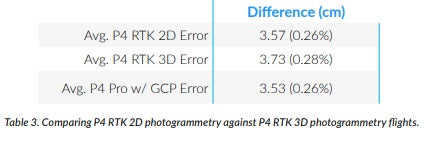
Average linear measurement error for the 2D flights was about 3.57cm or 0.26%. Average linear measurement error for the 3D flights was about 3.73cm or 0.28%. Average linear measurement error for Phantom 4 Pro flights was about 3.53cm or 0.26%.
At 0.16cm margin of error between the 2D and 3D flights there was not a statistically significant variation in linear measurement accuracy.
When flying the Phantom 4 RTK for high-accuracy missions, choosing 2D or 3D would be dependent on the user’s needs, flying 2D for relatively flat terrain, and flying 3D for structures, buildings, or other tall objects.
DroneDeploy
Conclusion - Phantom 4 RTK measurement accuracy can meet survey-grade requirements
Today, companies can achieve sub-3cm relative horizontal accuracy using traditional survey methods. These allow them to perform accurate surveys, bids, grading operations, and managing large-scale projects with ease.
Most survey grade maps traditionally deliver sub-3cm accuracy in the XY direction, and about 9cm accuracy in the Z direction.
In this, study, DroneDeploy has shown that the Phantom 4 RTK can deliver 2cm relative vertical accuracy and 1.20cm relative horizontal accuracy with maps processed on the DroneDeploy Map Engine (on average).
Based on these results, DroneDeploy recommends using the Phantom 4 RTK to create accurate maps for the measurement of point‑to‑point distances.
Not only can you get accurate results, but in most cases using the Phantom 4 RTK to survey will reduce costs associated with traditional methods, including that spent on labour, hardware, and software. This also comes with the general benefits our customers achieve, such as greater productivity, faster time to insights, improved collaboration, and increased job site safety. However, the use of some ground control checkpoints (1-2 GCPs) is still recommended to ensure accuracy and provide accountability for any measurements.
DroneDeploy verdict
Heliguy is stocking the DJI Phantom 4 RTK. The drone can be purchased by itself or with the D-RTK 2 Mobile Station. Our dedicated sales team can answer questions about the product, while we also have an expert technical department. To contact us, email info@heliguy.com or call 0191 296 1024.

written by
James Willoughby
James joined heliguy™ in 2018 following a 13-year stint in print and online journalism, having worked on regional and weekly newspaper titles. He is responsible for spearheading heliguy™'s content strategy and social media delivery. James collaborates with DJI Enterprise's European marketing team to coordinate and produce case studies and helps organise events and webinars.