Updated on 18 Sep 2024
Using Drone LiDAR For Public Safety
Drone LiDAR is an effective public safety mapping solution, including crash-scene investigation and search and rescue. Drone LiDAR is accurate, automated, efficient and can be deployed at night. The DJI L1 LiDAR sensor also generates real-t ... Read More

Drone LiDAR is an effective mapping solution for public safety;
It can be used for a range of applications, including crime and crash scene investigation, search and rescue, and following natural disasters and fires;
Drone LiDAR is highly accurate, highly automated, can be deployed at night, and is particularly effective in areas of dense vegetation;
The DJI L1 is an efficient, plug-and-play solution, which can generate point clouds in real-time for immediate situational awareness.
Say 'drone LiDAR' - and AEC is probably the first sector that springs to mind. But drone LiDAR can also be a highly effective tool for public safety.
This drone surveying technique is hugely beneficial to emergency response and evidence gathering: Notably the accuracy of measurements, object detection using high automation, and rapid and real-time data capture.
The fact that LiDAR can be deployed at night - in comparison to photogrammetry which is far less effective in low-light environments - is an added bonus for public safety crews. After all, incidents don't just happen during the day.
Drone LiDAR is also more accessible these days, thanks in part to the plug-and-play DJI Zenmuse L1, which is highly efficient, highly accurate and can generate point clouds in real time.
In this blog, we'll look at how LiDAR can assist public safety drone mapping and how the capabilities of the L1 facilitate this.
Drone LiDAR For Accident Reconstruction
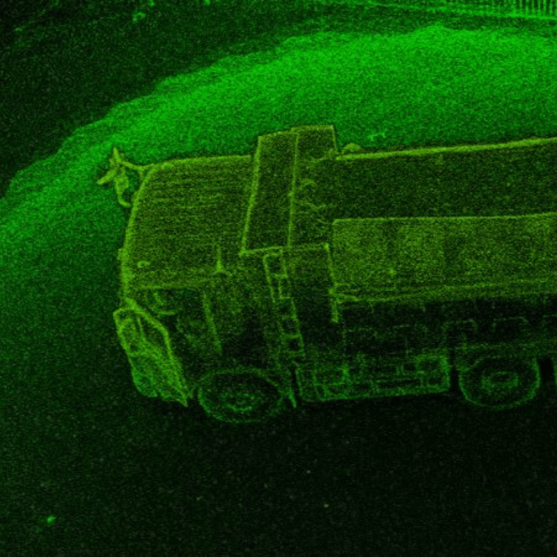
Drone LiDAR is an effective evidence-gathering tool, enabling public safety crews to digitally preserve 3D scene data that’s been rapidly captured in one site visit.
This method is particularly beneficial for crash-scene investigation.
Depending on the size of the crash, a drone can take less than 30 minutes to gather data - compared to the three or four hours it took previously.
In just a single flight, the drone can unobtrusively collect all necessary geospatial information from various angles, gathering thousands of points to create accurate and detailed models for thorough accident investigation.
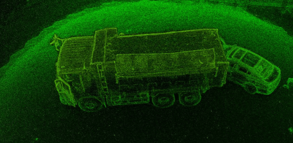
Crucially, these digitised assets feature the whole scene in one model, which can be accessed remotely.
The recorded data can be reconstructed to better understand the timeline of events and conduct analysis such as terrain profile, measuring skid marks and distances from each vehicle, and observing the damage in more detail. In turn, this can be presented as reliable evidence in court.
As an added bonus, the speed of data collection enables roads to be reopened quicker - freeing up commuters, costing less on accident personnel, and improving safety for crash-scene investigators.
For more information, read our in-depth blog on Using Drones for Accident Reconstruction.
Forest Fires
Perhaps more pertinent to countries like the US, where forest fires are more prevalent than in the UK, but drone LiDAR can be used to provide ecologically meaningful metrics for predicting fire risk, develop more detailed, site-specific fire impact studies and create post-fire management plans.
Wildfires don’t burn evenly through forests: Some areas may be barely touched, whilst in other areas, most of the trees and foliage will be severely damaged. Understanding the severity and distribution of a fire within a forest can assist with estimating and modelling future forest fires to aid prevention and containment.
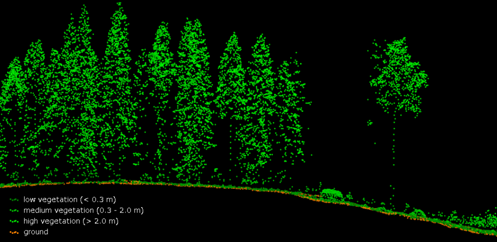
Using drone LiDAR, individual trees can be detected, and the vertical profile of the canopy and vegetation can be viewed, helping to build a richer and deeper understanding of the survey area.
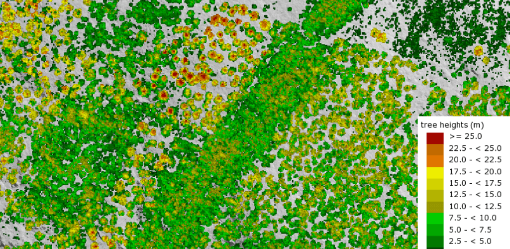
LiDAR is a particularly effective tool for mapping areas of dense vegetation; especially for collecting terrain and height information in these types of environments.
This is because LiDAR pulses are able to penetrate gaps between leaves and branches to reach ground level. In comparison, photogrammetry is not as effective in this situation as vegetation can stop you from acquiring an accurate representation of what the ground topography looks like.
For more details, read our LiDAR vs Photogrammetry blog.
Drone LiDAR For Search and Rescue
LiDAR sensors are highly effective at mapping surfaces: Think Digital Terrain Models, Digital Surface Models and Digital Elevation Models. (P.S, want to know more about these - then read our DTM, DSM and DEM blog here).
Such capabilities can aid search and rescue operations.
A drone-based LiDAR solution can easily detect humans on any given terrain and help rescue workers locate the position of a missing person quickly.
It can also be used to create a complete 3D view of the search area, complete with elevation data. This model can help rescue teams plan the best route to bring back the person safely.
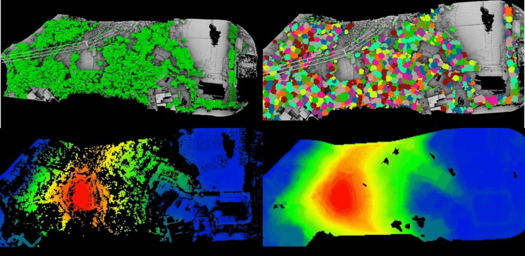
Knowing what type of hazards the rescue team may face, such as treacherous terrain, will increase the efficiency of rescue efforts and minimise injury to the rescue team.
LiDAR-equipped drones are also useful for conducting water rescues that are otherwise often the most difficult.
Using Bathymetric LiDAR sensors, drones can quickly map and measure the depth of water. As a result, it becomes easier for the rescue workers to quickly locate humans or wreckage partially submerged in the water.
Disaster Response And Drone LiDAR
LiDAR is growing in use for disaster response and risk assessment, and this data can fundamentally change the way we react to calamities.
As mentioned previously, drone LiDAR can be used to generate detailed and accurate topography maps and surface models and retrieve digital elevation data. Visualising this data in a point cloud enables emergency responders to easily identify areas most affected by a natural disaster.
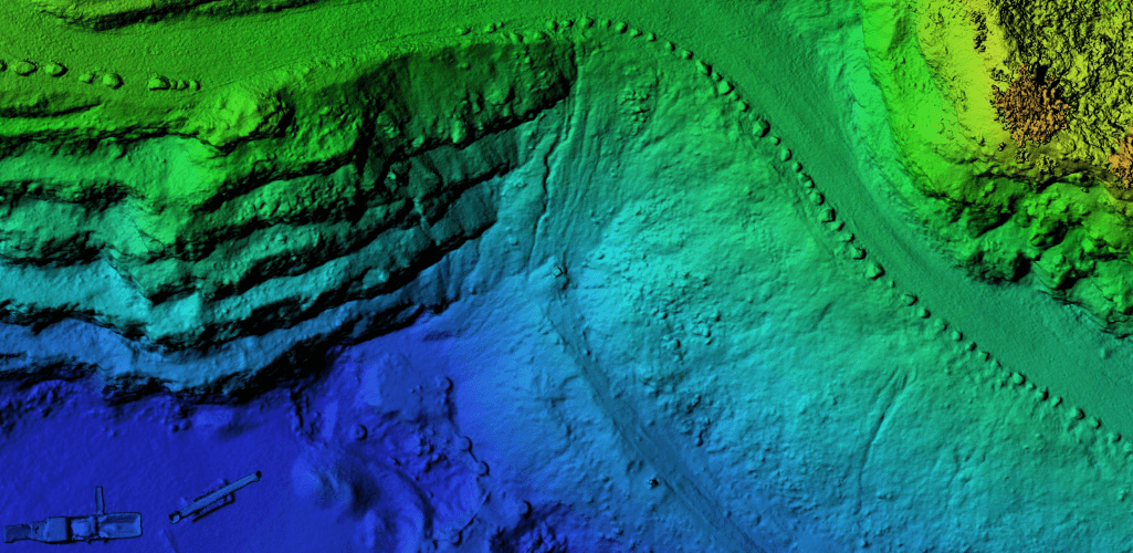
For instance, after a major storm, LiDAR data can be used for mapping the storms’ flood inundation, modeling storm surge, and evaluating topographic changes, among others. Latest elevation data can also come in handy for infrastructure repair and redevelopment after a disaster.
And the benefit of using a drone is that it can cover large swathes of land while keeping humans safely away from the danger zone, and can collect data significantly cheaper than alternative methods.
How The L1 LiDAR Sensor Can Help Public Safety Drone Mapping
So there you have it: LiDAR is an effective drone mapping solution for public safety.
But which LiDAR sensors are available to collect this type of data? Step forward the L1.
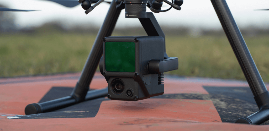
Engineered exclusively for the DJI M300 RTK drone, the DJI Zenmuse L1 LiDAR sensor is a powerful plug-and-play drone payload.
And its key specifications empower public safety officials in the following ways:
Rugged and Robust: The L1 has an IP54 rating, while the M300 RTK is IP45-rated, meaning they can be deployed in wet conditions. The L1 and M300 RTK can also operate in temperatures as low as -20°C and as high as 50°C. This enables public safety teams to react to incidents in a variety of climates and conditions. Read our guide to IP ratings and flying the M300 RTK in the rain.
Multi-return Capability: The L1 has a 450-metre detection range and a multi-return capability (up to three returns). This ensures it can generate highly-detailed maps, especially in areas of dense vegetation for missions such as search and rescue and forest fires.
Highly-efficient: The L1 is a highly-efficient solution, covering 2km² in a single flight, enabling public safety crews to quickly collect data over large areas.
Point Cloud Live View: Real-time point clouds provide immediate insights, helping operators make critical decisions quickly: Especially important for public safety crews for real-time situational awareness.
Highly Accurate: Public safety crews need accurate maps for accurate calculations. The L1 delivers a relative survey-grade accuracy of 5cm and absolute accuracy of 10cm while flying at an altitude of 50m.
Photogrammetry Sensor: The L1 has a 20MP photogrammetry sensor to create 2D orthomosaics and 3D models to compliment the LiDAR data.
The L1 can be used with DJI Terra for a one-stop post-processing solution, helping you generate 3D point clouds and accuracy reports.
To discuss drone LiDAR or any of the solutions mentioned in this blog, contact heliguy™ by phone or email.

written by
James Willoughby
James joined heliguy™ in 2018 following a 13-year stint in print and online journalism, having worked on regional and weekly newspaper titles. He is responsible for spearheading heliguy™'s content strategy and social media delivery. James collaborates with DJI Enterprise's European marketing team to coordinate and produce case studies and helps organise events and webinars.