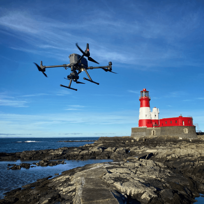
Updated on 18 Sep 2024
DJI M300 RTK Boosts Efficiency Of Seal Pup Count
The DJI M300 RTK has been used to conduct a seal pup count - collecting data quicker and more accurately than ever before. The P1 surveying camera captured high-res imagery from 120m, the H20T was used for thermal data and the M300 RTK hand ... Read More

DJI M300 RTK described as 'stunning and unbelievable' following seal pup count;
The P1 camera collected high-resolution imagery from 120 metres - helping to complete surveys in 15 minutes, compared to one day on foot;
H20T thermal camera used to help verify the findings;
M300 RTK handled 30mph winds and drizzle - enabling operations in conditions where other drones would need to be grounded;
Drone provided rangers with a more complete picture of the survey, reached outlying islands which are typically hard to access and made the survey more efficient, accurate and cost-effective.
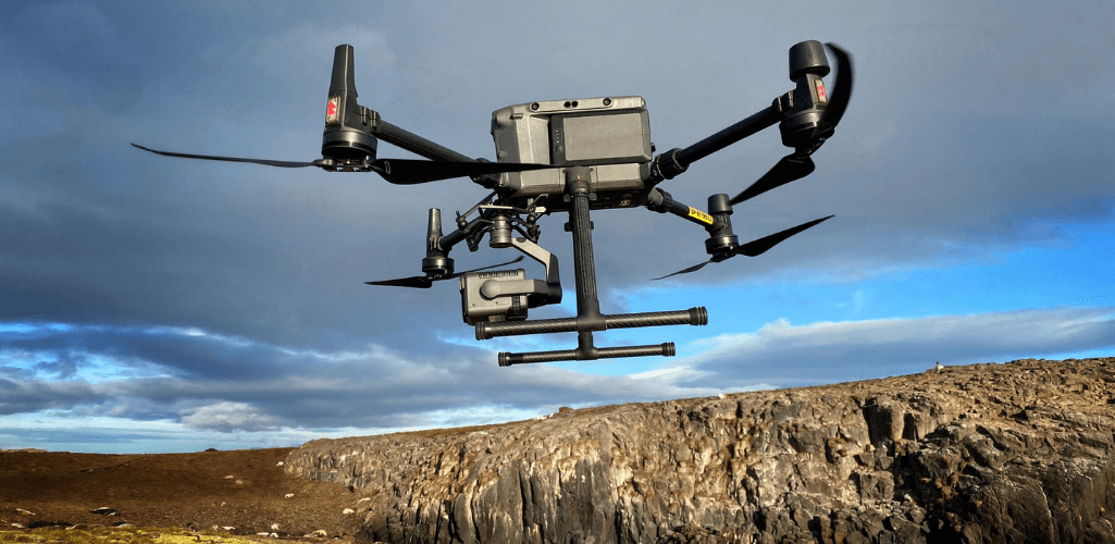
The DJI M300 RTK has been used to conduct a seal pup count - collecting data quicker and more accurately than ever before.
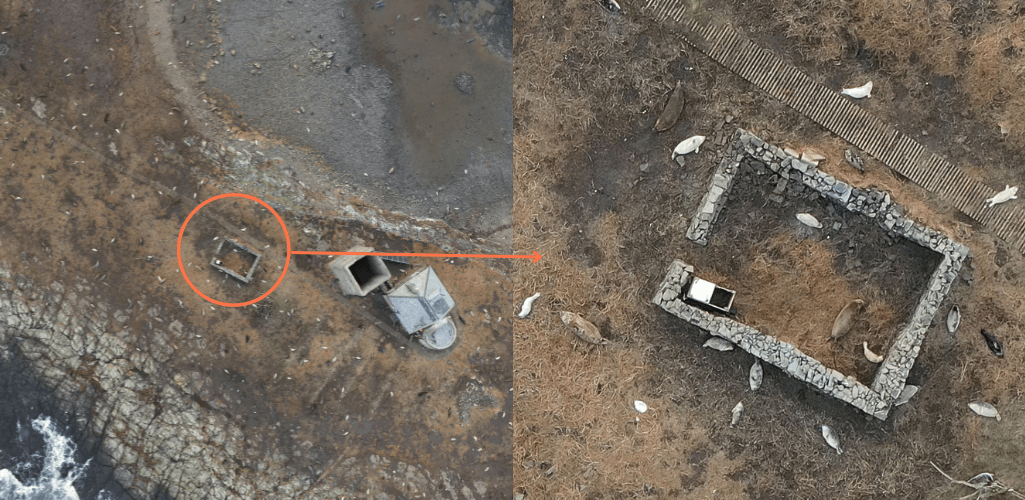
The drone was deployed over the Farne Islands, off the North East of England coast, with the P1 45MP photogrammetry camera, helping to gather crystal-clear imagery from 120 metres and complete surveys in just 15 minutes. The image below shows the level of detail the camera achieved from such a high-altitude.
To help verify the seal pup numbers and further enhance the accuracy of the findings, thermal drone imagery - collected via the H20T - was used for the first time during the annual count.
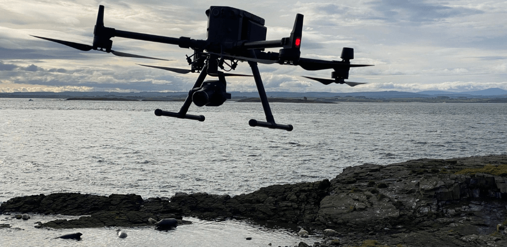
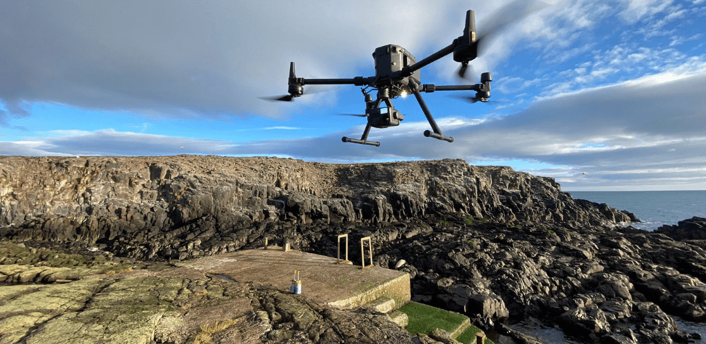
A hardy solution, the M300 RTK withstood the rigours of the hostile North Sea environment, including 30mph winds; faultlessly handling conditions when other drones would have to be grounded.
The drone enabled conservationists to look at large areas quickly and easily; count whole populations rather than just a sample; was less intrusive and stressful for the animals compared to manual, on-the-ground methods; enabled consistent surveys every four days; and allowed pups to be counted on difficult-to-reach outlying islands in tricky conditions.
The Farne Islands are cared for by the National Trust and drones have been used to conduct the seal counts annually since 2018 (although last year was cancelled due to the Covid pandemic).
It was the first time the M300 RTK was deployed for the research. Ritchie Southerton, who conducted the survey on behalf of TerraDrone Europe, said: "The M300 RTK is stunning - an unbelievable bit of kit, especially when paired with the P1 camera for surveying. Its ability to fly in tough conditions and capture crystal-clear data was incredible."
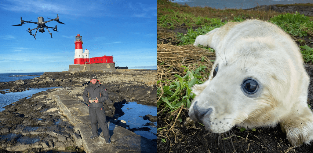
M300 RTK And P1
In previous years, Ritchie used the DJI Phantom 4 Pro for the survey. While it was a reliable solution, it was no comparison to the M300 RTK and P1 - a dedicated photogrammetry camera.
Thanks to the P1's 45MP full-frame sensor, Ritchie was able to capture quality data from 120 metres, meaning he could survey a whole island in just a quarter of an hour. It would have taken 45 minutes to capture the same data with the Phantom 4 Pro, or a whole day on foot!
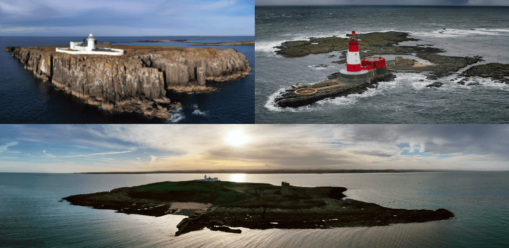
He said: "The M300 and P1 are a game-changer for aerial photogrammetry surveying. The resolution of the P1 enabled us to fly higher and faster, allowing more islands to be covered each day. And the data quality was so good - achieving 1.6cm per pixel."
This is demonstrated in the picture below. Look at how much of the island can be captured in one shot...
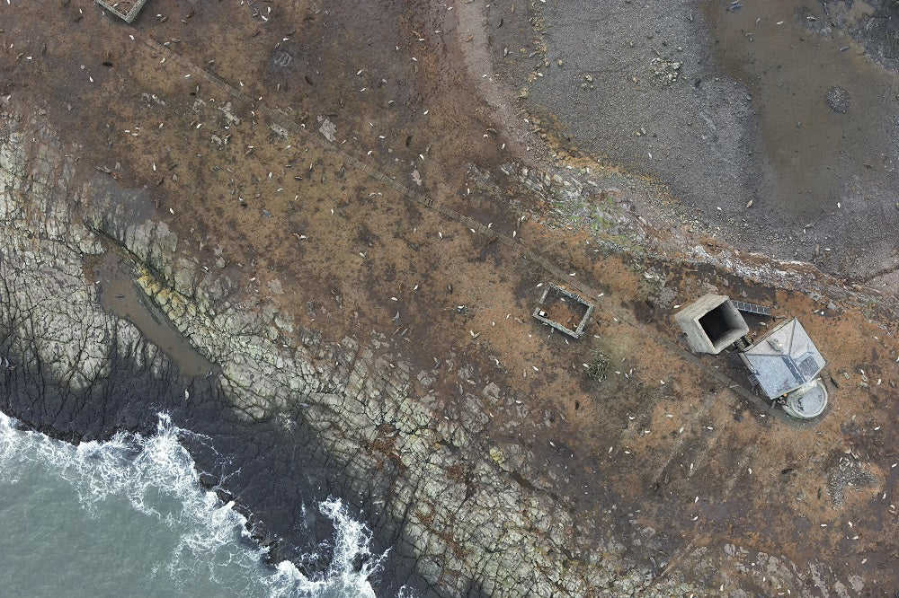
...and check out the quality of the image when zooming in.
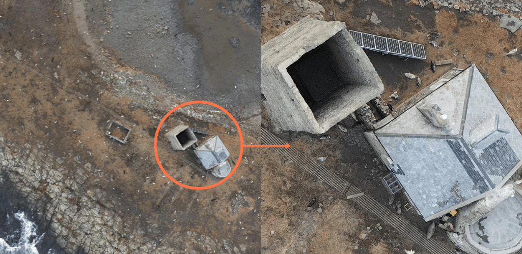
For instance, look at the clarity of the brickwork on the structures. The solar panels are crystal clear, you can count individual slabs on the floor, and each rung of the path can be made out.
This level of detail (from 120 metres remember!!) demonstrates how the P1 can benefit surveys, creating detailed and high-resolution 2D orthomosaics. This data can also be used to build sharp 3D models.
M300 RTK And H20T
The 2021 seal pup count saw thermal drone imaging used for the first time. The H20T, with a 640 x 512px resolution, was deployed. A quad-sensor solution, the camera also features wide angle, zoom and a laser rangefinder to enhance mission efficiency.
Farne Islands Ranger, Thomas Hendry, said: "The extra thermal imaging technology was useful now that the islands are supporting more and more pups and the population is denser.
"It allowed us to detect any seal pups that sadly hadn't survived, so that they weren't accidentally included in our numbers."
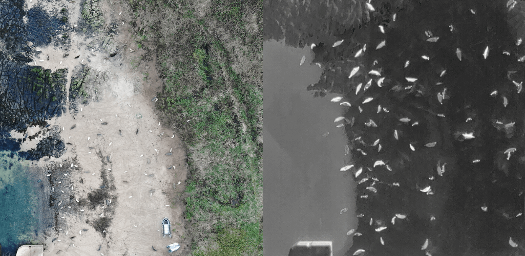
Ritchie added that the thermal also enabled the team to identify seals which were are hard to spot with the visual eye - as the image below demonstrates.
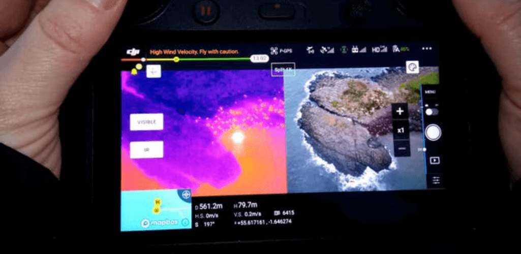
An added advantage of using the H20T was the ability to see a side-by-side camera view, comparing the thermal and visual data in real time, as the image below shows.
M300 RTK: A Hardy Drone Solution
The M300 RTK is DJI's most rugged and weather-proof enterprise drone to date, with an IP45 rating and the ability to handle 33mph winds.
And it stood up to the demands of operating in an unforgiving coastal environment in early winter - enabling more flying opportunities in the process.
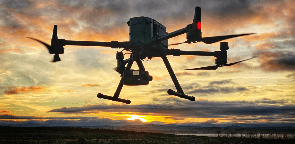
Ritchie said: "Compared to other drones, the weather had less impact on operations with the M300.
"Working in the North Sea is never the best, but the M300 RTK was faultless, even in 30mph winds, and we were able to conduct perfect surveys. It also flew reliably in heavy drizzle.
"No other drones - not even the DJI M200 Series - could handle those windy conditions and would have had to be grounded, limiting the data-collection time - but not the M300 RTK!"
The Science Behind The Survey
Thousands of adult seals return to the Farne Islands each year to pup – typically giving birth to one pup.
The survival rate varies from year to year but in spite of this, the last recorded seal pup numbers in 2019 reached a record high of 2,823 - an increase of 62 per cent over the last five years.
It is believed that the numbers will reach record numbers this year, with official statistics to be announced in February 2022.
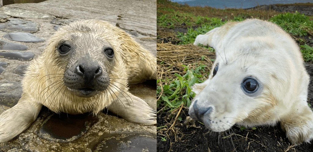
Using drone photography allowed the rangers to quickly and accurately count the seal pups on the images using computer-based machine learning – making the surveys quicker, more cost effective and more accurate than was previously possible.
Farne Islands Ranger, Thomas Hendry, said: "Once the seals are born, they’re sprayed with a harmless vegetable dye to indicate the week they are born. Using a rotation of three or four colours allows us to keep track of the numbers.
“The drone gives us an excellent view of the islands and from the clear images we can count the total numbers of seal pups born on each island. As the footage is taken whilst we are carrying out a visual count, we can compare different counting methods to check against the numbers we get on the ground.
“Since we started using the drone in 2018 it consistently seems to pick up more seals than we can see through on the ground monitoring, which has become increasingly difficult over the past five years with the colony becoming much denser due to the increasing number of pups being born."

written by
James Willoughby
James joined heliguy™ in 2018 following a 13-year stint in print and online journalism, having worked on regional and weekly newspaper titles. He is responsible for spearheading heliguy™'s content strategy and social media delivery. James collaborates with DJI Enterprise's European marketing team to coordinate and produce case studies and helps organise events and webinars.